Stonington Topo Map Colorado
To zoom in, hover over the map of Stonington
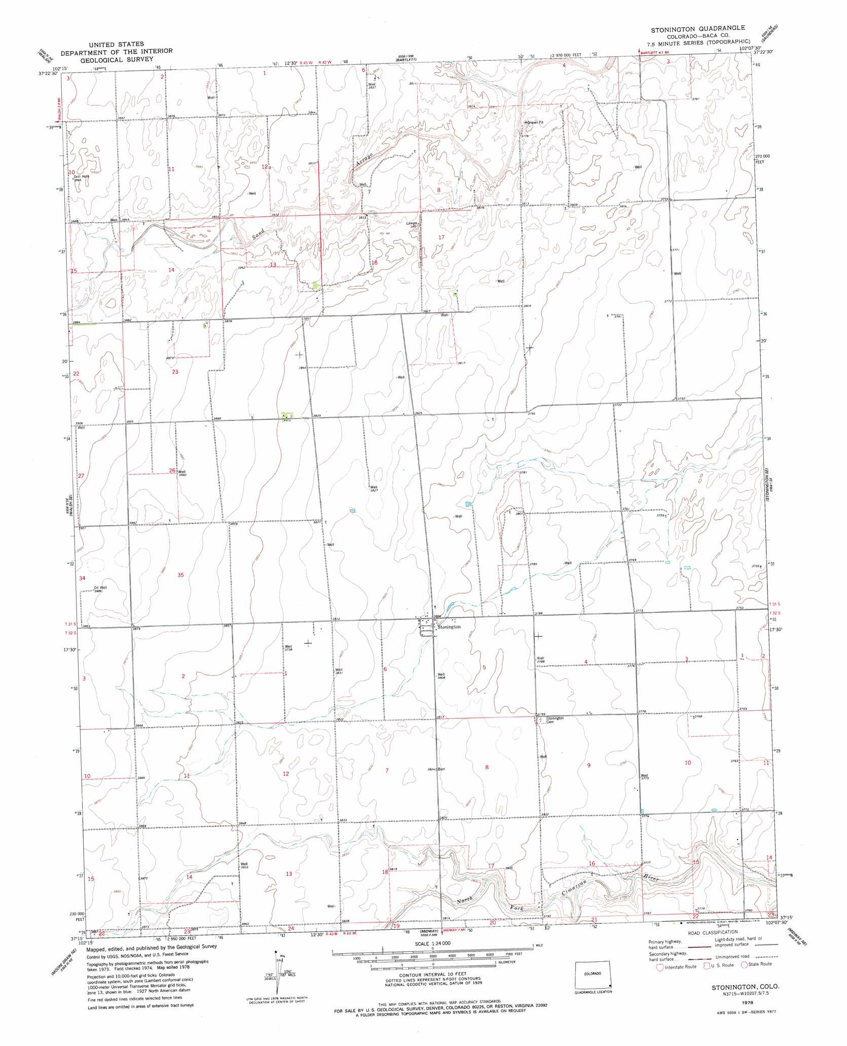
USGS Topo Quad 37102c2 - 1:24,000 scale
| Topo Map Name: | Stonington |
| USGS Topo Quad ID: | 37102c2 |
| Print Size: | ca. 21 1/4" wide x 27" high |
| Southeast Coordinates: | 37.25° N latitude / 102.125° W longitude |
| Map Center Coordinates: | 37.3125° N latitude / 102.1875° W longitude |
| U.S. State: | CO |
| Filename: | o37102c2.jpg |
| Download Map JPG Image: | Stonington topo map 1:24,000 scale |
| Map Type: | Topographic |
| Topo Series: | 7.5´ |
| Map Scale: | 1:24,000 |
| Source of Map Images: | United States Geological Survey (USGS) |
| Alternate Map Versions: |
Stonington CO 1978, updated 1979 Download PDF Buy paper map Stonington CO 2010 Download PDF Buy paper map Stonington CO 2013 Download PDF Buy paper map Stonington CO 2016 Download PDF Buy paper map |
1:24,000 Topo Quads surrounding Stonington
Two Buttes |
Two Buttes Se |
Lycan |
Lycan Se |
Manter |
Vilas North |
Walsh |
Bartlett |
Saunders |
Richfield Nw |
Vilas South |
Walsh Se |
Stonington |
Stonington Se |
Richfield Sw |
Moore Draw Nw |
Moore Draw Ne |
Midway |
Midway Ne |
Elkhart Nw |
Moore Draw Sw |
Moore Draw Se |
Midway Sw |
Midway Se |
Elkhart North |
> Back to 37102a1 at 1:100,000 scale
> Back to 37102a1 at 1:250,000 scale
> Back to U.S. Topo Maps home
Stonington topo map: Gazetteer
Stonington: Populated Places
Stonington elevation 1161m 3809′Stonington: Streams
North Fork Cimarron River elevation 1141m 3743′Sand Arroyo elevation 1146m 3759′
Stonington digital topo map on disk
Buy this Stonington topo map showing relief, roads, GPS coordinates and other geographical features, as a high-resolution digital map file on DVD: