Walsh Topo Map Colorado
To zoom in, hover over the map of Walsh
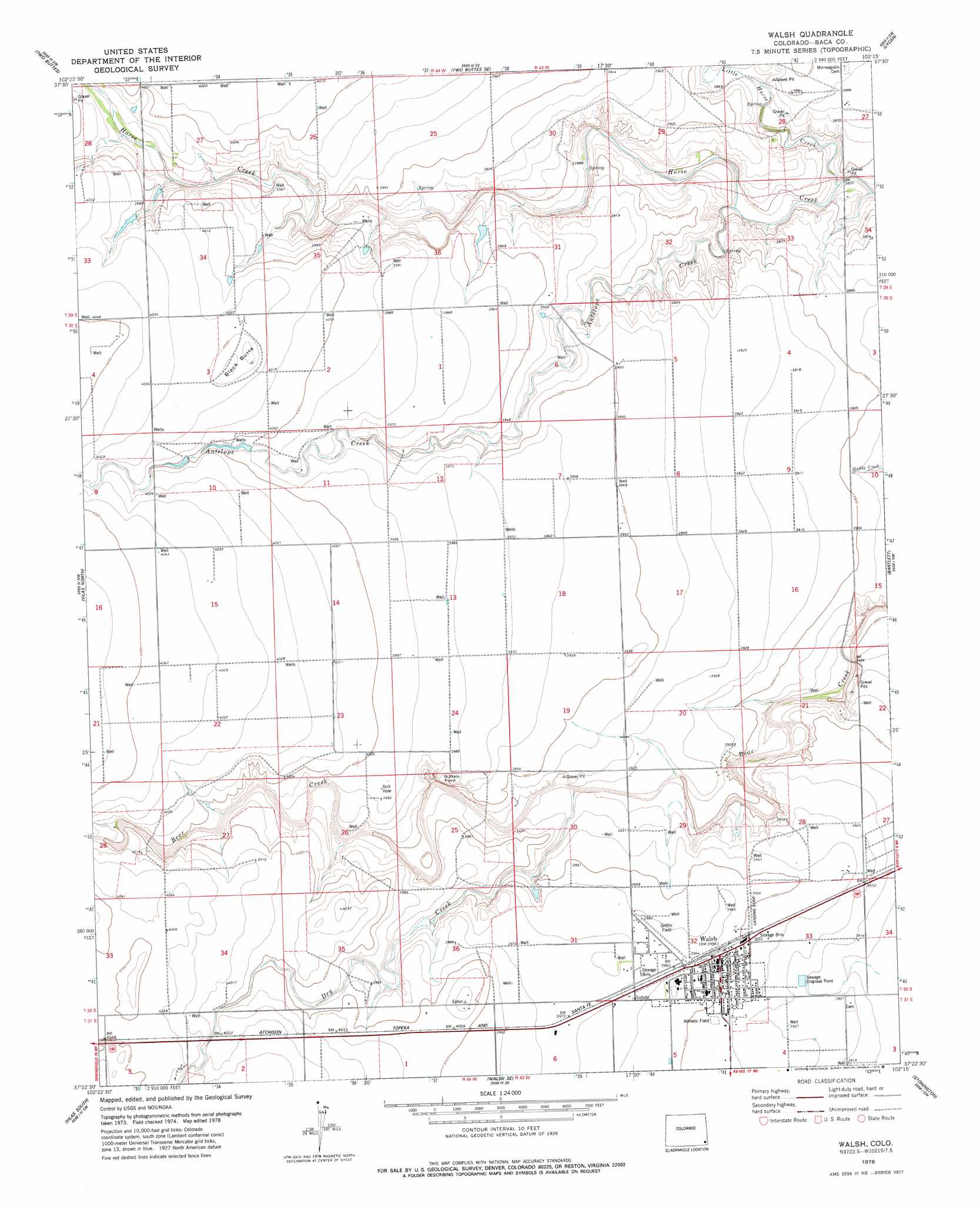
USGS Topo Quad 37102d3 - 1:24,000 scale
| Topo Map Name: | Walsh |
| USGS Topo Quad ID: | 37102d3 |
| Print Size: | ca. 21 1/4" wide x 27" high |
| Southeast Coordinates: | 37.375° N latitude / 102.25° W longitude |
| Map Center Coordinates: | 37.4375° N latitude / 102.3125° W longitude |
| U.S. State: | CO |
| Filename: | o37102d3.jpg |
| Download Map JPG Image: | Walsh topo map 1:24,000 scale |
| Map Type: | Topographic |
| Topo Series: | 7.5´ |
| Map Scale: | 1:24,000 |
| Source of Map Images: | United States Geological Survey (USGS) |
| Alternate Map Versions: |
Walsh CO 1978, updated 1978 Download PDF Buy paper map Walsh CO 2010 Download PDF Buy paper map Walsh CO 2013 Download PDF Buy paper map Walsh CO 2016 Download PDF Buy paper map |
1:24,000 Topo Quads surrounding Walsh
Two Buttes Reservoir |
Two Buttes Nw |
Plains Community |
Webb |
Lycan Ne |
Horse Creek Springs |
Two Buttes |
Two Buttes Se |
Lycan |
Lycan Se |
Springfield East |
Vilas North |
Walsh |
Bartlett |
Saunders |
Bisonte |
Vilas South |
Walsh Se |
Stonington |
Stonington Se |
Campo Ne |
Moore Draw Nw |
Moore Draw Ne |
Midway |
Midway Ne |
> Back to 37102a1 at 1:100,000 scale
> Back to 37102a1 at 1:250,000 scale
> Back to U.S. Topo Maps home
Walsh topo map: Gazetteer
Walsh: Airports
Griffen Field elevation 1208m 3963′Griffin Field elevation 1208m 3963′
Walsh: Cliffs
Buffalo Point elevation 1218m 3996′Walsh: Populated Places
Walsh elevation 1205m 3953′Walsh: Streams
Antelope Creek elevation 1169m 3835′Dry Creek elevation 1192m 3910′
Little Horse Creek elevation 1164m 3818′
Walsh: Summits
Black Butte elevation 1233m 4045′Walsh digital topo map on disk
Buy this Walsh topo map showing relief, roads, GPS coordinates and other geographical features, as a high-resolution digital map file on DVD: