Mcendree Ranch Topo Map Colorado
To zoom in, hover over the map of Mcendree Ranch
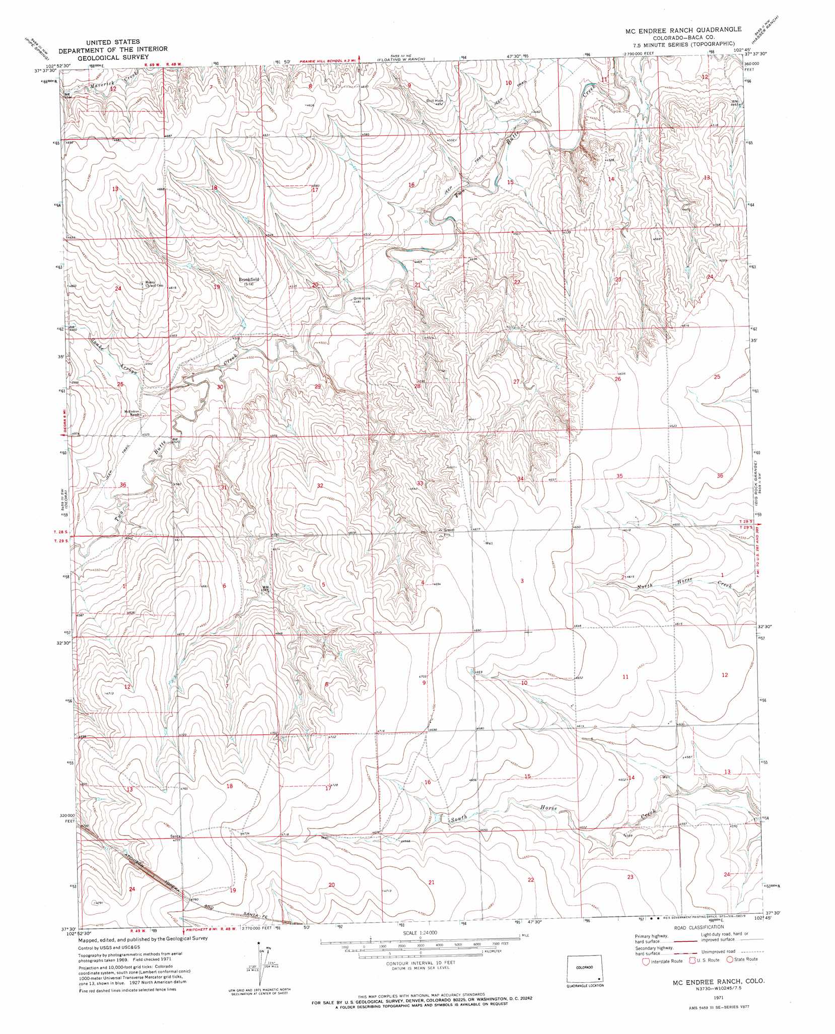
USGS Topo Quad 37102e7 - 1:24,000 scale
| Topo Map Name: | Mcendree Ranch |
| USGS Topo Quad ID: | 37102e7 |
| Print Size: | ca. 21 1/4" wide x 27" high |
| Southeast Coordinates: | 37.5° N latitude / 102.75° W longitude |
| Map Center Coordinates: | 37.5625° N latitude / 102.8125° W longitude |
| U.S. State: | CO |
| Filename: | o37102e7.jpg |
| Download Map JPG Image: | Mcendree Ranch topo map 1:24,000 scale |
| Map Type: | Topographic |
| Topo Series: | 7.5´ |
| Map Scale: | 1:24,000 |
| Source of Map Images: | United States Geological Survey (USGS) |
| Alternate Map Versions: |
Mc Endree Ranch CO 1971, updated 1973 Download PDF Buy paper map McEndree Ranch CO 2010 Download PDF Buy paper map McEndree Ranch CO 2013 Download PDF Buy paper map McEndree Ranch CO 2016 Download PDF Buy paper map |
1:24,000 Topo Quads surrounding Mcendree Ranch
Toonerville Se |
Hand Springs |
Dripping Spring |
Cat Creek |
Gobblers Knob |
Clay Ranch |
Pipe Spring |
Floating W Ranch |
Hasser Ranch |
Two Buttes Reservoir |
Walker Canyon |
Deora |
Mcendree Ranch |
Big Rock Grange |
Horse Creek Springs |
Table Mesa |
Pritchett Nw |
Harbord |
Springfield West |
Springfield East |
Utleyville |
Lone Rock |
Pritchett |
Springfield Sw |
Bisonte |
> Back to 37102e1 at 1:100,000 scale
> Back to 37102a1 at 1:250,000 scale
> Back to U.S. Topo Maps home
Mcendree Ranch topo map: Gazetteer
Mcendree Ranch: Populated Places
Brookfield (historical) elevation 1393m 4570′Mcendree Ranch: Streams
Snake Arroyo elevation 1370m 4494′Mcendree Ranch digital topo map on disk
Buy this Mcendree Ranch topo map showing relief, roads, GPS coordinates and other geographical features, as a high-resolution digital map file on DVD: