Deora Topo Map Colorado
To zoom in, hover over the map of Deora
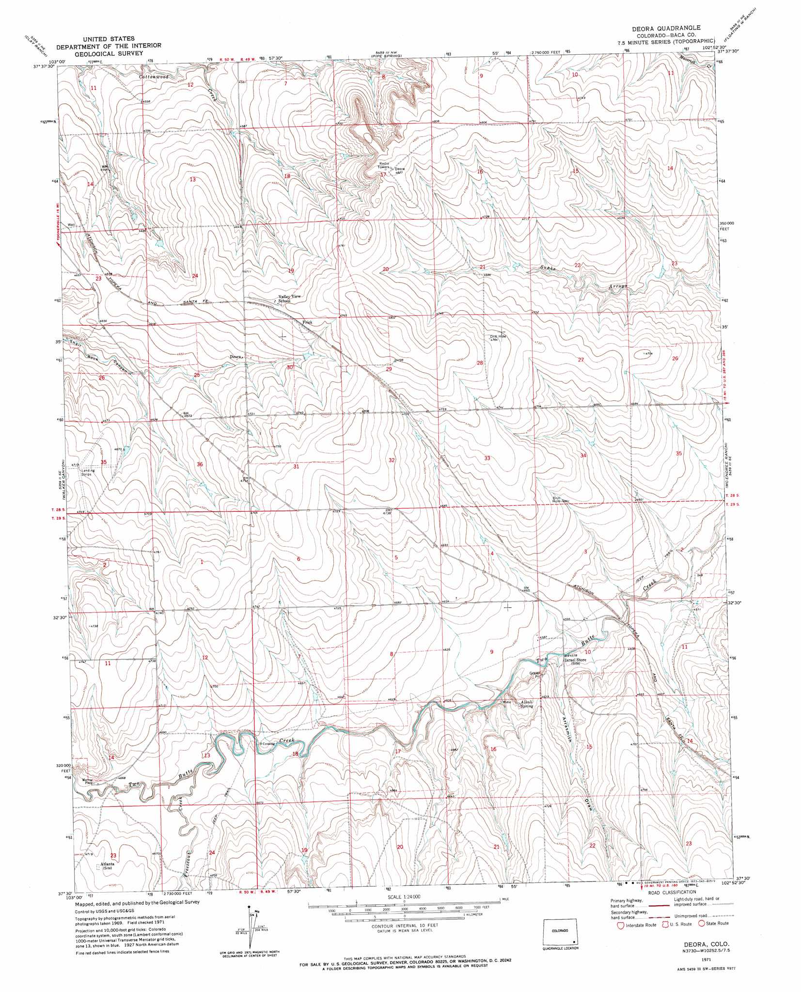
USGS Topo Quad 37102e8 - 1:24,000 scale
| Topo Map Name: | Deora |
| USGS Topo Quad ID: | 37102e8 |
| Print Size: | ca. 21 1/4" wide x 27" high |
| Southeast Coordinates: | 37.5° N latitude / 102.875° W longitude |
| Map Center Coordinates: | 37.5625° N latitude / 102.9375° W longitude |
| U.S. State: | CO |
| Filename: | o37102e8.jpg |
| Download Map JPG Image: | Deora topo map 1:24,000 scale |
| Map Type: | Topographic |
| Topo Series: | 7.5´ |
| Map Scale: | 1:24,000 |
| Source of Map Images: | United States Geological Survey (USGS) |
| Alternate Map Versions: |
Deora CO 1971, updated 1973 Download PDF Buy paper map Deora CO 2010 Download PDF Buy paper map Deora CO 2013 Download PDF Buy paper map Deora CO 2016 Download PDF Buy paper map |
1:24,000 Topo Quads surrounding Deora
Toonerville |
Toonerville Se |
Hand Springs |
Dripping Spring |
Cat Creek |
Ninaview |
Clay Ranch |
Pipe Spring |
Floating W Ranch |
Hasser Ranch |
Plug Hat Ranch |
Walker Canyon |
Deora |
Mcendree Ranch |
Big Rock Grange |
Buck Canyon |
Table Mesa |
Pritchett Nw |
Harbord |
Springfield West |
Andrix |
Utleyville |
Lone Rock |
Pritchett |
Springfield Sw |
> Back to 37102e1 at 1:100,000 scale
> Back to 37102a1 at 1:250,000 scale
> Back to U.S. Topo Maps home
Deora topo map: Gazetteer
Deora: Populated Places
Atlanta elevation 1438m 4717′Deora elevation 1424m 4671′
Frick elevation 1447m 4747′
Murray Place elevation 1424m 4671′
Deora: Springs
Alkali Spring elevation 1402m 4599′Deora: Streams
Freezeout Creek elevation 1415m 4642′Deora: Valleys
Antelope Draw elevation 1411m 4629′Arrasmith Draw elevation 1394m 4573′
Deora digital topo map on disk
Buy this Deora topo map showing relief, roads, GPS coordinates and other geographical features, as a high-resolution digital map file on DVD: