North Plum Creek Se Topo Map Colorado
To zoom in, hover over the map of North Plum Creek Se
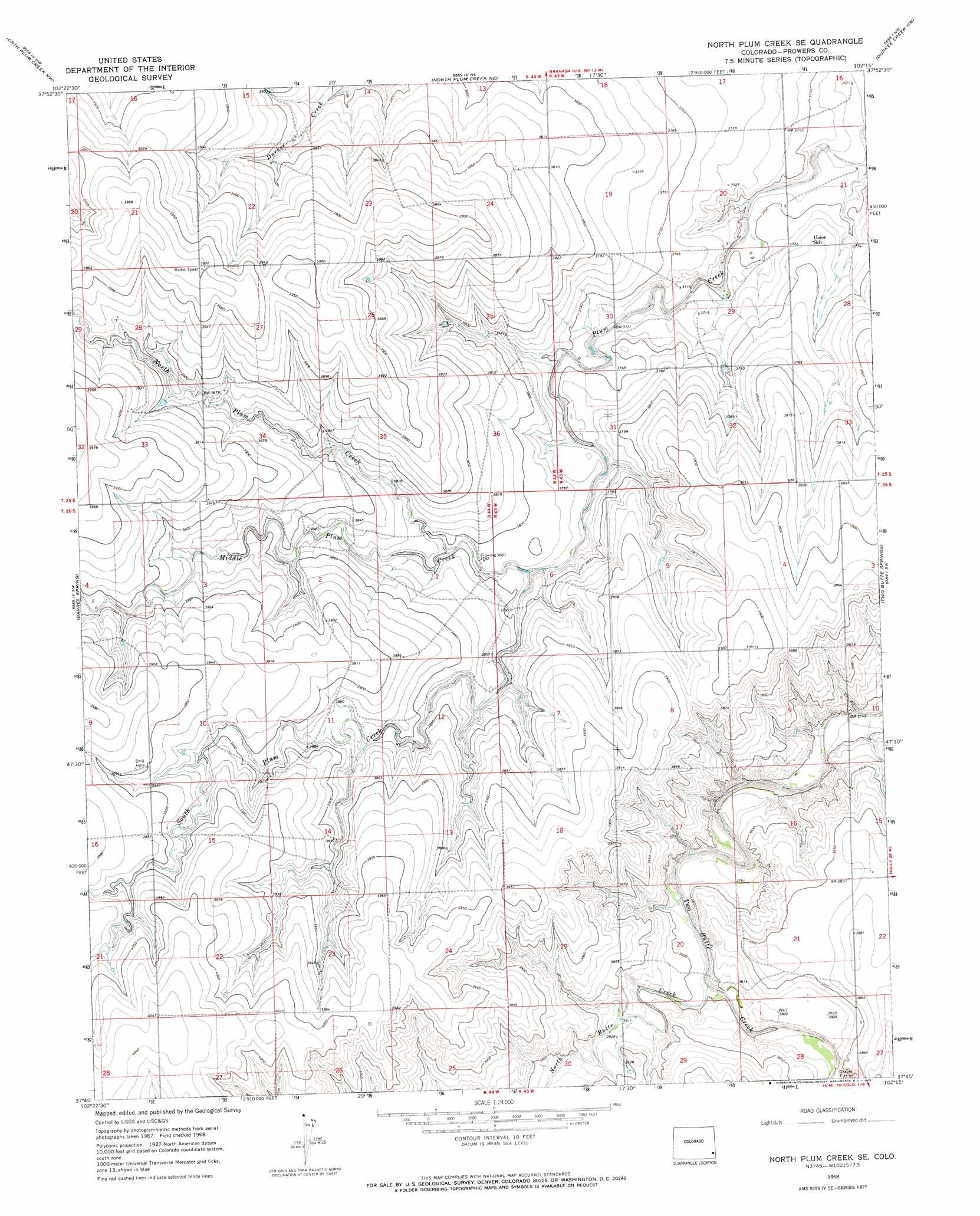
USGS Topo Quad 37102g3 - 1:24,000 scale
| Topo Map Name: | North Plum Creek Se |
| USGS Topo Quad ID: | 37102g3 |
| Print Size: | ca. 21 1/4" wide x 27" high |
| Southeast Coordinates: | 37.75° N latitude / 102.25° W longitude |
| Map Center Coordinates: | 37.8125° N latitude / 102.3125° W longitude |
| U.S. State: | CO |
| Filename: | o37102g3.jpg |
| Download Map JPG Image: | North Plum Creek Se topo map 1:24,000 scale |
| Map Type: | Topographic |
| Topo Series: | 7.5´ |
| Map Scale: | 1:24,000 |
| Source of Map Images: | United States Geological Survey (USGS) |
| Alternate Map Versions: |
North Plum Creek SE CO 1968, updated 1971 Download PDF Buy paper map North Plum Creek SE CO 2010 Download PDF Buy paper map North Plum Creek SE CO 2013 Download PDF Buy paper map North Plum Creek SE CO 2016 Download PDF Buy paper map |
1:24,000 Topo Quads surrounding North Plum Creek Se
Lamar East |
Carlton |
Granada |
Holly West |
Holly East |
Cat Creek Ne |
North Plum Creek Nw |
North Plum Creek Ne |
Durkee Creek Nw |
Durkee Creek Ne |
Gobblers Knob |
Barrel Spring |
North Plum Creek Se |
Two Butte Springs |
Durkee Creek Se |
Two Buttes Reservoir |
Two Buttes Nw |
Plains Community |
Webb |
Lycan Ne |
Horse Creek Springs |
Two Buttes |
Two Buttes Se |
Lycan |
Lycan Se |
> Back to 37102e1 at 1:100,000 scale
> Back to 37102a1 at 1:250,000 scale
> Back to U.S. Topo Maps home
North Plum Creek Se topo map: Gazetteer
North Plum Creek Se: Streams
Middle Plum Creek elevation 1156m 3792′North Butte Creek elevation 1155m 3789′
North Plum Creek elevation 1156m 3792′
South Plum Creek elevation 1151m 3776′
North Plum Creek Se digital topo map on disk
Buy this North Plum Creek Se topo map showing relief, roads, GPS coordinates and other geographical features, as a high-resolution digital map file on DVD: