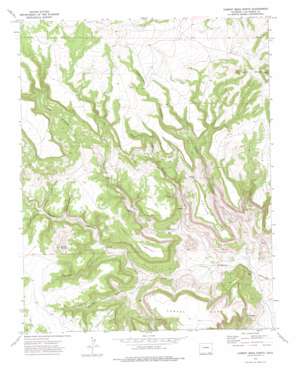
Cobert Mesa North Topo Map Colorado
To zoom in, hover over the map of Cobert Mesa North
USGS Topo Quad 37103a5 - 1:24,000 scale
| Topo Map Name: | Cobert Mesa North |
| USGS Topo Quad ID: | 37103a5 |
| Print Size: | ca. 21 1/4" wide x 27" high |
| Southeast Coordinates: | 37° N latitude / 103.5° W longitude |
| Map Center Coordinates: | 37.0625° N latitude / 103.5625° W longitude |
| U.S. State: | CO |
| Filename: | o37103a5.jpg |
| Download Map JPG Image: | Cobert Mesa North topo map 1:24,000 scale |
| Map Type: | Topographic |
| Topo Series: | 7.5´ |
| Map Scale: | 1:24,000 |
| Source of Map Images: | United States Geological Survey (USGS) |
| Alternate Map Versions: |
Cobert Mesa North CO 1972, updated 1975 Download PDF Buy paper map Cobert Mesa North CO 2010 Download PDF Buy paper map Cobert Mesa North CO 2013 Download PDF Buy paper map Cobert Mesa North CO 2016 Download PDF Buy paper map |
1:24,000 Topo Quads surrounding Cobert Mesa North
> Back to 37103a1 at 1:100,000 scale
> Back to 37102a1 at 1:250,000 scale
> Back to U.S. Topo Maps home
Cobert Mesa North topo map: Gazetteer
Cobert Mesa North: Gaps
Cotton Gap elevation 1800m 5905′Cobert Mesa North: Ridges
The Hogback elevation 1812m 5944′Cobert Mesa North: Summits
Brushy Mountain elevation 1875m 6151′Cobert Mesa elevation 1837m 6026′
Cotton Mesa elevation 1827m 5994′
Jesus Mesa elevation 1882m 6174′
Mesa de Maya elevation 1996m 6548′
Seven L Buttes elevation 1996m 6548′
Cobert Mesa North: Valleys
Cheney Canyon elevation 1692m 5551′Cotton Canyon elevation 1574m 5164′
Flathead Canyon elevation 1695m 5561′
Gotera Canyon elevation 1586m 5203′
Gotera Rincon elevation 1729m 5672′
Honeymoon Canyon elevation 1784m 5853′
Phillips Canyon elevation 1616m 5301′
Rodriques Canyon elevation 1676m 5498′
Spring Canyon elevation 1580m 5183′
Steel Trap Canyon elevation 1733m 5685′
Cobert Mesa North digital topo map on disk
Buy this Cobert Mesa North topo map showing relief, roads, GPS coordinates and other geographical features, as a high-resolution digital map file on DVD:


