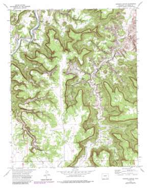
Johnson Canyon Topo Map Colorado
To zoom in, hover over the map of Johnson Canyon
USGS Topo Quad 37103d6 - 1:24,000 scale
| Topo Map Name: | Johnson Canyon |
| USGS Topo Quad ID: | 37103d6 |
| Print Size: | ca. 21 1/4" wide x 27" high |
| Southeast Coordinates: | 37.375° N latitude / 103.625° W longitude |
| Map Center Coordinates: | 37.4375° N latitude / 103.6875° W longitude |
| U.S. State: | CO |
| Filename: | o37103d6.jpg |
| Download Map JPG Image: | Johnson Canyon topo map 1:24,000 scale |
| Map Type: | Topographic |
| Topo Series: | 7.5´ |
| Map Scale: | 1:24,000 |
| Source of Map Images: | United States Geological Survey (USGS) |
| Alternate Map Versions: |
Johnson Canyon CO 1972, updated 1975 Download PDF Buy paper map Johnson Canyon CO 1972, updated 1975 Download PDF Buy paper map Johnson Canyon CO 1972, updated 1985 Download PDF Buy paper map Johnson Canyon CO 1972, updated 1985 Download PDF Buy paper map Johnson Canyon CO 2010 Download PDF Buy paper map Johnson Canyon CO 2013 Download PDF Buy paper map Johnson Canyon CO 2016 Download PDF Buy paper map |
| FStopo: | US Forest Service topo Johnson Canyon is available: Download FStopo PDF Download FStopo TIF |
1:24,000 Topo Quads surrounding Johnson Canyon
> Back to 37103a1 at 1:100,000 scale
> Back to 37102a1 at 1:250,000 scale
> Back to U.S. Topo Maps home
Johnson Canyon topo map: Gazetteer
Johnson Canyon: Springs
Barriet Spring elevation 1595m 5232′Johnson Canyon: Streams
Lockwood Arroyo elevation 1385m 4543′Plum Creek elevation 1375m 4511′
Johnson Canyon: Valleys
Barriet Canyon elevation 1382m 4534′Calf Canyon elevation 1395m 4576′
Chacuaco Canyon elevation 1378m 4520′
Goat Ranch Canyon elevation 1417m 4648′
Johnson Canyon elevation 1407m 4616′
Jones Canyon elevation 1549m 5082′
Lions Canyon elevation 1410m 4625′
Lockwood Canyon elevation 1389m 4557′
Lost Canyon elevation 1389m 4557′
Sandoval Canyon elevation 1448m 4750′
Scorpio Canyon elevation 1470m 4822′
Trough Canyon elevation 1447m 4747′
Umbrella Canyon elevation 1444m 4737′
Water Canyon elevation 1470m 4822′
Whitewater Canyon elevation 1477m 4845′
Johnson Canyon digital topo map on disk
Buy this Johnson Canyon topo map showing relief, roads, GPS coordinates and other geographical features, as a high-resolution digital map file on DVD:


