Plug Hat Ranch Topo Map Colorado
To zoom in, hover over the map of Plug Hat Ranch
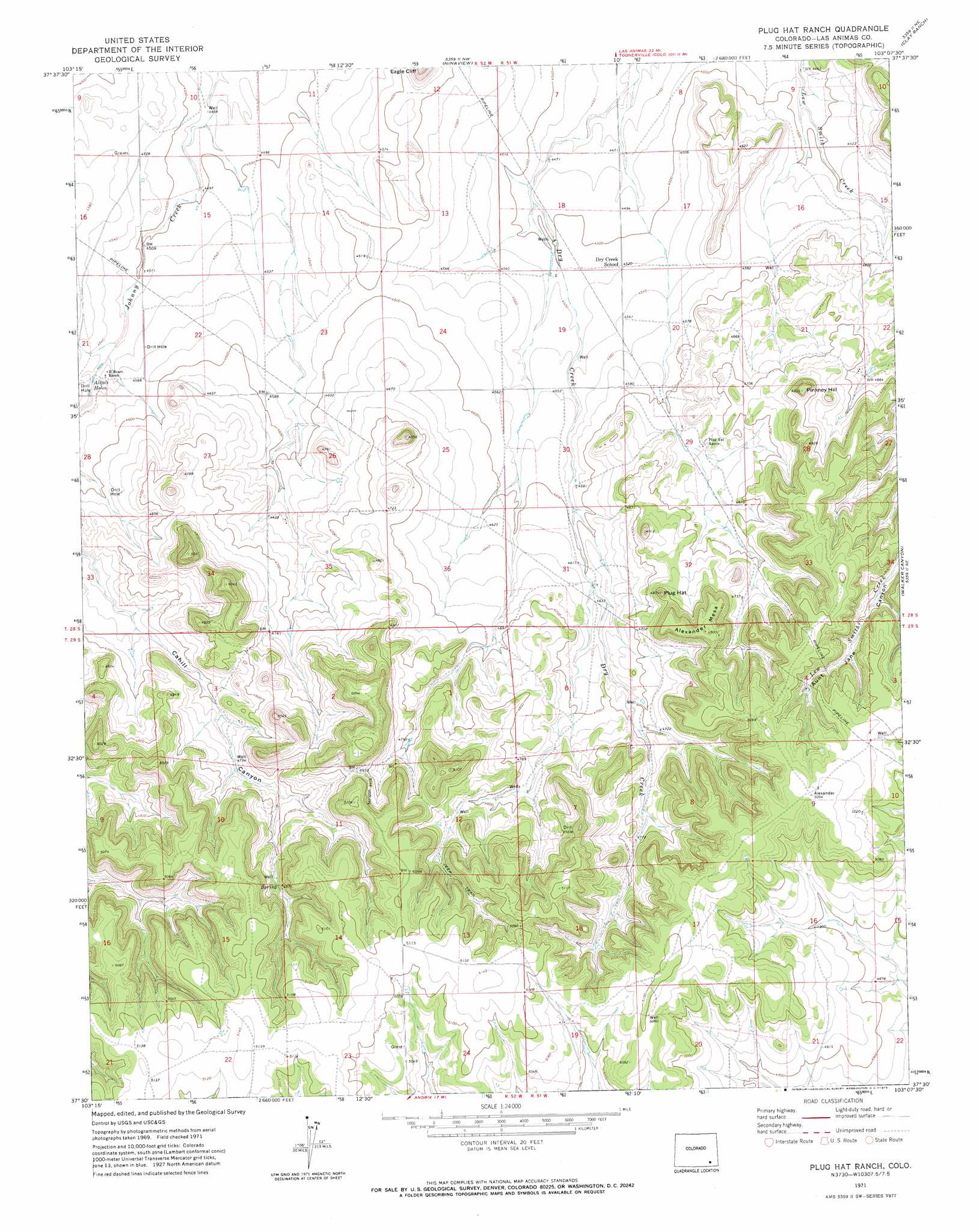
USGS Topo Quad 37103e2 - 1:24,000 scale
| Topo Map Name: | Plug Hat Ranch |
| USGS Topo Quad ID: | 37103e2 |
| Print Size: | ca. 21 1/4" wide x 27" high |
| Southeast Coordinates: | 37.5° N latitude / 103.125° W longitude |
| Map Center Coordinates: | 37.5625° N latitude / 103.1875° W longitude |
| U.S. State: | CO |
| Filename: | o37103e2.jpg |
| Download Map JPG Image: | Plug Hat Ranch topo map 1:24,000 scale |
| Map Type: | Topographic |
| Topo Series: | 7.5´ |
| Map Scale: | 1:24,000 |
| Source of Map Images: | United States Geological Survey (USGS) |
| Alternate Map Versions: |
Plug Hat Ranch CO 1971, updated 1973 Download PDF Buy paper map Plug Hat Ranch CO 2010 Download PDF Buy paper map Plug Hat Ranch CO 2013 Download PDF Buy paper map Plug Hat Ranch CO 2016 Download PDF Buy paper map |
1:24,000 Topo Quads surrounding Plug Hat Ranch
Higbee |
Turkey Canyon |
Toonerville |
Toonerville Se |
Hand Springs |
Corbin Canyon |
Rock Canyon |
Ninaview |
Clay Ranch |
Pipe Spring |
Lost Canyon |
Brown Canyon |
Plug Hat Ranch |
Walker Canyon |
Deora |
Icehouse Canyon |
Robbers Roost Canyon |
Buck Canyon |
Table Mesa |
Pritchett Nw |
Cherry Canyon |
Kim North |
Andrix |
Utleyville |
Lone Rock |
> Back to 37103e1 at 1:100,000 scale
> Back to 37102a1 at 1:250,000 scale
> Back to U.S. Topo Maps home
Plug Hat Ranch topo map: Gazetteer
Plug Hat Ranch: Lakes
Alkali Holes elevation 1384m 4540′Plug Hat Ranch: Summits
Alexander Mesa elevation 1525m 5003′Nelson Hill elevation 1523m 4996′
Pinkney Hill elevation 1504m 4934′
Plug Hat elevation 1486m 4875′
Plug Hat Ranch digital topo map on disk
Buy this Plug Hat Ranch topo map showing relief, roads, GPS coordinates and other geographical features, as a high-resolution digital map file on DVD: