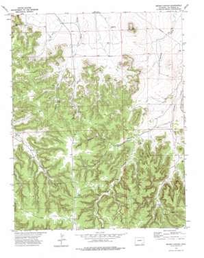
Brown Canyon Topo Map Colorado
To zoom in, hover over the map of Brown Canyon
USGS Topo Quad 37103e3 - 1:24,000 scale
| Topo Map Name: | Brown Canyon |
| USGS Topo Quad ID: | 37103e3 |
| Print Size: | ca. 21 1/4" wide x 27" high |
| Southeast Coordinates: | 37.5° N latitude / 103.25° W longitude |
| Map Center Coordinates: | 37.5625° N latitude / 103.3125° W longitude |
| U.S. State: | CO |
| Filename: | o37103e3.jpg |
| Download Map JPG Image: | Brown Canyon topo map 1:24,000 scale |
| Map Type: | Topographic |
| Topo Series: | 7.5´ |
| Map Scale: | 1:24,000 |
| Source of Map Images: | United States Geological Survey (USGS) |
| Alternate Map Versions: |
Brown Canyon CO 1972, updated 1976 Download PDF Buy paper map Brown Canyon CO 2010 Download PDF Buy paper map Brown Canyon CO 2013 Download PDF Buy paper map Brown Canyon CO 2016 Download PDF Buy paper map |
1:24,000 Topo Quads surrounding Brown Canyon
> Back to 37103e1 at 1:100,000 scale
> Back to 37102a1 at 1:250,000 scale
> Back to U.S. Topo Maps home
Brown Canyon topo map: Gazetteer
Brown Canyon: Airports
Platte Ranch Heliport elevation 1582m 5190′Brown Canyon: Gaps
Wagon Gap elevation 1446m 4744′Brown Canyon: Mines
Johnny Branch Mine elevation 1403m 4603′Brown Canyon: Reservoirs
Funk Reservoir elevation 1426m 4678′Brown Canyon: Springs
Brown Spring elevation 1455m 4773′Brown Canyon: Summits
Lone Mesa elevation 1515m 4970′Long Canyon Hill elevation 1519m 4983′
Brown Canyon: Valleys
Brown Canyon elevation 1417m 4648′Cahill Canyon elevation 1390m 4560′
Deadman Canyon elevation 1422m 4665′
Irwin Canyon elevation 1402m 4599′
Lindsey Canyon elevation 1408m 4619′
North Deadman Canyon elevation 1440m 4724′
Shell Canyon elevation 1402m 4599′
South Deadman Canyon elevation 1440m 4724′
Brown Canyon digital topo map on disk
Buy this Brown Canyon topo map showing relief, roads, GPS coordinates and other geographical features, as a high-resolution digital map file on DVD:


