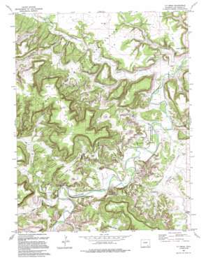
O V Mesa Topo Map Colorado
To zoom in, hover over the map of O V Mesa
USGS Topo Quad 37103e6 - 1:24,000 scale
| Topo Map Name: | O V Mesa |
| USGS Topo Quad ID: | 37103e6 |
| Print Size: | ca. 21 1/4" wide x 27" high |
| Southeast Coordinates: | 37.5° N latitude / 103.625° W longitude |
| Map Center Coordinates: | 37.5625° N latitude / 103.6875° W longitude |
| U.S. State: | CO |
| Filename: | o37103e6.jpg |
| Download Map JPG Image: | O V Mesa topo map 1:24,000 scale |
| Map Type: | Topographic |
| Topo Series: | 7.5´ |
| Map Scale: | 1:24,000 |
| Source of Map Images: | United States Geological Survey (USGS) |
| Alternate Map Versions: |
O V Mesa CO 1972, updated 1976 Download PDF Buy paper map O V Mesa CO 1972, updated 1976 Download PDF Buy paper map O V Mesa CO 1972, updated 1985 Download PDF Buy paper map O V Mesa CO 1993, updated 1994 Download PDF Buy paper map O V Mesa CO 1996, updated 2000 Download PDF Buy paper map O V Mesa CO 2011 Download PDF Buy paper map O V Mesa CO 2013 Download PDF Buy paper map O V Mesa CO 2016 Download PDF Buy paper map |
| FStopo: | US Forest Service topo O V Mesa is available: Download FStopo PDF Download FStopo TIF |
1:24,000 Topo Quads surrounding O V Mesa
> Back to 37103e1 at 1:100,000 scale
> Back to 37102a1 at 1:250,000 scale
> Back to U.S. Topo Maps home
O V Mesa topo map: Gazetteer
O V Mesa: Gaps
Pameña Gap elevation 1412m 4632′O V Mesa: Ranges
Black Hills elevation 1637m 5370′O V Mesa: Streams
Chacuaco Creek elevation 1346m 4416′O V Mesa: Summits
O V Mesa elevation 1650m 5413′O V Mesa: Valleys
Bent Canyon elevation 1350m 4429′Bravo Canyon elevation 1348m 4422′
Bruno Canyon elevation 1377m 4517′
Horse Canyon elevation 1430m 4691′
Iron Canyon elevation 1340m 4396′
Red Rock Canyon elevation 1373m 4504′
Reed Canyon elevation 1369m 4491′
Rourke Canyon elevation 1336m 4383′
Sugarloaf Canyon elevation 1420m 4658′
O V Mesa digital topo map on disk
Buy this O V Mesa topo map showing relief, roads, GPS coordinates and other geographical features, as a high-resolution digital map file on DVD:


