Clay Ranch Topo Map Colorado
To zoom in, hover over the map of Clay Ranch
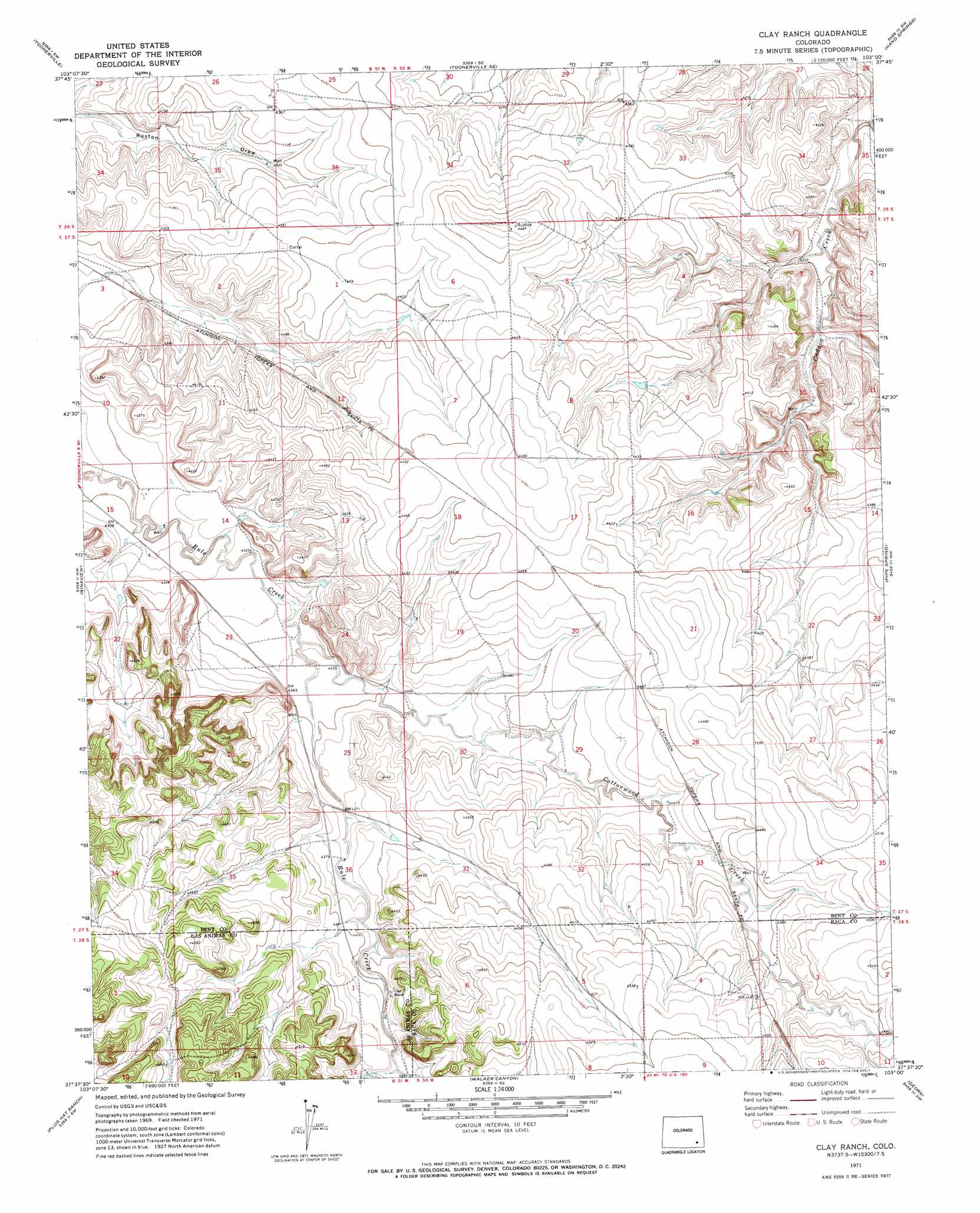
USGS Topo Quad 37103f1 - 1:24,000 scale
| Topo Map Name: | Clay Ranch |
| USGS Topo Quad ID: | 37103f1 |
| Print Size: | ca. 21 1/4" wide x 27" high |
| Southeast Coordinates: | 37.625° N latitude / 103° W longitude |
| Map Center Coordinates: | 37.6875° N latitude / 103.0625° W longitude |
| U.S. State: | CO |
| Filename: | o37103f1.jpg |
| Download Map JPG Image: | Clay Ranch topo map 1:24,000 scale |
| Map Type: | Topographic |
| Topo Series: | 7.5´ |
| Map Scale: | 1:24,000 |
| Source of Map Images: | United States Geological Survey (USGS) |
| Alternate Map Versions: |
Clay Ranch CO 1971, updated 1974 Download PDF Buy paper map Clay Ranch CO 2010 Download PDF Buy paper map Clay Ranch CO 2013 Download PDF Buy paper map Clay Ranch CO 2016 Download PDF Buy paper map |
1:24,000 Topo Quads surrounding Clay Ranch
Hackamore Ranch |
Gilpin |
Toonerville Ne |
High Rock |
Denny Lake |
Turkey Canyon |
Toonerville |
Toonerville Se |
Hand Springs |
Dripping Spring |
Rock Canyon |
Ninaview |
Clay Ranch |
Pipe Spring |
Floating W Ranch |
Brown Canyon |
Plug Hat Ranch |
Walker Canyon |
Deora |
Mcendree Ranch |
Robbers Roost Canyon |
Buck Canyon |
Table Mesa |
Pritchett Nw |
Harbord |
> Back to 37103e1 at 1:100,000 scale
> Back to 37102a1 at 1:250,000 scale
> Back to U.S. Topo Maps home
Clay Ranch topo map: Gazetteer
Clay Ranch: Streams
Cottonwood Creek elevation 1320m 4330′Shelton Creek elevation 1278m 4192′
Clay Ranch digital topo map on disk
Buy this Clay Ranch topo map showing relief, roads, GPS coordinates and other geographical features, as a high-resolution digital map file on DVD: