Gilpin Topo Map Colorado
To zoom in, hover over the map of Gilpin
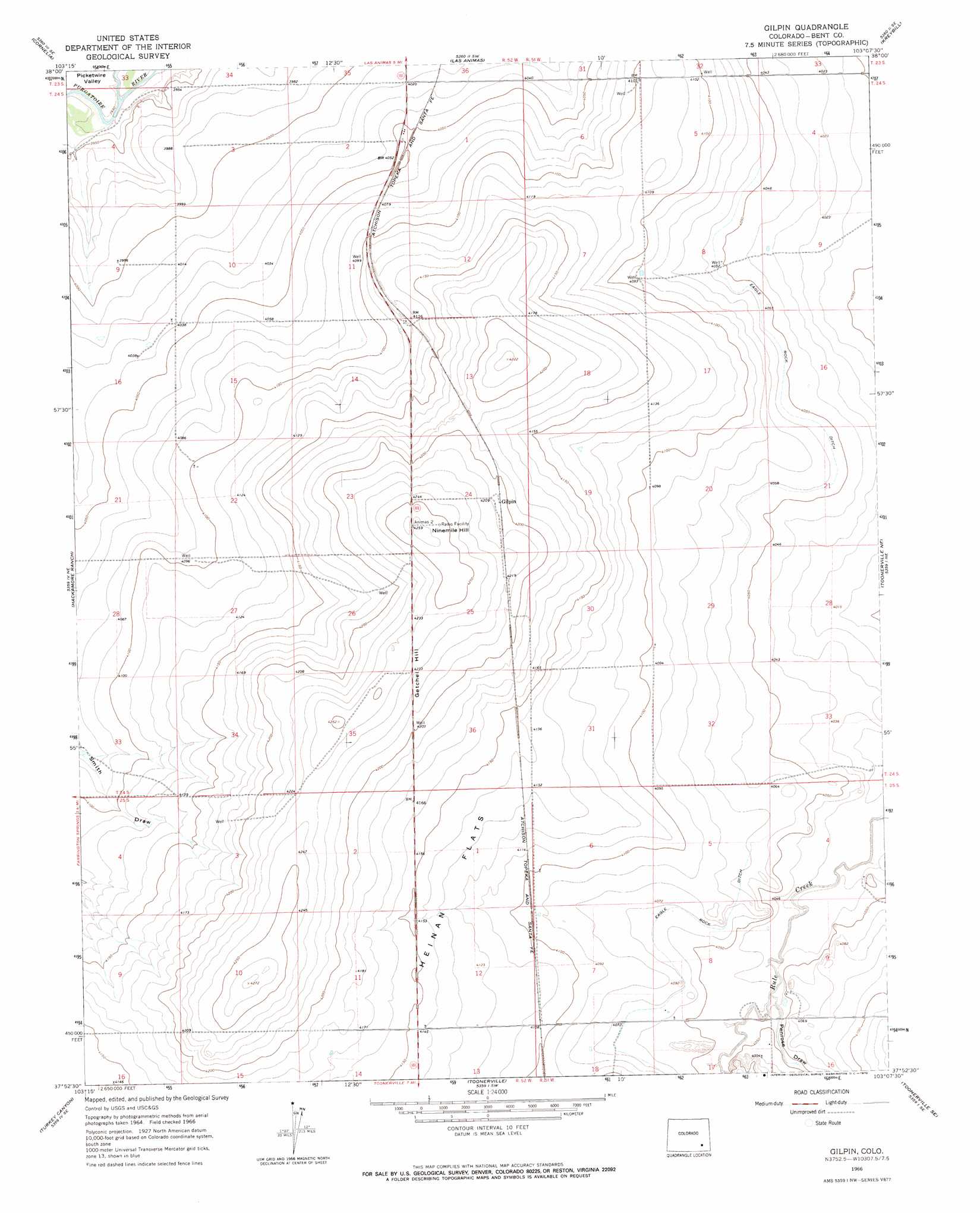
USGS Topo Quad 37103h2 - 1:24,000 scale
| Topo Map Name: | Gilpin |
| USGS Topo Quad ID: | 37103h2 |
| Print Size: | ca. 21 1/4" wide x 27" high |
| Southeast Coordinates: | 37.875° N latitude / 103.125° W longitude |
| Map Center Coordinates: | 37.9375° N latitude / 103.1875° W longitude |
| U.S. State: | CO |
| Filename: | o37103h2.jpg |
| Download Map JPG Image: | Gilpin topo map 1:24,000 scale |
| Map Type: | Topographic |
| Topo Series: | 7.5´ |
| Map Scale: | 1:24,000 |
| Source of Map Images: | United States Geological Survey (USGS) |
| Alternate Map Versions: |
Gilpin CO 1966, updated 1969 Download PDF Buy paper map Gilpin CO 2010 Download PDF Buy paper map Gilpin CO 2013 Download PDF Buy paper map Gilpin CO 2016 Download PDF Buy paper map |
1:24,000 Topo Quads surrounding Gilpin
Lewis Ranch |
Mcintosh Ranch |
Bishop Ranch |
Tree Top Ranch |
Lubers |
Hadley |
Cornelia |
Las Animas |
Kreybill |
Hasty |
Thompson Arroyo |
Hackamore Ranch |
Gilpin |
Toonerville Ne |
High Rock |
Higbee |
Turkey Canyon |
Toonerville |
Toonerville Se |
Hand Springs |
Corbin Canyon |
Rock Canyon |
Ninaview |
Clay Ranch |
Pipe Spring |
> Back to 37103e1 at 1:100,000 scale
> Back to 37102a1 at 1:250,000 scale
> Back to U.S. Topo Maps home
Gilpin topo map: Gazetteer
Gilpin: Canals
Eagle Rock Ditch elevation 1239m 4064′Gilpin: Flats
Heinan Flats elevation 1265m 4150′Gilpin: Populated Places
Gilpin elevation 1283m 4209′Gilpin: Summits
Getchel Hill elevation 1291m 4235′Ninemile Hill elevation 1299m 4261′
Gilpin: Valleys
Penrose Draw elevation 1229m 4032′Gilpin digital topo map on disk
Buy this Gilpin topo map showing relief, roads, GPS coordinates and other geographical features, as a high-resolution digital map file on DVD: