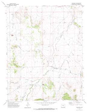
Trinchera Topo Map Colorado
To zoom in, hover over the map of Trinchera
USGS Topo Quad 37104a1 - 1:24,000 scale
| Topo Map Name: | Trinchera |
| USGS Topo Quad ID: | 37104a1 |
| Print Size: | ca. 21 1/4" wide x 27" high |
| Southeast Coordinates: | 37° N latitude / 104° W longitude |
| Map Center Coordinates: | 37.0625° N latitude / 104.0625° W longitude |
| U.S. State: | CO |
| Filename: | o37104a1.jpg |
| Download Map JPG Image: | Trinchera topo map 1:24,000 scale |
| Map Type: | Topographic |
| Topo Series: | 7.5´ |
| Map Scale: | 1:24,000 |
| Source of Map Images: | United States Geological Survey (USGS) |
| Alternate Map Versions: |
Trinchera CO 1971, updated 1973 Download PDF Buy paper map Trinchera CO 2010 Download PDF Buy paper map Trinchera CO 2013 Download PDF Buy paper map Trinchera CO 2016 Download PDF Buy paper map |
1:24,000 Topo Quads surrounding Trinchera
> Back to 37104a1 at 1:100,000 scale
> Back to 37104a1 at 1:250,000 scale
> Back to U.S. Topo Maps home
Trinchera topo map: Gazetteer
Trinchera: Canals
Border Ditch elevation 1839m 6033′Hart Ditch elevation 1805m 5921′
Newcomb Ditch elevation 1701m 5580′
Trinchera Company Ditch elevation 1817m 5961′
Trinchera: Populated Places
Trinchera elevation 1769m 5803′Trinchera: Streams
Cadilloso Arroyo elevation 1816m 5958′Chaney Arroyo elevation 1718m 5636′
Doss Arroyo elevation 1701m 5580′
Rito Azul elevation 1782m 5846′
Rito Azul elevation 1782m 5846′
Salazar Arroyo elevation 1745m 5725′
Salazar Arroyo elevation 1745m 5725′
Trinchera Creek elevation 1825m 5987′
Trinchera: Summits
Nola Butte elevation 1800m 5905′Plaza Butte elevation 1838m 6030′
Trinchera digital topo map on disk
Buy this Trinchera topo map showing relief, roads, GPS coordinates and other geographical features, as a high-resolution digital map file on DVD:


