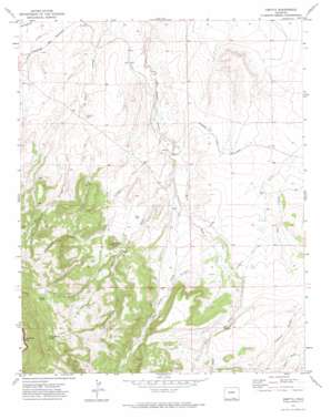
Abeyta Topo Map Colorado
To zoom in, hover over the map of Abeyta
USGS Topo Quad 37104a2 - 1:24,000 scale
| Topo Map Name: | Abeyta |
| USGS Topo Quad ID: | 37104a2 |
| Print Size: | ca. 21 1/4" wide x 27" high |
| Southeast Coordinates: | 37° N latitude / 104.125° W longitude |
| Map Center Coordinates: | 37.0625° N latitude / 104.1875° W longitude |
| U.S. State: | CO |
| Filename: | o37104a2.jpg |
| Download Map JPG Image: | Abeyta topo map 1:24,000 scale |
| Map Type: | Topographic |
| Topo Series: | 7.5´ |
| Map Scale: | 1:24,000 |
| Source of Map Images: | United States Geological Survey (USGS) |
| Alternate Map Versions: |
Abeyta CO 1971, updated 1974 Download PDF Buy paper map Abeyta CO 2010 Download PDF Buy paper map Abeyta CO 2013 Download PDF Buy paper map Abeyta CO 2016 Download PDF Buy paper map |
1:24,000 Topo Quads surrounding Abeyta
> Back to 37104a1 at 1:100,000 scale
> Back to 37104a1 at 1:250,000 scale
> Back to U.S. Topo Maps home
Abeyta topo map: Gazetteer
Abeyta: Canals
Hollenbeck Ditch elevation 1823m 5980′Quintanilla Ditch elevation 1825m 5987′
Abeyta: Populated Places
Abeyta elevation 1745m 5725′Abeyta: Reservoirs
Cordova Lake elevation 1742m 5715′Abeyta: Springs
Juan Abeyta Spring elevation 2279m 7477′Ojito Bañadero elevation 1873m 6145′
Rivale Spring elevation 2233m 7326′
Abeyta: Streams
Gurule Arroyo elevation 1731m 5679′Rito Agua Dulce elevation 1751m 5744′
Rito Seco elevation 1738m 5702′
Rito Seco elevation 1738m 5702′
San Isidro Creek elevation 1927m 6322′
Thompson Creek elevation 1730m 5675′
Abeyta: Summits
McBride Butte elevation 1936m 6351′Abeyta: Valleys
Cañoncito Romero elevation 1845m 6053′Abeyta digital topo map on disk
Buy this Abeyta topo map showing relief, roads, GPS coordinates and other geographical features, as a high-resolution digital map file on DVD:


