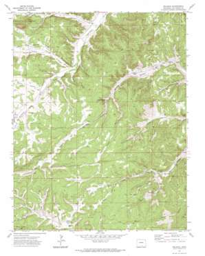
Delagua Topo Map Colorado
To zoom in, hover over the map of Delagua
USGS Topo Quad 37104c6 - 1:24,000 scale
| Topo Map Name: | Delagua |
| USGS Topo Quad ID: | 37104c6 |
| Print Size: | ca. 21 1/4" wide x 27" high |
| Southeast Coordinates: | 37.25° N latitude / 104.625° W longitude |
| Map Center Coordinates: | 37.3125° N latitude / 104.6875° W longitude |
| U.S. State: | CO |
| Filename: | o37104c6.jpg |
| Download Map JPG Image: | Delagua topo map 1:24,000 scale |
| Map Type: | Topographic |
| Topo Series: | 7.5´ |
| Map Scale: | 1:24,000 |
| Source of Map Images: | United States Geological Survey (USGS) |
| Alternate Map Versions: |
Delagua CO 1971, updated 1975 Download PDF Buy paper map Delagua CO 2010 Download PDF Buy paper map Delagua CO 2013 Download PDF Buy paper map Delagua CO 2016 Download PDF Buy paper map |
1:24,000 Topo Quads surrounding Delagua
> Back to 37104a1 at 1:100,000 scale
> Back to 37104a1 at 1:250,000 scale
> Back to U.S. Topo Maps home
Delagua topo map: Gazetteer
Delagua: Flats
Prairie Dog Flat elevation 2212m 7257′Delagua: Mines
Bear Canon Mines elevation 2107m 6912′Bear Canyon Mine elevation 2079m 6820′
Delagua and Delagua Mines elevation 2215m 7267′
Prairie Canon Mines elevation 2098m 6883′
Prairie Canyon Mine elevation 2189m 7181′
Three Pines Number One Mine elevation 2105m 6906′
Toller Mine elevation 2074m 6804′
Trinidad Basin Strip Mine elevation 2165m 7103′
Delagua: Populated Places
Delagua (historical) elevation 2038m 6686′Reilly Canyon elevation 2183m 7162′
Vallorso elevation 2070m 6791′
Delagua: Springs
Bear Canyon Spring elevation 2115m 6938′Canyon Del Agua Spring elevation 2080m 6824′
Delagua: Streams
Trujillo Creek elevation 2027m 6650′Delagua: Summits
Bald Knobs elevation 2351m 7713′Delagua: Valleys
Bear Canyon elevation 2074m 6804′Canyon Bonito elevation 2070m 6791′
Castro Canyon elevation 2047m 6715′
Frio Canyon elevation 2104m 6902′
Gregg Canyon elevation 2214m 7263′
Hunter Canyon elevation 2148m 7047′
Mauricio Canyon elevation 2009m 6591′
Mitotes Canyon elevation 2072m 6797′
Munoz Canyon elevation 2038m 6686′
Prairie Canyon elevation 2086m 6843′
Scott Canyon elevation 2184m 7165′
Trujillo Canyon elevation 2040m 6692′
Ute Canyon elevation 2088m 6850′
Wheeler Canyon elevation 2063m 6768′
Williams Canyon elevation 2042m 6699′
Delagua digital topo map on disk
Buy this Delagua topo map showing relief, roads, GPS coordinates and other geographical features, as a high-resolution digital map file on DVD:


