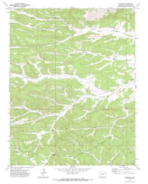
Gulnare Topo Map Colorado
To zoom in, hover over the map of Gulnare
USGS Topo Quad 37104c7 - 1:24,000 scale
| Topo Map Name: | Gulnare |
| USGS Topo Quad ID: | 37104c7 |
| Print Size: | ca. 21 1/4" wide x 27" high |
| Southeast Coordinates: | 37.25° N latitude / 104.75° W longitude |
| Map Center Coordinates: | 37.3125° N latitude / 104.8125° W longitude |
| U.S. State: | CO |
| Filename: | o37104c7.jpg |
| Download Map JPG Image: | Gulnare topo map 1:24,000 scale |
| Map Type: | Topographic |
| Topo Series: | 7.5´ |
| Map Scale: | 1:24,000 |
| Source of Map Images: | United States Geological Survey (USGS) |
| Alternate Map Versions: |
Gulnare CO 1971, updated 1973 Download PDF Buy paper map Gulnare CO 1971, updated 1973 Download PDF Buy paper map Gulnare CO 1971, updated 1974 Download PDF Buy paper map Gulnare CO 2010 Download PDF Buy paper map Gulnare CO 2013 Download PDF Buy paper map Gulnare CO 2016 Download PDF Buy paper map |
1:24,000 Topo Quads surrounding Gulnare
> Back to 37104a1 at 1:100,000 scale
> Back to 37104a1 at 1:250,000 scale
> Back to U.S. Topo Maps home
Gulnare topo map: Gazetteer
Gulnare: Dams
Apishapa Dam elevation 2133m 6998′Upper Reservoir Number 4 Dam elevation 2587m 8487′
Gulnare: Gaps
Cottontail Pass elevation 2433m 7982′Gulnare: Populated Places
Gulnare elevation 2128m 6981′Gulnare: Reservoirs
Mitotes Lake elevation 2135m 7004′Upper Reservoir Number 4 elevation 2587m 8487′
Gulnare: Streams
Jarosa Creek elevation 2134m 7001′Middle Fork Trujillo Creek elevation 2270m 7447′
North Fork Trujillo Creek elevation 2270m 7447′
South Fork Trujillo Creek elevation 2232m 7322′
Gulnare: Valleys
Borrego Canyon elevation 2195m 7201′Jarosa Canyon elevation 2157m 7076′
Gulnare digital topo map on disk
Buy this Gulnare topo map showing relief, roads, GPS coordinates and other geographical features, as a high-resolution digital map file on DVD:


