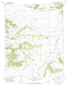
Hidden Valley Ranch Topo Map Colorado
To zoom in, hover over the map of Hidden Valley Ranch
USGS Topo Quad 37104e3 - 1:24,000 scale
| Topo Map Name: | Hidden Valley Ranch |
| USGS Topo Quad ID: | 37104e3 |
| Print Size: | ca. 21 1/4" wide x 27" high |
| Southeast Coordinates: | 37.5° N latitude / 104.25° W longitude |
| Map Center Coordinates: | 37.5625° N latitude / 104.3125° W longitude |
| U.S. State: | CO |
| Filename: | o37104e3.jpg |
| Download Map JPG Image: | Hidden Valley Ranch topo map 1:24,000 scale |
| Map Type: | Topographic |
| Topo Series: | 7.5´ |
| Map Scale: | 1:24,000 |
| Source of Map Images: | United States Geological Survey (USGS) |
| Alternate Map Versions: |
Hidden Valley Ranch CO 1971, updated 1974 Download PDF Buy paper map Hidden Valley Ranch CO 2010 Download PDF Buy paper map Hidden Valley Ranch CO 2013 Download PDF Buy paper map Hidden Valley Ranch CO 2016 Download PDF Buy paper map |
1:24,000 Topo Quads surrounding Hidden Valley Ranch
> Back to 37104e1 at 1:100,000 scale
> Back to 37104a1 at 1:250,000 scale
> Back to U.S. Topo Maps home
Hidden Valley Ranch topo map: Gazetteer
Hidden Valley Ranch: Cliffs
Black Bluff elevation 1741m 5711′Hidden Valley Ranch: Reservoirs
East Tank elevation 1709m 5606′Hidden Valley Ranch: Streams
Bates Lake Arroyo elevation 1635m 5364′Elmore Arroyo elevation 1647m 5403′
Sorgs Arroyo elevation 1663m 5456′
Hidden Valley Ranch: Summits
Brushy Knob elevation 1734m 5688′Cone Mountain elevation 1828m 5997′
Flattop Butte elevation 1845m 6053′
Gobblers Knob elevation 1729m 5672′
Mica Butte elevation 1743m 5718′
Hidden Valley Ranch: Valleys
East Draw elevation 1653m 5423′Miners Canyon elevation 1715m 5626′
Smith Hollow elevation 1635m 5364′
Hidden Valley Ranch: Wells
Monroe Well elevation 1662m 5452′Revell Well elevation 1719m 5639′
School Section Well elevation 1678m 5505′
Springer Well elevation 1765m 5790′
Sulfur Well elevation 1735m 5692′
Hidden Valley Ranch digital topo map on disk
Buy this Hidden Valley Ranch topo map showing relief, roads, GPS coordinates and other geographical features, as a high-resolution digital map file on DVD:


