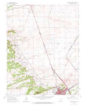
Walsenburg North Topo Map Colorado
To zoom in, hover over the map of Walsenburg North
USGS Topo Quad 37104f7 - 1:24,000 scale
| Topo Map Name: | Walsenburg North |
| USGS Topo Quad ID: | 37104f7 |
| Print Size: | ca. 21 1/4" wide x 27" high |
| Southeast Coordinates: | 37.625° N latitude / 104.75° W longitude |
| Map Center Coordinates: | 37.6875° N latitude / 104.8125° W longitude |
| U.S. State: | CO |
| Filename: | o37104f7.jpg |
| Download Map JPG Image: | Walsenburg North topo map 1:24,000 scale |
| Map Type: | Topographic |
| Topo Series: | 7.5´ |
| Map Scale: | 1:24,000 |
| Source of Map Images: | United States Geological Survey (USGS) |
| Alternate Map Versions: |
Walsenburg North CO 1963, updated 1966 Download PDF Buy paper map Walsenburg North CO 2010 Download PDF Buy paper map Walsenburg North CO 2013 Download PDF Buy paper map Walsenburg North CO 2016 Download PDF Buy paper map |
1:24,000 Topo Quads surrounding Walsenburg North
> Back to 37104e1 at 1:100,000 scale
> Back to 37104a1 at 1:250,000 scale
> Back to U.S. Topo Maps home
Walsenburg North topo map: Gazetteer
Walsenburg North: Airports
Johnson Field elevation 1839m 6033′Walsenburg Landing Field elevation 1843m 6046′
Walsenburg North: Canals
Holita Ditch elevation 1879m 6164′Homestead Canal elevation 1834m 6017′
Homestead Canal elevation 1847m 6059′
Walsenburg North: Dams
D E Farr Dam elevation 1836m 6023′Huajatolla Hills Dam elevation 1865m 6118′
La Joya Dam elevation 1866m 6122′
North Walsenburg Flood Control Dam elevation 1928m 6325′
Walsenburg North: Gaps
Long Saddle elevation 1941m 6368′Walsenburg North: Mines
Black Beauty Mine elevation 1944m 6377′Black Canyon Mine elevation 1912m 6272′
Breen Mine elevation 1925m 6315′
Caddell Mine elevation 1927m 6322′
Calumet Mine elevation 1956m 6417′
Carbonado Mine elevation 1947m 6387′
Champion Mine elevation 1909m 6263′
Cuchara Canyon Mine elevation 1925m 6315′
Gordon Mine elevation 1933m 6341′
Gordon Mine elevation 1934m 6345′
Huerfano Coal Mine elevation 1930m 6332′
Jobal Mine elevation 1917m 6289′
Long Saddle Mine elevation 1941m 6368′
Maitland Mine elevation 1919m 6295′
Major Mine elevation 1926m 6318′
McNally Mine elevation 1931m 6335′
Morning Glory Mine elevation 1923m 6309′
New Maitland Mine elevation 1922m 6305′
Old Pictou Mine elevation 1898m 6227′
Pacific Mine elevation 1991m 6532′
Pictou Mine elevation 1921m 6302′
Piñon Mine elevation 1947m 6387′
Strawberry Mine elevation 1951m 6400′
Strong Mine elevation 1912m 6272′
Sunshine Mine elevation 1918m 6292′
Tioga Mine elevation 1821m 5974′
Toltec Mine elevation 1906m 6253′
Walsenburg North: Populated Places
Maitland elevation 1909m 6263′Pictou elevation 1914m 6279′
Walsenburg North: Reservoirs
David E Farr Reservoir elevation 1836m 6023′Huajatolla Hills Reservoir elevation 1865m 6118′
La Joya Reservoir elevation 1866m 6122′
North Walsenburg Flood Control Reservoir elevation 1928m 6325′
Walsenburg North: Springs
Cottonwood Spring elevation 1964m 6443′Lower Spring elevation 1920m 6299′
Walsenburg North: Streams
Bear Creek elevation 1862m 6108′Maitland Arroyo elevation 1821m 5974′
Walsenburg North: Summits
Walsen Crag elevation 2045m 6709′Walsenburg North digital topo map on disk
Buy this Walsenburg North topo map showing relief, roads, GPS coordinates and other geographical features, as a high-resolution digital map file on DVD:


