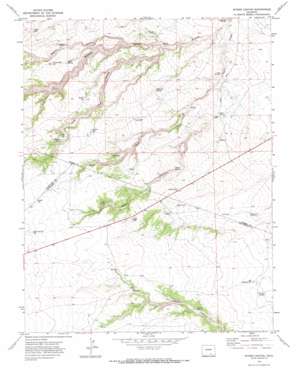
Myers Canyon Topo Map Colorado
To zoom in, hover over the map of Myers Canyon
USGS Topo Quad 37104g3 - 1:24,000 scale
| Topo Map Name: | Myers Canyon |
| USGS Topo Quad ID: | 37104g3 |
| Print Size: | ca. 21 1/4" wide x 27" high |
| Southeast Coordinates: | 37.75° N latitude / 104.25° W longitude |
| Map Center Coordinates: | 37.8125° N latitude / 104.3125° W longitude |
| U.S. State: | CO |
| Filename: | o37104g3.jpg |
| Download Map JPG Image: | Myers Canyon topo map 1:24,000 scale |
| Map Type: | Topographic |
| Topo Series: | 7.5´ |
| Map Scale: | 1:24,000 |
| Source of Map Images: | United States Geological Survey (USGS) |
| Alternate Map Versions: |
Myers Canyon CO 1970, updated 1974 Download PDF Buy paper map Myers Canyon CO 2010 Download PDF Buy paper map Myers Canyon CO 2013 Download PDF Buy paper map Myers Canyon CO 2016 Download PDF Buy paper map |
1:24,000 Topo Quads surrounding Myers Canyon
> Back to 37104e1 at 1:100,000 scale
> Back to 37104a1 at 1:250,000 scale
> Back to U.S. Topo Maps home
Myers Canyon topo map: Gazetteer
Myers Canyon: Populated Places
Cedar Crest elevation 1673m 5488′Myers Canyon: Reservoirs
Baxter Reservoir elevation 1716m 5629′Big Flannery Reservoir elevation 1647m 5403′
Cable Reservoir elevation 1665m 5462′
Canyon Reservoir elevation 1703m 5587′
Federal Reservoir elevation 1719m 5639′
Log House Reservoir elevation 1707m 5600′
Mayer Reservoir elevation 1702m 5583′
Prairie Dog Reservoir elevation 1706m 5597′
Railroad Fill Reservoir elevation 1793m 5882′
Rikoff Reservoir elevation 1781m 5843′
Myers Canyon: Springs
Averson Spring elevation 1660m 5446′Cottonwood Spring elevation 1506m 4940′
El Hondo Spring elevation 1605m 5265′
Iron Spring elevation 1535m 5036′
Myers Spring elevation 1647m 5403′
Nevitt Spring elevation 1725m 5659′
Oscar Spring elevation 1681m 5515′
Whiskey Spring elevation 1708m 5603′
Myers Canyon: Summits
Blue Hill elevation 1744m 5721′Myers Canyon: Valleys
Lone Jack Canyon elevation 1538m 5045′Madden Canyon elevation 1508m 4947′
Robins Canyon elevation 1567m 5141′
Myers Canyon digital topo map on disk
Buy this Myers Canyon topo map showing relief, roads, GPS coordinates and other geographical features, as a high-resolution digital map file on DVD:


