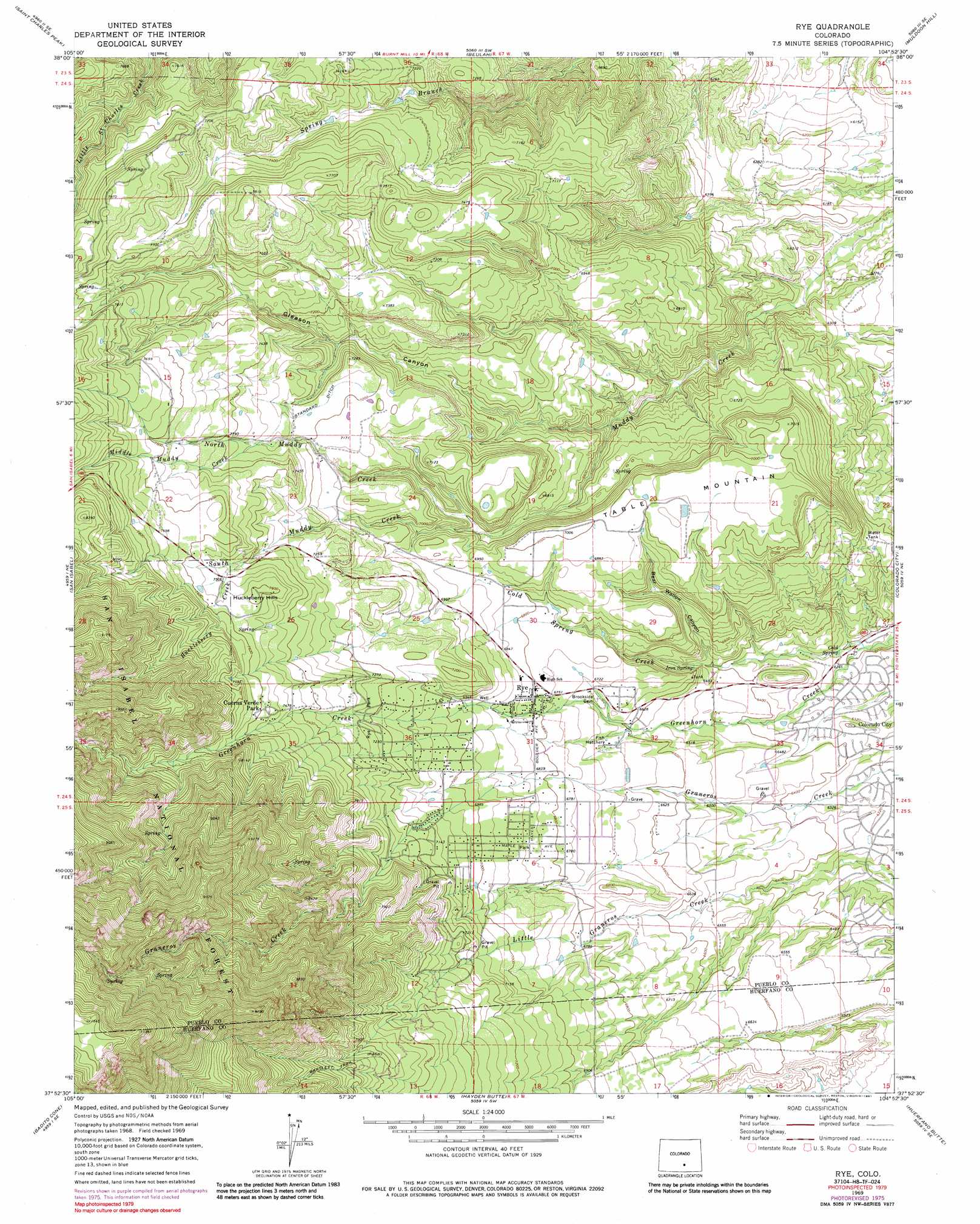
Rye Topo Map Colorado
To zoom in, hover over the map of Rye
USGS Topo Quad 37104h8 - 1:24,000 scale
| Topo Map Name: | Rye |
| USGS Topo Quad ID: | 37104h8 |
| Print Size: | ca. 21 1/4" wide x 27" high |
| Southeast Coordinates: | 37.875° N latitude / 104.875° W longitude |
| Map Center Coordinates: | 37.9375° N latitude / 104.9375° W longitude |
| U.S. State: | CO |
| Filename: | o37104h8.jpg |
| Download Map JPG Image: | Rye topo map 1:24,000 scale |
| Map Type: | Topographic |
| Topo Series: | 7.5´ |
| Map Scale: | 1:24,000 |
| Source of Map Images: | United States Geological Survey (USGS) |
| Alternate Map Versions: |
Rye CO 1969, updated 1972 Download PDF Buy paper map Rye CO 1969, updated 1972 Download PDF Buy paper map Rye CO 1969, updated 1975 Download PDF Buy paper map Rye CO 1969, updated 1977 Download PDF Buy paper map Rye CO 1969, updated 1985 Download PDF Buy paper map Rye CO 1969, updated 1991 Download PDF Buy paper map Rye CO 1975, updated 1977 Download PDF Buy paper map Rye CO 1994, updated 1998 Download PDF Buy paper map Rye CO 1994, updated 1998 Download PDF Buy paper map Rye CO 2011 Download PDF Buy paper map Rye CO 2013 Download PDF Buy paper map Rye CO 2016 Download PDF Buy paper map |
| FStopo: | US Forest Service topo Rye is available: Download FStopo PDF Download FStopo TIF |
1:24,000 Topo Quads surrounding Rye
Hardscrabble Mountain |
Wetmore |
Owl Canyon |
Beulah Ne |
Southwest Pueblo |
Deer Peak |
Saint Charles Peak |
Beulah |
Muldoon Hill |
Verde School |
Bear Creek |
San Isabel |
Rye |
Colorado City |
Graneros Flats |
Gardner |
Badito Cone |
Hayden Butte |
Huerfano Butte |
Lascar |
Little Sheep Mountain |
Farisita |
Black Hills |
Walsenburg North |
Maria Reservoir |
> Back to 37104e1 at 1:100,000 scale
> Back to 37104a1 at 1:250,000 scale
> Back to U.S. Topo Maps home
Rye topo map: Gazetteer
Rye: Arches
Saint Charles Arch elevation 2259m 7411′Rye: Canals
Standard Ditch elevation 2199m 7214′Rye: Parks
Rye Park elevation 2198m 7211′Rye: Populated Places
Cuerna Verde Park elevation 2311m 7582′Rye elevation 2073m 6801′
Rye: Springs
Cold Spring elevation 1893m 6210′Iron Spring elevation 1982m 6502′
Rye: Streams
Cold Spring Creek elevation 1882m 6174′Huckleberry Creek elevation 2259m 7411′
Middle Muddy Creek elevation 2224m 7296′
North Muddy Creek elevation 2071m 6794′
South Muddy Creek elevation 2071m 6794′
Rye: Summits
Huckleberry Hills elevation 2319m 7608′Table Mountain elevation 2146m 7040′
Rye: Valleys
Bear Wallow Canyon elevation 1950m 6397′Gleason Canyon elevation 2032m 6666′
Rye digital topo map on disk
Buy this Rye topo map showing relief, roads, GPS coordinates and other geographical features, as a high-resolution digital map file on DVD: