La Valley Topo Map Colorado
To zoom in, hover over the map of La Valley
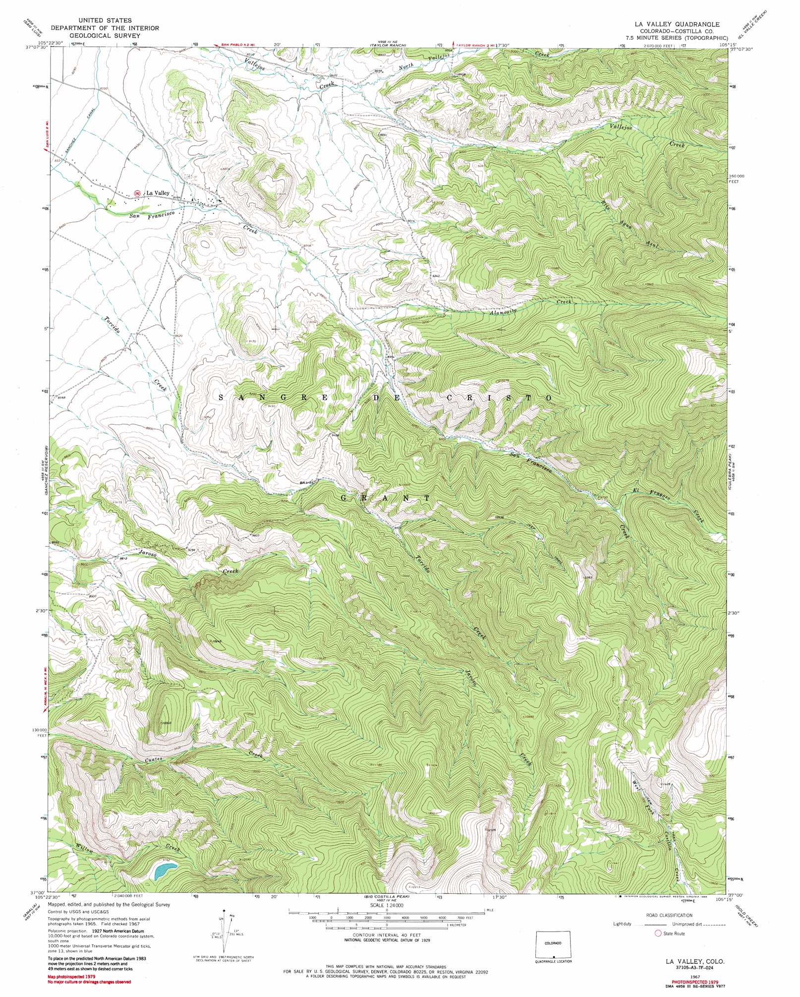
USGS Topo Quad 37105a3 - 1:24,000 scale
| Topo Map Name: | La Valley |
| USGS Topo Quad ID: | 37105a3 |
| Print Size: | ca. 21 1/4" wide x 27" high |
| Southeast Coordinates: | 37° N latitude / 105.25° W longitude |
| Map Center Coordinates: | 37.0625° N latitude / 105.3125° W longitude |
| U.S. State: | CO |
| Filename: | o37105a3.jpg |
| Download Map JPG Image: | La Valley topo map 1:24,000 scale |
| Map Type: | Topographic |
| Topo Series: | 7.5´ |
| Map Scale: | 1:24,000 |
| Source of Map Images: | United States Geological Survey (USGS) |
| Alternate Map Versions: |
La Valley CO 1967, updated 1970 Download PDF Buy paper map La Valley CO 1967, updated 1970 Download PDF Buy paper map La Valley CO 1967, updated 1986 Download PDF Buy paper map La Valley CO 2010 Download PDF Buy paper map La Valley CO 2013 Download PDF Buy paper map La Valley CO 2016 Download PDF Buy paper map |
1:24,000 Topo Quads surrounding La Valley
Blanca Se |
Fort Garland Sw |
Ojito Peak |
Trinchera Peak |
Cucharas Pass |
San Acacio |
San Luis |
Taylor Ranch |
El Valle Creek |
Stonewall |
Garcia |
Sanchez Reservoir |
La Valley |
Culebra Peak |
Torres |
Costilla |
Amalia |
Big Costilla Peak |
The Wall |
Vermejo Park |
Cerro |
Latir Peak |
Comanche Point |
Ash Mountain |
Van Bremmer Park |
> Back to 37105a1 at 1:100,000 scale
> Back to 37104a1 at 1:250,000 scale
> Back to U.S. Topo Maps home
La Valley topo map: Gazetteer
La Valley: Populated Places
La Valley elevation 2603m 8540′La Valley: Ranges
Sangre de Cristo Mountains elevation 3331m 10928′La Valley: Streams
Alamosito Creek elevation 2692m 8832′El Fragoso Creek elevation 2970m 9744′
North Vallejos Creek elevation 2628m 8622′
Rito Agua Azul elevation 2787m 9143′
La Valley digital topo map on disk
Buy this La Valley topo map showing relief, roads, GPS coordinates and other geographical features, as a high-resolution digital map file on DVD: