Garcia Topo Map Colorado
To zoom in, hover over the map of Garcia
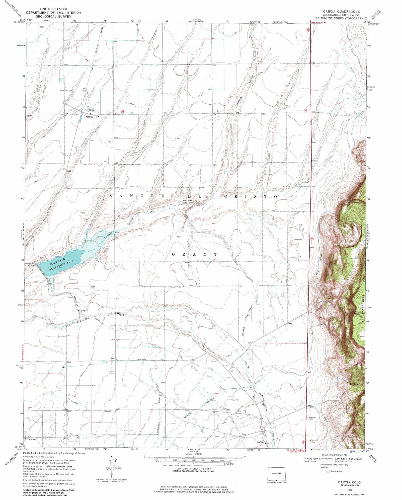
USGS Topo Quad 37105a5 - 1:24,000 scale
| Topo Map Name: | Garcia |
| USGS Topo Quad ID: | 37105a5 |
| Print Size: | ca. 21 1/4" wide x 27" high |
| Southeast Coordinates: | 37° N latitude / 105.5° W longitude |
| Map Center Coordinates: | 37.0625° N latitude / 105.5625° W longitude |
| U.S. State: | CO |
| Filename: | o37105a5.jpg |
| Download Map JPG Image: | Garcia topo map 1:24,000 scale |
| Map Type: | Topographic |
| Topo Series: | 7.5´ |
| Map Scale: | 1:24,000 |
| Source of Map Images: | United States Geological Survey (USGS) |
| Alternate Map Versions: |
Garcia CO 1967, updated 1971 Download PDF Buy paper map Garcia CO 1967, updated 1971 Download PDF Buy paper map Garcia CO 1967, updated 1986 Download PDF Buy paper map Garcia CO 2010 Download PDF Buy paper map Garcia CO 2013 Download PDF Buy paper map Garcia CO 2016 Download PDF Buy paper map |
1:24,000 Topo Quads surrounding Garcia
Pikes Stockade |
Lasauses |
Blanca Se |
Fort Garland Sw |
Ojito Peak |
Manassa Ne |
Mesito Reservoir |
San Acacio |
San Luis |
Taylor Ranch |
Kiowa Hill |
Sky Valley Ranch |
Garcia |
Sanchez Reservoir |
La Valley |
La Segita Peaks Ne |
Ute Mountain |
Costilla |
Amalia |
Big Costilla Peak |
Cerro De La Olla |
Sunshine |
Cerro |
Latir Peak |
Comanche Point |
> Back to 37105a1 at 1:100,000 scale
> Back to 37104a1 at 1:250,000 scale
> Back to U.S. Topo Maps home
Garcia topo map: Gazetteer
Garcia: Canals
Chalifa Ditch elevation 2343m 7687′Eastdale Branch Cerro Canal elevation 2343m 7687′
Eastdale Canal Number 2 elevation 2338m 7670′
Jaroso Ditch elevation 2322m 7618′
Mesa Ditch elevation 2351m 7713′
Reservoir Ditch elevation 2326m 7631′
Garcia: Dams
Eastdale Number 1 Dam elevation 2309m 7575′Eastdale Number 2 Dam elevation 2334m 7657′
Garcia: Populated Places
Garcia elevation 2355m 7726′Jaroso elevation 2309m 7575′
Mesita elevation 2339m 7673′
Garcia: Reservoirs
Eastdale Reservoir Number 1 elevation 2309m 7575′Eastdale Reservoir Number 2 elevation 2334m 7657′
Garcia: Streams
Costilla Creek elevation 2358m 7736′Garcia digital topo map on disk
Buy this Garcia topo map showing relief, roads, GPS coordinates and other geographical features, as a high-resolution digital map file on DVD: