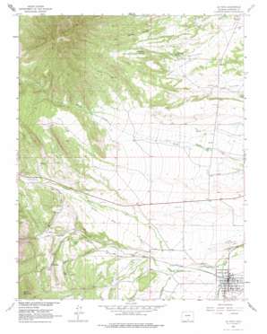
La Veta Topo Map Colorado
To zoom in, hover over the map of La Veta
USGS Topo Quad 37105e1 - 1:24,000 scale
| Topo Map Name: | La Veta |
| USGS Topo Quad ID: | 37105e1 |
| Print Size: | ca. 21 1/4" wide x 27" high |
| Southeast Coordinates: | 37.5° N latitude / 105° W longitude |
| Map Center Coordinates: | 37.5625° N latitude / 105.0625° W longitude |
| U.S. State: | CO |
| Filename: | o37105e1.jpg |
| Download Map JPG Image: | La Veta topo map 1:24,000 scale |
| Map Type: | Topographic |
| Topo Series: | 7.5´ |
| Map Scale: | 1:24,000 |
| Source of Map Images: | United States Geological Survey (USGS) |
| Alternate Map Versions: |
La Veta CO 1963, updated 1966 Download PDF Buy paper map La Veta CO 1963, updated 1966 Download PDF Buy paper map La Veta CO 1963, updated 1974 Download PDF Buy paper map La Veta CO 2010 Download PDF Buy paper map La Veta CO 2013 Download PDF Buy paper map La Veta CO 2016 Download PDF Buy paper map |
1:24,000 Topo Quads surrounding La Veta
> Back to 37105e1 at 1:100,000 scale
> Back to 37104a1 at 1:250,000 scale
> Back to U.S. Topo Maps home
La Veta topo map: Gazetteer
La Veta: Airports
Cuchara Valley at La Veta Airport elevation 2168m 7112′La Veta Landing Field elevation 2180m 7152′
La Veta: Canals
Bowen Drain elevation 2186m 7171′Dyer Ditch elevation 2172m 7125′
La Veta: Dams
C T Ritchey Dam elevation 2223m 7293′Mill Lake Dam elevation 2164m 7099′
Owens Number 2 Dam elevation 2235m 7332′
La Veta: Lakes
Frisco Lake elevation 2303m 7555′Pinon Lake elevation 2344m 7690′
La Veta: Mines
City Slicker Mine elevation 2352m 7716′Cod Number One Mine elevation 2366m 7762′
Cod Number Two Mine elevation 2338m 7670′
Klikus Mine elevation 2333m 7654′
Lone Pine Mine elevation 2414m 7919′
Oak Creek Mine elevation 2323m 7621′
Oakdale Mine elevation 2389m 7837′
Occidental Mine elevation 2415m 7923′
Ojo Mines elevation 2415m 7923′
Reliance Mine elevation 2414m 7919′
La Veta: Populated Places
La Veta elevation 2145m 7037′Occidental elevation 2352m 7716′
La Veta: Reservoirs
C T Ritchey Reservoir elevation 2223m 7293′Mill Lake elevation 2164m 7099′
Owens Reservoir Number 2 elevation 2235m 7332′
La Veta: Springs
Big Canejo Springs elevation 2359m 7739′Little Canejo Spring elevation 2231m 7319′
La Veta: Streams
Indian Creek elevation 2160m 7086′Middle Creek elevation 2123m 6965′
Oak Creek elevation 2187m 7175′
South Abeyta Creek elevation 2165m 7103′
La Veta: Summits
Cross Mountain elevation 2757m 9045′Silver Mountain elevation 3208m 10524′
La Veta: Valleys
Poison Canyon elevation 2222m 7290′La Veta digital topo map on disk
Buy this La Veta topo map showing relief, roads, GPS coordinates and other geographical features, as a high-resolution digital map file on DVD:


