Badito Cone Topo Map Colorado
To zoom in, hover over the map of Badito Cone
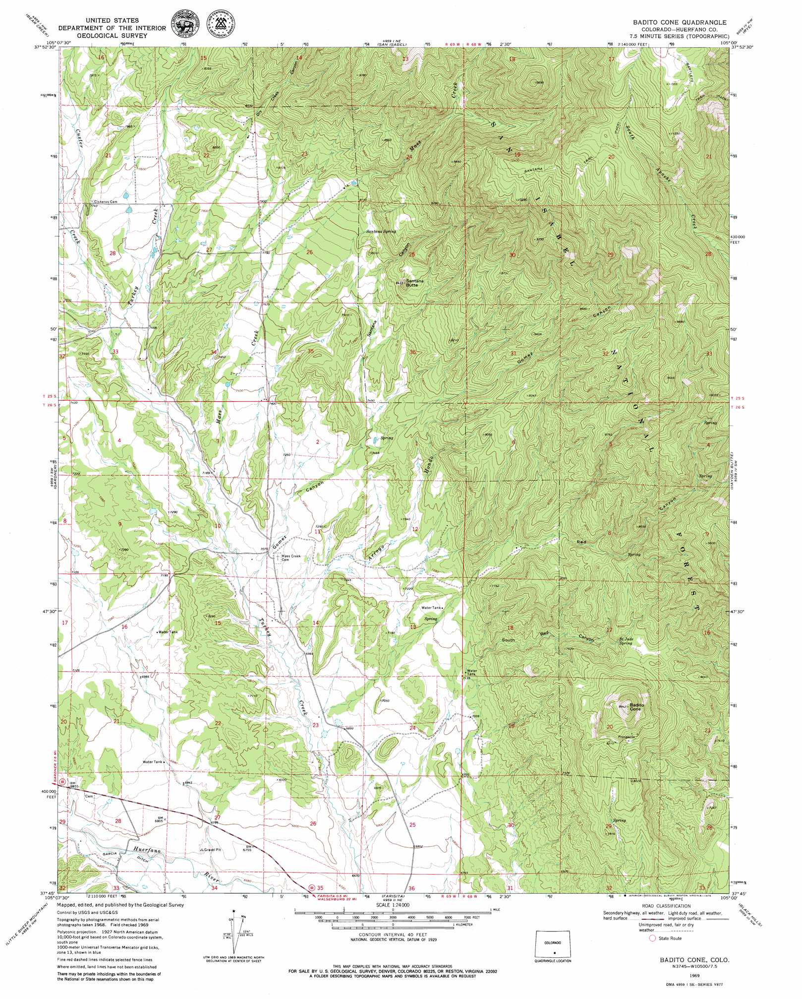
USGS Topo Quad 37105g1 - 1:24,000 scale
| Topo Map Name: | Badito Cone |
| USGS Topo Quad ID: | 37105g1 |
| Print Size: | ca. 21 1/4" wide x 27" high |
| Southeast Coordinates: | 37.75° N latitude / 105° W longitude |
| Map Center Coordinates: | 37.8125° N latitude / 105.0625° W longitude |
| U.S. State: | CO |
| Filename: | o37105g1.jpg |
| Download Map JPG Image: | Badito Cone topo map 1:24,000 scale |
| Map Type: | Topographic |
| Topo Series: | 7.5´ |
| Map Scale: | 1:24,000 |
| Source of Map Images: | United States Geological Survey (USGS) |
| Alternate Map Versions: |
Badito Cone CO 1969, updated 1973 Download PDF Buy paper map Badito Cone CO 1969, updated 1973 Download PDF Buy paper map Badito Cone CO 1969, updated 1979 Download PDF Buy paper map Badito Cone CO 1994, updated 1998 Download PDF Buy paper map Badito Cone CO 2011 Download PDF Buy paper map Badito Cone CO 2013 Download PDF Buy paper map Badito Cone CO 2016 Download PDF Buy paper map |
| FStopo: | US Forest Service topo Badito Cone is available: Download FStopo PDF Download FStopo TIF |
1:24,000 Topo Quads surrounding Badito Cone
Rosita |
Deer Peak |
Saint Charles Peak |
Beulah |
Muldoon Hill |
Devils Gulch |
Bear Creek |
San Isabel |
Rye |
Colorado City |
Creager Reservoir |
Gardner |
Badito Cone |
Hayden Butte |
Huerfano Butte |
Red Wing |
Little Sheep Mountain |
Farisita |
Black Hills |
Walsenburg North |
Russell |
La Veta Pass |
La Veta |
Ritter Arroyo |
Walsenburg South |
> Back to 37105e1 at 1:100,000 scale
> Back to 37104a1 at 1:250,000 scale
> Back to U.S. Topo Maps home
Badito Cone topo map: Gazetteer
Badito Cone: Mines
Stumbling Stud Mine elevation 2418m 7933′Badito Cone: Springs
Saint Jude Spring elevation 2372m 7782′Santana Spring elevation 2453m 8047′
Badito Cone: Streams
Arroyo Hondo elevation 2107m 6912′Custer Creek elevation 2241m 7352′
Maes Creek elevation 2170m 7119′
Badito Cone: Summits
Badito Cone elevation 2728m 8950′Santana Butte elevation 2560m 8398′
Badito Cone: Trails
Santana Trail elevation 3225m 10580′Badito Cone: Valleys
Dry Creek Canyon elevation 2362m 7749′Gomez Canyon elevation 2144m 7034′
Red Canyon elevation 2301m 7549′
Reveille Canyon elevation 2353m 7719′
Santana Canyon elevation 2267m 7437′
South Red Canyon elevation 2179m 7148′
Badito Cone digital topo map on disk
Buy this Badito Cone topo map showing relief, roads, GPS coordinates and other geographical features, as a high-resolution digital map file on DVD: