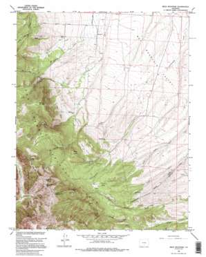
Beck Mountain Topo Map Colorado
To zoom in, hover over the map of Beck Mountain
USGS Topo Quad 37105h4 - 1:24,000 scale
| Topo Map Name: | Beck Mountain |
| USGS Topo Quad ID: | 37105h4 |
| Print Size: | ca. 21 1/4" wide x 27" high |
| Southeast Coordinates: | 37.875° N latitude / 105.375° W longitude |
| Map Center Coordinates: | 37.9375° N latitude / 105.4375° W longitude |
| U.S. State: | CO |
| Filename: | o37105h4.jpg |
| Download Map JPG Image: | Beck Mountain topo map 1:24,000 scale |
| Map Type: | Topographic |
| Topo Series: | 7.5´ |
| Map Scale: | 1:24,000 |
| Source of Map Images: | United States Geological Survey (USGS) |
| Alternate Map Versions: |
Beck Mountain CO 1960, updated 1963 Download PDF Buy paper map Beck Mountain CO 1960, updated 1963 Download PDF Buy paper map Beck Mountain CO 1960, updated 1971 Download PDF Buy paper map Beck Mountain CO 1960, updated 1971 Download PDF Buy paper map Beck Mountain CO 1960, updated 1978 Download PDF Buy paper map Beck Mountain CO 1960, updated 1995 Download PDF Buy paper map Beck Mountain CO 2001, updated 2005 Download PDF Buy paper map Beck Mountain CO 2011 Download PDF Buy paper map Beck Mountain CO 2013 Download PDF Buy paper map Beck Mountain CO 2016 Download PDF Buy paper map |
| FStopo: | US Forest Service topo Beck Mountain is available: Download FStopo PDF Download FStopo TIF |
1:24,000 Topo Quads surrounding Beck Mountain
> Back to 37105e1 at 1:100,000 scale
> Back to 37104a1 at 1:250,000 scale
> Back to U.S. Topo Maps home
Beck Mountain topo map: Gazetteer
Beck Mountain: Falls
Crystal Falls elevation 2835m 9301′Beck Mountain: Flats
Loco Park elevation 2938m 9639′Beck Mountain: Springs
Mud Springs elevation 2717m 8914′Wolf Spring elevation 2759m 9051′
Beck Mountain: Streams
Bear Creek elevation 2858m 9376′Crystal Falls Creek elevation 2589m 8494′
Hudson Creek elevation 2518m 8261′
Jones Creek elevation 3002m 9849′
Music Pass Creek elevation 2669m 8756′
Spring Creek elevation 2539m 8330′
Beck Mountain: Summits
Beck Mountain elevation 3278m 10754′Blizzardine Peak elevation 3618m 11870′
Blueberry Peak elevation 3655m 11991′
Carbon Hill elevation 3226m 10583′
Huckleberry Mountain elevation 3339m 10954′
Loco Hill elevation 3002m 9849′
Middle Knob elevation 3105m 10187′
Snowslide Mountain elevation 3556m 11666′
Beck Mountain: Trails
Marble Mountain Trail elevation 3034m 9954′Music Pass Trail elevation 3263m 10705′
Rainbow Trail elevation 3016m 9895′
Beck Mountain digital topo map on disk
Buy this Beck Mountain topo map showing relief, roads, GPS coordinates and other geographical features, as a high-resolution digital map file on DVD:


