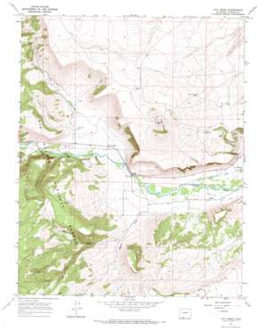
Fox Creek Topo Map Colorado
To zoom in, hover over the map of Fox Creek
USGS Topo Quad 37106a2 - 1:24,000 scale
| Topo Map Name: | Fox Creek |
| USGS Topo Quad ID: | 37106a2 |
| Print Size: | ca. 21 1/4" wide x 27" high |
| Southeast Coordinates: | 37° N latitude / 106.125° W longitude |
| Map Center Coordinates: | 37.0625° N latitude / 106.1875° W longitude |
| U.S. State: | CO |
| Filename: | o37106a2.jpg |
| Download Map JPG Image: | Fox Creek topo map 1:24,000 scale |
| Map Type: | Topographic |
| Topo Series: | 7.5´ |
| Map Scale: | 1:24,000 |
| Source of Map Images: | United States Geological Survey (USGS) |
| Alternate Map Versions: |
Fox Creek CO 1967, updated 1971 Download PDF Buy paper map Fox Creek CO 1967, updated 1971 Download PDF Buy paper map Fox Creek CO 2001, updated 2005 Download PDF Buy paper map Fox Creek CO 2011 Download PDF Buy paper map Fox Creek CO 2013 Download PDF Buy paper map Fox Creek CO 2016 Download PDF Buy paper map |
| FStopo: | US Forest Service topo Fox Creek is available: Download FStopo PDF Download FStopo TIF |
1:24,000 Topo Quads surrounding Fox Creek
> Back to 37106a1 at 1:100,000 scale
> Back to 37106a1 at 1:250,000 scale
> Back to U.S. Topo Maps home
Fox Creek topo map: Gazetteer
Fox Creek: Bridges
Broyles Bridge elevation 2522m 8274′Fox Creek: Dams
Banded Pigeon Dam elevation 2733m 8966′Blackbird Dam elevation 2787m 9143′
Early Bird Dam elevation 2724m 8937′
Fox Creek: Populated Places
Cañon elevation 2495m 8185′Fox Creek elevation 2544m 8346′
Fox Creek: Springs
Cold Springs elevation 2807m 9209′Fox Creek: Streams
Bighorn Creek elevation 2511m 8238′Bighorn Creek elevation 2511m 8238′
Fox Creek elevation 2528m 8293′
Rito Hondo elevation 2549m 8362′
Fox Creek: Summits
Los Mogotes elevation 2991m 9812′Fox Creek: Valleys
Conoboy Canyon elevation 2559m 8395′Hicks Canyon elevation 2571m 8435′
Long Canyon elevation 2652m 8700′
Massey Gulch elevation 2559m 8395′
Trail Gulch elevation 2573m 8441′
Fox Creek digital topo map on disk
Buy this Fox Creek topo map showing relief, roads, GPS coordinates and other geographical features, as a high-resolution digital map file on DVD:


