Center North Topo Map Colorado
To zoom in, hover over the map of Center North
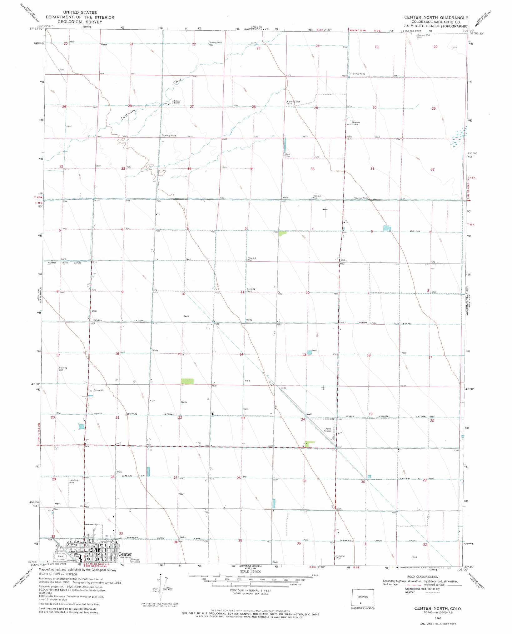
USGS Topo Quad 37106g1 - 1:24,000 scale
| Topo Map Name: | Center North |
| USGS Topo Quad ID: | 37106g1 |
| Print Size: | ca. 21 1/4" wide x 27" high |
| Southeast Coordinates: | 37.75° N latitude / 106° W longitude |
| Map Center Coordinates: | 37.8125° N latitude / 106.0625° W longitude |
| U.S. State: | CO |
| Filename: | o37106g1.jpg |
| Download Map JPG Image: | Center North topo map 1:24,000 scale |
| Map Type: | Topographic |
| Topo Series: | 7.5´ |
| Map Scale: | 1:24,000 |
| Source of Map Images: | United States Geological Survey (USGS) |
| Alternate Map Versions: |
Center North CO 1968, updated 1970 Download PDF Buy paper map Center North CO 2010 Download PDF Buy paper map Center North CO 2013 Download PDF Buy paper map Center North CO 2016 Download PDF Buy paper map |
1:24,000 Topo Quads surrounding Center North
Laughlin Gulch |
Saguache |
Hickey Bridge |
Moffat North |
Mirage |
Lime Creek |
Swede Corners |
Harrence Lake |
Moffat South |
Sheds Camp |
Twin Mountains Se |
La Garita |
Center North |
Deadman Camp Sw |
Deadman Camp |
Del Norte |
Sevenmile Plaza |
Center South |
Hooper West |
Hooper East |
Dog Mountain |
Monte Vista |
Homelake |
Mount Pleasant School |
Hooper Se |
> Back to 37106e1 at 1:100,000 scale
> Back to 37106a1 at 1:250,000 scale
> Back to U.S. Topo Maps home
Center North topo map: Gazetteer
Center North: Airports
Finley Airport elevation 2331m 7647′Leach Airport elevation 2316m 7598′
Center North: Canals
Farmers Union Canal elevation 2330m 7644′North Lateral elevation 2308m 7572′
Center North: Populated Places
Center elevation 2330m 7644′Center North digital topo map on disk
Buy this Center North topo map showing relief, roads, GPS coordinates and other geographical features, as a high-resolution digital map file on DVD: