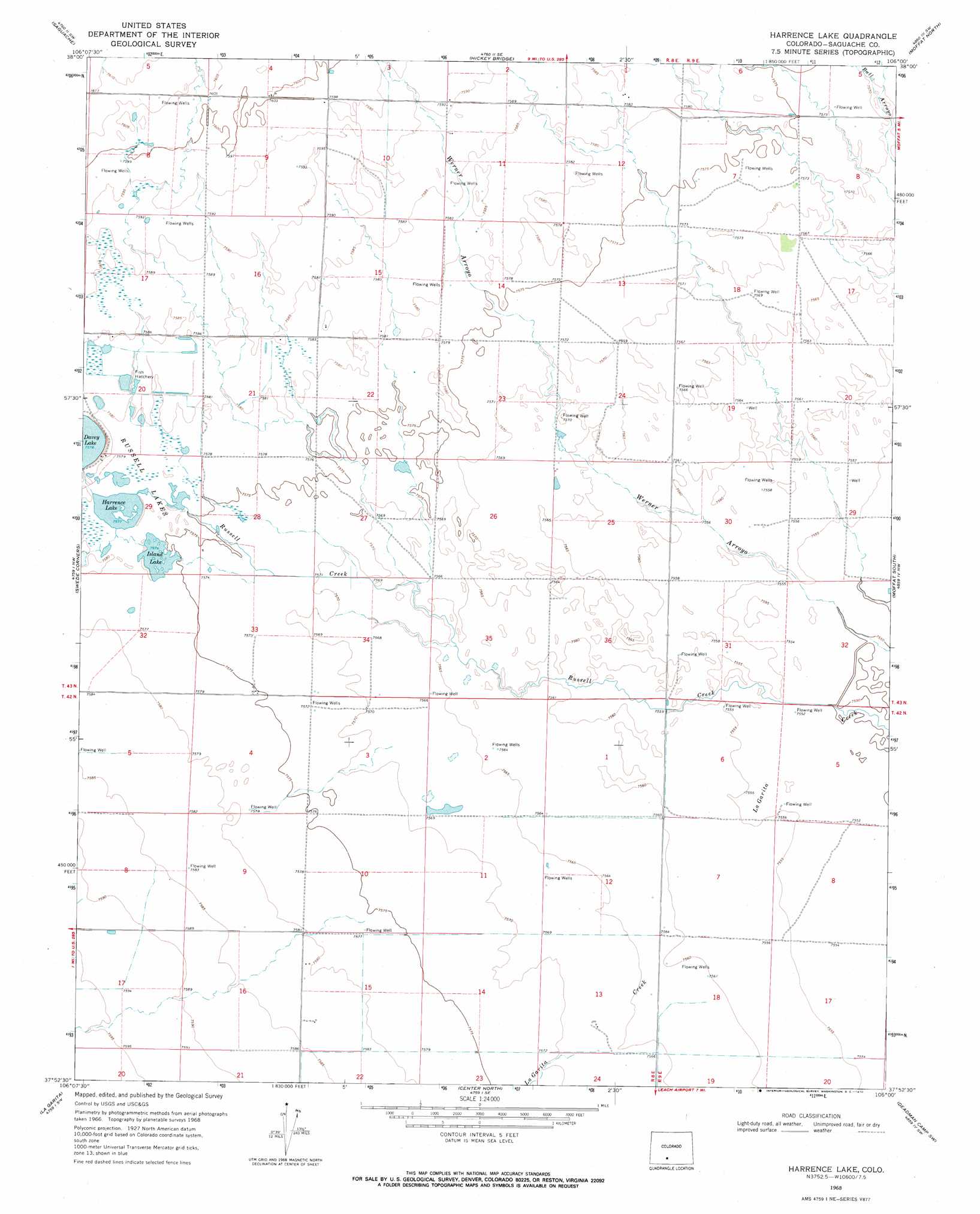
Harrence Lake Topo Map Colorado
To zoom in, hover over the map of Harrence Lake
USGS Topo Quad 37106h1 - 1:24,000 scale
| Topo Map Name: | Harrence Lake |
| USGS Topo Quad ID: | 37106h1 |
| Print Size: | ca. 21 1/4" wide x 27" high |
| Southeast Coordinates: | 37.875° N latitude / 106° W longitude |
| Map Center Coordinates: | 37.9375° N latitude / 106.0625° W longitude |
| U.S. State: | CO |
| Filename: | o37106h1.jpg |
| Download Map JPG Image: | Harrence Lake topo map 1:24,000 scale |
| Map Type: | Topographic |
| Topo Series: | 7.5´ |
| Map Scale: | 1:24,000 |
| Source of Map Images: | United States Geological Survey (USGS) |
| Alternate Map Versions: |
Harrence Lake CO 1968, updated 1970 Download PDF Buy paper map Harrence Lake CO 1968, updated 1971 Download PDF Buy paper map Harrence Lake CO 2010 Download PDF Buy paper map Harrence Lake CO 2013 Download PDF Buy paper map Harrence Lake CO 2016 Download PDF Buy paper map |
1:24,000 Topo Quads surrounding Harrence Lake
Lake Mountain Ne |
Klondike Mine |
Graveyard Gulch |
Villa Grove |
Valley View Hot Springs |
Laughlin Gulch |
Saguache |
Hickey Bridge |
Moffat North |
Mirage |
Lime Creek |
Swede Corners |
Harrence Lake |
Moffat South |
Sheds Camp |
Twin Mountains Se |
La Garita |
Center North |
Deadman Camp Sw |
Deadman Camp |
Del Norte |
Sevenmile Plaza |
Center South |
Hooper West |
Hooper East |
> Back to 37106e1 at 1:100,000 scale
> Back to 37106a1 at 1:250,000 scale
> Back to U.S. Topo Maps home
Harrence Lake topo map: Gazetteer
Harrence Lake: Lakes
Harrence Lake elevation 2311m 7582′Island Lake elevation 2311m 7582′
Harrence Lake: Streams
Russell Creek elevation 2303m 7555′Harrence Lake digital topo map on disk
Buy this Harrence Lake topo map showing relief, roads, GPS coordinates and other geographical features, as a high-resolution digital map file on DVD: