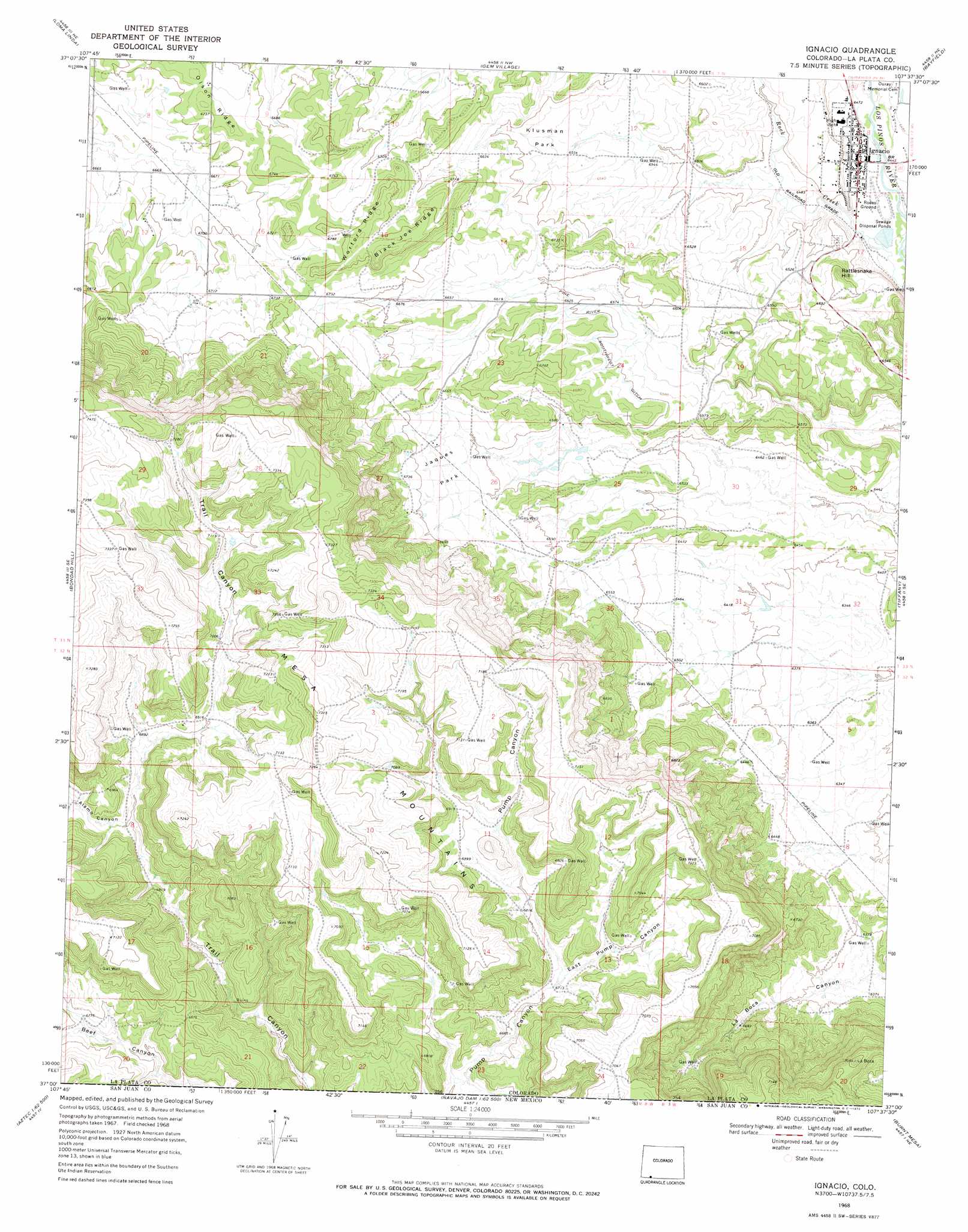
Ignacio Topo Map Colorado
To zoom in, hover over the map of Ignacio
USGS Topo Quad 37107a6 - 1:24,000 scale
| Topo Map Name: | Ignacio |
| USGS Topo Quad ID: | 37107a6 |
| Print Size: | ca. 21 1/4" wide x 27" high |
| Southeast Coordinates: | 37° N latitude / 107.625° W longitude |
| Map Center Coordinates: | 37.0625° N latitude / 107.6875° W longitude |
| U.S. State: | CO |
| Filename: | o37107a6.jpg |
| Download Map JPG Image: | Ignacio topo map 1:24,000 scale |
| Map Type: | Topographic |
| Topo Series: | 7.5´ |
| Map Scale: | 1:24,000 |
| Source of Map Images: | United States Geological Survey (USGS) |
| Alternate Map Versions: |
Ignacio CO 1968, updated 1972 Download PDF Buy paper map Ignacio CO 2010 Download PDF Buy paper map Ignacio CO 2013 Download PDF Buy paper map Ignacio CO 2016 Download PDF Buy paper map |
1:24,000 Topo Quads surrounding Ignacio
Durango West |
Durango East |
Rules Hill |
Ludwig Mountain |
Baldy Mountain |
Basin Mountain |
Loma Linda |
Gem Village |
Bayfield |
Pargin Mountain |
Long Mountain |
Bondad Hill |
Ignacio |
Tiffany |
Allison |
Cedar Hill |
Tank Mountain |
Anastacio Spring |
Burnt Mesa |
Bancos Mesa Nw |
Aztec |
Turley |
Archuleta |
Navajo Dam |
Gomez Ranch |
> Back to 37107a1 at 1:100,000 scale
> Back to 37106a1 at 1:250,000 scale
> Back to U.S. Topo Maps home
Ignacio topo map: Gazetteer
Ignacio: Canals
Pine River Southwest Ditch elevation 2015m 6610′Ignacio: Flats
Jaques Park elevation 2027m 6650′Klusman Park elevation 2002m 6568′
Ignacio: Populated Places
Ignacio elevation 1967m 6453′Ignacio: Ridges
Black Joe Ridge elevation 2084m 6837′Olson Ridge elevation 2062m 6765′
Worford Ridge elevation 2082m 6830′
Ignacio: Streams
Ignacio Creek elevation 2001m 6564′Rock Creek elevation 1953m 6407′
Ignacio: Summits
Rattlesnake Hill elevation 2039m 6689′Ignacio: Valleys
Alamo Canyon elevation 2073m 6801′East Pump Canyon elevation 2050m 6725′
Ignacio digital topo map on disk
Buy this Ignacio topo map showing relief, roads, GPS coordinates and other geographical features, as a high-resolution digital map file on DVD: