Bondad Hill Topo Map Colorado
To zoom in, hover over the map of Bondad Hill
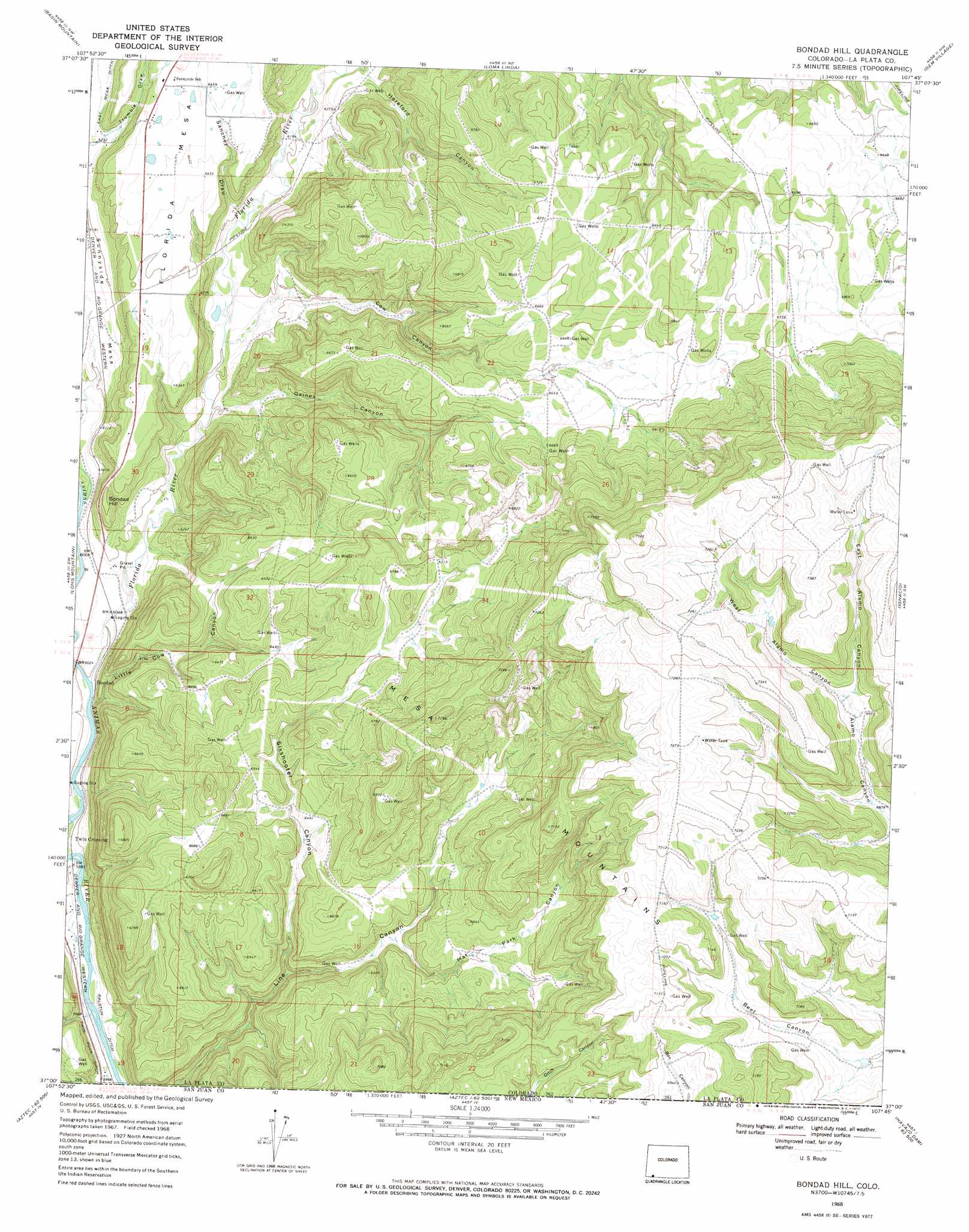
USGS Topo Quad 37107a7 - 1:24,000 scale
| Topo Map Name: | Bondad Hill |
| USGS Topo Quad ID: | 37107a7 |
| Print Size: | ca. 21 1/4" wide x 27" high |
| Southeast Coordinates: | 37° N latitude / 107.75° W longitude |
| Map Center Coordinates: | 37.0625° N latitude / 107.8125° W longitude |
| U.S. State: | CO |
| Filename: | o37107a7.jpg |
| Download Map JPG Image: | Bondad Hill topo map 1:24,000 scale |
| Map Type: | Topographic |
| Topo Series: | 7.5´ |
| Map Scale: | 1:24,000 |
| Source of Map Images: | United States Geological Survey (USGS) |
| Alternate Map Versions: |
Bondad Hill CO 1968, updated 1972 Download PDF Buy paper map Bondad Hill CO 2010 Download PDF Buy paper map Bondad Hill CO 2013 Download PDF Buy paper map Bondad Hill CO 2016 Download PDF Buy paper map |
1:24,000 Topo Quads surrounding Bondad Hill
Hesperus |
Durango West |
Durango East |
Rules Hill |
Ludwig Mountain |
Kline |
Basin Mountain |
Loma Linda |
Gem Village |
Bayfield |
Pinkerton Mesa |
Long Mountain |
Bondad Hill |
Ignacio |
Tiffany |
Abode Downs Ranch |
Cedar Hill |
Tank Mountain |
Anastacio Spring |
Burnt Mesa |
Flora Vista |
Aztec |
Turley |
Archuleta |
Navajo Dam |
> Back to 37107a1 at 1:100,000 scale
> Back to 37106a1 at 1:250,000 scale
> Back to U.S. Topo Maps home
Bondad Hill topo map: Gazetteer
Bondad Hill: Canals
S and M Canal elevation 1926m 6318′Bondad Hill: Ranges
Mesa Mountains elevation 2304m 7559′Bondad Hill: Reservoirs
Lambert Reservoir elevation 1891m 6204′Bondad Hill: Streams
Finney Cuts elevation 2005m 6578′Florida River elevation 1827m 5994′
West Leon Creek elevation 2039m 6689′
Bondad Hill: Summits
Bondad Hill elevation 1925m 6315′Bondad Hill: Valleys
Cow Canyon elevation 1871m 6138′East Alamo Canyon elevation 2123m 6965′
Gaines Canyon elevation 1859m 6099′
Hat Park Canyon elevation 1940m 6364′
Little Cow Canyon elevation 1828m 5997′
Sanchez Draw elevation 1881m 6171′
Sixshooter Canyon elevation 1880m 6167′
West Alamo Canyon elevation 2123m 6965′
Bondad Hill digital topo map on disk
Buy this Bondad Hill topo map showing relief, roads, GPS coordinates and other geographical features, as a high-resolution digital map file on DVD: