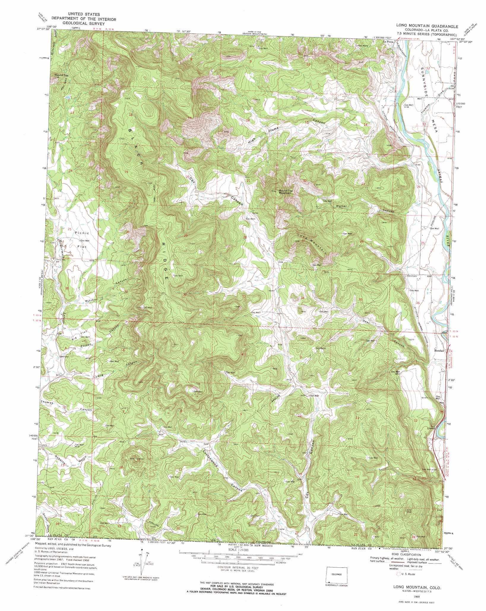
Long Mountain Topo Map Colorado
To zoom in, hover over the map of Long Mountain
USGS Topo Quad 37107a8 - 1:24,000 scale
| Topo Map Name: | Long Mountain |
| USGS Topo Quad ID: | 37107a8 |
| Print Size: | ca. 21 1/4" wide x 27" high |
| Southeast Coordinates: | 37° N latitude / 107.875° W longitude |
| Map Center Coordinates: | 37.0625° N latitude / 107.9375° W longitude |
| U.S. State: | CO |
| Filename: | o37107a8.jpg |
| Download Map JPG Image: | Long Mountain topo map 1:24,000 scale |
| Map Type: | Topographic |
| Topo Series: | 7.5´ |
| Map Scale: | 1:24,000 |
| Source of Map Images: | United States Geological Survey (USGS) |
| Alternate Map Versions: |
Long Mountain CO 1968, updated 1972 Download PDF Buy paper map Long Mountain CO 2010 Download PDF Buy paper map Long Mountain CO 2013 Download PDF Buy paper map Long Mountain CO 2016 Download PDF Buy paper map |
1:24,000 Topo Quads surrounding Long Mountain
Thompson Park |
Hesperus |
Durango West |
Durango East |
Rules Hill |
Mormon Reservoir |
Kline |
Basin Mountain |
Loma Linda |
Gem Village |
Redmesa |
Pinkerton Mesa |
Long Mountain |
Bondad Hill |
Ignacio |
La Plata |
Abode Downs Ranch |
Cedar Hill |
Tank Mountain |
Anastacio Spring |
Farmington North |
Flora Vista |
Aztec |
Turley |
Archuleta |
> Back to 37107a1 at 1:100,000 scale
> Back to 37106a1 at 1:250,000 scale
> Back to U.S. Topo Maps home
Long Mountain topo map: Gazetteer
Long Mountain: Canals
Citizens Animas Ditch elevation 1873m 6145′Long Mountain: Flats
Big Flat elevation 1962m 6437′Picnic Flat elevation 1996m 6548′
Long Mountain: Populated Places
Bondad elevation 1841m 6040′Long Mountain: Ridges
Black Ridge elevation 2232m 7322′Long Mountain: Summits
Long Mountain elevation 2153m 7063′Round Top elevation 2145m 7037′
Round Top Mountain elevation 2234m 7329′
Long Mountain: Valleys
Cottonwood Canyon elevation 1889m 6197′Deer Canyon elevation 1847m 6059′
High Flume Canyon elevation 1864m 6115′
La Posta Canyon elevation 1868m 6128′
Long Canyon elevation 1936m 6351′
Mitchell Canyon elevation 1954m 6410′
Poison Canyon elevation 1940m 6364′
Trumble Draw elevation 1857m 6092′
Walter Canyon elevation 1872m 6141′
Long Mountain digital topo map on disk
Buy this Long Mountain topo map showing relief, roads, GPS coordinates and other geographical features, as a high-resolution digital map file on DVD: