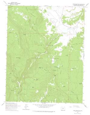
Chris Mountain Topo Map Colorado
To zoom in, hover over the map of Chris Mountain
USGS Topo Quad 37107c2 - 1:24,000 scale
| Topo Map Name: | Chris Mountain |
| USGS Topo Quad ID: | 37107c2 |
| Print Size: | ca. 21 1/4" wide x 27" high |
| Southeast Coordinates: | 37.25° N latitude / 107.125° W longitude |
| Map Center Coordinates: | 37.3125° N latitude / 107.1875° W longitude |
| U.S. State: | CO |
| Filename: | o37107c2.jpg |
| Download Map JPG Image: | Chris Mountain topo map 1:24,000 scale |
| Map Type: | Topographic |
| Topo Series: | 7.5´ |
| Map Scale: | 1:24,000 |
| Source of Map Images: | United States Geological Survey (USGS) |
| Alternate Map Versions: |
Chris Mountain CO 1964, updated 1967 Download PDF Buy paper map Chris Mountain CO 1964, updated 1967 Download PDF Buy paper map Chris Mountain CO 1964, updated 1975 Download PDF Buy paper map Chris Mountain CO 1964, updated 1975 Download PDF Buy paper map Chris Mountain CO 2011 Download PDF Buy paper map Chris Mountain CO 2013 Download PDF Buy paper map Chris Mountain CO 2016 Download PDF Buy paper map |
| FStopo: | US Forest Service topo Chris Mountain is available: Download FStopo PDF Download FStopo TIF |
1:24,000 Topo Quads surrounding Chris Mountain
> Back to 37107a1 at 1:100,000 scale
> Back to 37106a1 at 1:250,000 scale
> Back to U.S. Topo Maps home
Chris Mountain topo map: Gazetteer
Chris Mountain: Dams
Dunnagan Dam elevation 2441m 8008′Chris Mountain: Flats
O'Neal Park elevation 2465m 8087′Chris Mountain: Reservoirs
Dunnagan Reservoir elevation 2441m 8008′Gopher Reservoir elevation 2402m 7880′
Newt Jack Spring Reservoir elevation 2422m 7946′
Osborn Reservoir Number 1 elevation 2544m 8346′
Osborn Reservoir Number 2 elevation 2676m 8779′
Park Reservoir elevation 2440m 8005′
Perino Reservoir elevation 2458m 8064′
Round Park Reservoir elevation 2362m 7749′
Sawmill Reservoir elevation 2451m 8041′
Turkey Springs Reservoir elevation 2469m 8100′
Chris Mountain: Springs
Butcher Spring elevation 2413m 7916′Driveway Springs elevation 2689m 8822′
Hotz Spring elevation 2403m 7883′
Lost Spring elevation 2510m 8234′
Middle Mountain Spring elevation 2723m 8933′
Mud Spring elevation 2450m 8038′
Snow Spring elevation 2283m 7490′
Chris Mountain: Streams
West Fork Devil Creek elevation 2216m 7270′Chris Mountain: Summits
Brockover Mesa elevation 2504m 8215′Chris Mountain elevation 2705m 8874′
Flatiron Mesa elevation 2455m 8054′
Middle Mountain elevation 2957m 9701′
The Ant Hill elevation 2462m 8077′
Chris Mountain: Trails
Fourmile Stock Trail elevation 2425m 7956′Middle Mountain Trail elevation 2882m 9455′
Piedra Stock Trail elevation 2432m 7979′
Chris Mountain: Valleys
Dunagan Canyon elevation 2362m 7749′Perry Draw elevation 2428m 7965′
Reservoir Gulch elevation 2469m 8100′
Roush Draw elevation 2428m 7965′
Chris Mountain digital topo map on disk
Buy this Chris Mountain topo map showing relief, roads, GPS coordinates and other geographical features, as a high-resolution digital map file on DVD:


