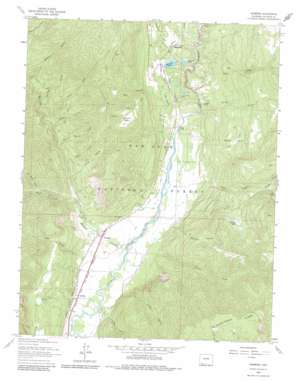
Hermosa Topo Map Colorado
To zoom in, hover over the map of Hermosa
USGS Topo Quad 37107d7 - 1:24,000 scale
| Topo Map Name: | Hermosa |
| USGS Topo Quad ID: | 37107d7 |
| Print Size: | ca. 21 1/4" wide x 27" high |
| Southeast Coordinates: | 37.375° N latitude / 107.75° W longitude |
| Map Center Coordinates: | 37.4375° N latitude / 107.8125° W longitude |
| U.S. State: | CO |
| Filename: | o37107d7.jpg |
| Download Map JPG Image: | Hermosa topo map 1:24,000 scale |
| Map Type: | Topographic |
| Topo Series: | 7.5´ |
| Map Scale: | 1:24,000 |
| Source of Map Images: | United States Geological Survey (USGS) |
| Alternate Map Versions: |
Hermosa CO 1963, updated 1965 Download PDF Buy paper map Hermosa CO 1963, updated 1965 Download PDF Buy paper map Hermosa CO 1963, updated 1970 Download PDF Buy paper map Hermosa CO 1963, updated 1970 Download PDF Buy paper map Hermosa CO 1963, updated 1981 Download PDF Buy paper map Hermosa CO 2011 Download PDF Buy paper map Hermosa CO 2013 Download PDF Buy paper map Hermosa CO 2016 Download PDF Buy paper map |
| FStopo: | US Forest Service topo Hermosa is available: Download FStopo PDF Download FStopo TIF |
1:24,000 Topo Quads surrounding Hermosa
> Back to 37107a1 at 1:100,000 scale
> Back to 37106a1 at 1:250,000 scale
> Back to U.S. Topo Maps home
Hermosa topo map: Gazetteer
Hermosa: Bridges
Bakers Bridge elevation 2056m 6745′Hermosa: Canals
Animas Valley Consolidated Ditch elevation 2025m 6643′Reid Ditch elevation 2015m 6610′
Hermosa: Dams
Keeler Dam elevation 2212m 7257′Warner Number 5 Dam elevation 2271m 7450′
Hermosa: Gaps
Treasure Pass elevation 2164m 7099′Hermosa: Lakes
Shalona Lake elevation 2202m 7224′Stratton Lake elevation 2225m 7299′
Hermosa: Mines
Painter Placer elevation 2083m 6833′Poverty Hill Mine elevation 2006m 6581′
Tripp Gulch Mine elevation 2285m 7496′
Hermosa: Populated Places
Hermosa elevation 2025m 6643′Rockwood elevation 2243m 7358′
Trimble elevation 2005m 6578′
Hermosa: Reservoirs
Keeler Reservoir elevation 2212m 7257′Smith Lake elevation 2096m 6876′
Warner Reservoir Number 5 elevation 2271m 7450′
Hermosa: Ridges
Missionary Ridge elevation 2953m 9688′Hermosa: Springs
Pinkerton Hot Springs elevation 2071m 6794′Stratten Warm Spring elevation 2019m 6624′
Trimble Hot Springs elevation 2006m 6581′
Tripp Hot Spring elevation 2007m 6584′
Tripp Hot Springs elevation 2084m 6837′
Hermosa: Streams
Bear Creek elevation 2113m 6932′Big Spring Creek elevation 2142m 7027′
Buck Creek elevation 2207m 7240′
Carson Creek elevation 2095m 6873′
Cliff Creek elevation 2102m 6896′
Coon Creek elevation 2034m 6673′
Elbert Creek elevation 2063m 6768′
Goulding Creek elevation 2237m 7339′
Hermosa Creek elevation 2007m 6584′
Jones Creek elevation 2171m 7122′
Middle Fork Coon Creek elevation 2519m 8264′
No Buck Creek elevation 2274m 7460′
North Fork Coon Creek elevation 2519m 8264′
Silver Creek elevation 2152m 7060′
South Fork Coon Creek elevation 2539m 8330′
Stevens Creek elevation 2092m 6863′
Swampy Creek elevation 2186m 7171′
Hermosa: Summits
Spud Hill elevation 2439m 8001′Hermosa: Swamps
Mitchell Lakes elevation 2613m 8572′Hermosa: Valleys
Bell Canyon elevation 2121m 6958′Elkhorn Canyon elevation 2056m 6745′
Freed Canyon elevation 2062m 6765′
Kroeger Canyon elevation 2058m 6751′
Long Hollow elevation 2091m 6860′
Tripp Gulch elevation 2044m 6706′
Hermosa digital topo map on disk
Buy this Hermosa topo map showing relief, roads, GPS coordinates and other geographical features, as a high-resolution digital map file on DVD:


