Bristol Head Topo Map Colorado
To zoom in, hover over the map of Bristol Head
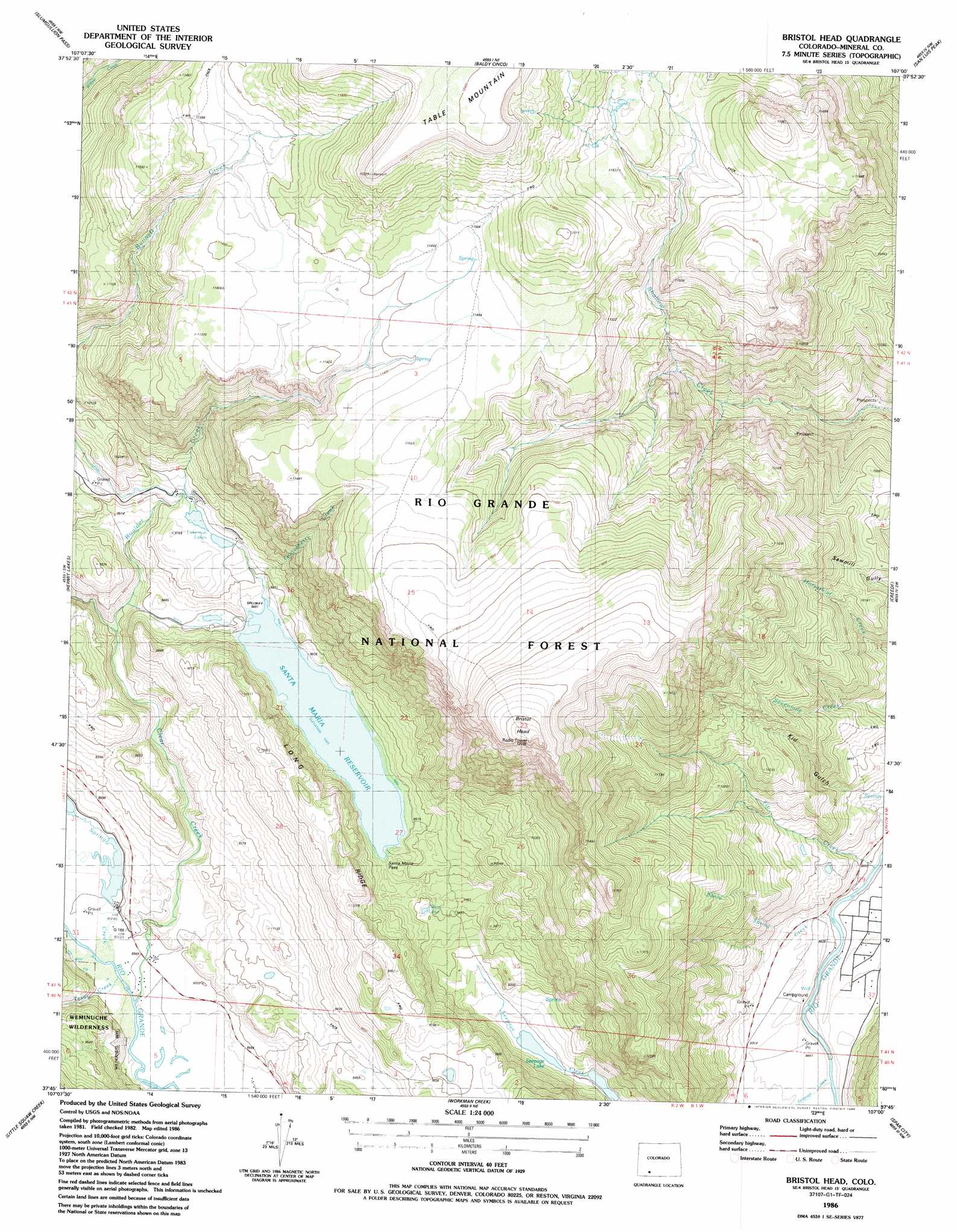
USGS Topo Quad 37107g1 - 1:24,000 scale
| Topo Map Name: | Bristol Head |
| USGS Topo Quad ID: | 37107g1 |
| Print Size: | ca. 21 1/4" wide x 27" high |
| Southeast Coordinates: | 37.75° N latitude / 107° W longitude |
| Map Center Coordinates: | 37.8125° N latitude / 107.0625° W longitude |
| U.S. State: | CO |
| Filename: | o37107g1.jpg |
| Download Map JPG Image: | Bristol Head topo map 1:24,000 scale |
| Map Type: | Topographic |
| Topo Series: | 7.5´ |
| Map Scale: | 1:24,000 |
| Source of Map Images: | United States Geological Survey (USGS) |
| Alternate Map Versions: |
Bristol Head CO 1986, updated 1986 Download PDF Buy paper map Bristol Head CO 2001, updated 2005 Download PDF Buy paper map Bristol Head CO 2011 Download PDF Buy paper map Bristol Head CO 2013 Download PDF Buy paper map Bristol Head CO 2016 Download PDF Buy paper map |
| FStopo: | US Forest Service topo Bristol Head is available: Download FStopo PDF Download FStopo TIF |
1:24,000 Topo Quads surrounding Bristol Head
Lake City |
Cannibal Plateau |
Mineral Mountain |
Stewart Peak |
Elk Park |
Lake San Cristobal |
Slumgullion Pass |
Baldy Cinco |
San Luis Peak |
Halfmoon Pass |
Finger Mesa |
Hermit Lakes |
Bristol Head |
Creede |
Wagon Wheel Gap |
Weminuche Pass |
Little Squaw Creek |
Workman Creek |
Spar City |
Lake Humphreys |
Granite Lake |
Cimarrona Peak |
Palomino Mountain |
South River Creek |
Mount Hope |
> Back to 37107e1 at 1:100,000 scale
> Back to 37106a1 at 1:250,000 scale
> Back to U.S. Topo Maps home
Bristol Head topo map: Gazetteer
Bristol Head: Dams
Bristol Head Number 2 Dam elevation 2785m 9137′Santa Maria Lake Dam elevation 2892m 9488′
Bristol Head: Gaps
Santa Maria Pass elevation 2899m 9511′Bristol Head: Lakes
Ghost Lake elevation 2847m 9340′Lakeman Lakes elevation 2958m 9704′
Bristol Head: Reservoirs
Bristol Head Reservoir Number 2 elevation 2785m 9137′Santa Maria Reservoir elevation 2892m 9488′
Seepage Lake elevation 2753m 9032′
Bristol Head: Ridges
Long Ridge elevation 3112m 10209′Bristol Head: Streams
Banta Spring Creek elevation 2679m 8789′Boulder Creek elevation 2803m 9196′
Clear Creek elevation 2734m 8969′
Fir Creek elevation 2675m 8776′
Gooseberry Creek elevation 2892m 9488′
Seepage Creek elevation 2692m 8832′
Spring Creek elevation 2737m 8979′
Texas Creek elevation 2736m 8976′
Bristol Head: Summits
Bristol Head elevation 3875m 12713′Bristol Head: Trails
Long Ridge Stock Driveway elevation 2928m 9606′McKenzie Stock Driveway elevation 3512m 11522′
Bristol Head: Valleys
Kid Gulch elevation 2697m 8848′Bristol Head digital topo map on disk
Buy this Bristol Head topo map showing relief, roads, GPS coordinates and other geographical features, as a high-resolution digital map file on DVD: