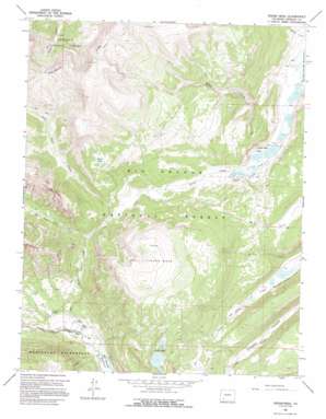
Finger Mesa Topo Map Colorado
To zoom in, hover over the map of Finger Mesa
USGS Topo Quad 37107g3 - 1:24,000 scale
| Topo Map Name: | Finger Mesa |
| USGS Topo Quad ID: | 37107g3 |
| Print Size: | ca. 21 1/4" wide x 27" high |
| Southeast Coordinates: | 37.75° N latitude / 107.25° W longitude |
| Map Center Coordinates: | 37.8125° N latitude / 107.3125° W longitude |
| U.S. State: | CO |
| Filename: | o37107g3.jpg |
| Download Map JPG Image: | Finger Mesa topo map 1:24,000 scale |
| Map Type: | Topographic |
| Topo Series: | 7.5´ |
| Map Scale: | 1:24,000 |
| Source of Map Images: | United States Geological Survey (USGS) |
| Alternate Map Versions: |
Finger Mesa CO 1964, updated 1967 Download PDF Buy paper map Finger Mesa CO 1964, updated 1967 Download PDF Buy paper map Finger Mesa CO 1964, updated 1995 Download PDF Buy paper map Finger Mesa CO 2001, updated 2005 Download PDF Buy paper map Finger Mesa CO 2011 Download PDF Buy paper map Finger Mesa CO 2013 Download PDF Buy paper map Finger Mesa CO 2016 Download PDF Buy paper map |
| FStopo: | US Forest Service topo Finger Mesa is available: Download FStopo PDF Download FStopo TIF |
1:24,000 Topo Quads surrounding Finger Mesa
> Back to 37107e1 at 1:100,000 scale
> Back to 37106a1 at 1:250,000 scale
> Back to U.S. Topo Maps home
Finger Mesa topo map: Gazetteer
Finger Mesa: Dams
Castle Number 4 Dam elevation 3136m 10288′Hermit number 3 Dam elevation 3013m 9885′
Hermit Number 4 Dam elevation 3025m 9924′
Love Lake Dam elevation 3526m 11568′
Finger Mesa: Lakes
Heart Lake elevation 3555m 11663′Finger Mesa: Reservoirs
Castle Number 4 Reservoir elevation 3136m 10288′Castle Rock Lake elevation 3148m 10328′
Hermit Number 4 Reservoir elevation 3025m 9924′
Hermit Reservoir 3 elevation 3013m 9885′
Lost Lakes elevation 3325m 10908′
Love Lake elevation 3526m 11568′
Pearl Lakes elevation 3155m 10351′
Finger Mesa: Streams
Grouse Creek elevation 3012m 9881′Lost Trail Creek elevation 2889m 9478′
West Lost Trail Creek elevation 3139m 10298′
Finger Mesa: Summits
Finger Mesa elevation 3734m 12250′Finger Mesa: Valleys
Crooked Canyon elevation 2989m 9806′Finger Mesa digital topo map on disk
Buy this Finger Mesa topo map showing relief, roads, GPS coordinates and other geographical features, as a high-resolution digital map file on DVD:


