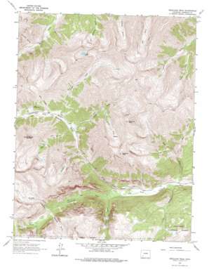
Redcloud Peak Topo Map Colorado
To zoom in, hover over the map of Redcloud Peak
USGS Topo Quad 37107h4 - 1:24,000 scale
| Topo Map Name: | Redcloud Peak |
| USGS Topo Quad ID: | 37107h4 |
| Print Size: | ca. 21 1/4" wide x 27" high |
| Southeast Coordinates: | 37.875° N latitude / 107.375° W longitude |
| Map Center Coordinates: | 37.9375° N latitude / 107.4375° W longitude |
| U.S. State: | CO |
| Filename: | o37107h4.jpg |
| Download Map JPG Image: | Redcloud Peak topo map 1:24,000 scale |
| Map Type: | Topographic |
| Topo Series: | 7.5´ |
| Map Scale: | 1:24,000 |
| Source of Map Images: | United States Geological Survey (USGS) |
| Alternate Map Versions: |
Redcloud Peak CO 1964, updated 1967 Download PDF Buy paper map Redcloud Peak CO 1964, updated 1974 Download PDF Buy paper map Redcloud Peak CO 2001, updated 2004 Download PDF Buy paper map Redcloud Peak CO 2011 Download PDF Buy paper map Redcloud Peak CO 2013 Download PDF Buy paper map Redcloud Peak CO 2016 Download PDF Buy paper map |
| FStopo: | US Forest Service topo Redcloud Peak is available: Download FStopo PDF Download FStopo TIF |
1:24,000 Topo Quads surrounding Redcloud Peak
> Back to 37107e1 at 1:100,000 scale
> Back to 37106a1 at 1:250,000 scale
> Back to U.S. Topo Maps home
Redcloud Peak topo map: Gazetteer
Redcloud Peak: Flats
Burrows Park elevation 3243m 10639′Redcloud Peak: Lakes
Cooper Lake elevation 3888m 12755′Redcloud Peak: Mines
Burrows Park Group Mine elevation 3355m 11007′Henderson Mine elevation 3684m 12086′
Moro Mine elevation 3659m 12004′
Ohio Mine elevation 3403m 11164′
Seward County Mine elevation 3249m 10659′
Redcloud Peak: Post Offices
Whitecross Post Office (historical) elevation 3237m 10620′Redcloud Peak: Streams
Bent Creek elevation 2864m 9396′Campbell Creek elevation 3124m 10249′
Cooper Creek elevation 3211m 10534′
Cottonwood Creek elevation 2912m 9553′
East Fork Bent Creek elevation 3173m 10410′
Rock Creek elevation 3237m 10620′
Sambrito Creek elevation 3844m 12611′
Silver Creek elevation 3168m 10393′
Snare Creek elevation 3268m 10721′
South Fork Silver Creek elevation 3438m 11279′
Redcloud Peak: Summits
Redcloud Peak elevation 4276m 14028′Sunshine Peak elevation 4271m 14012′
Whitecross Mountain elevation 4112m 13490′
Redcloud Peak: Valleys
Boulder Gulch elevation 3094m 10150′Boulder Gulch elevation 3207m 10521′
Cataract Gulch elevation 2939m 9642′
Cleveland Gulch elevation 3291m 10797′
Cuba Gulch elevation 3269m 10725′
Grizzly Gulch elevation 3170m 10400′
Middle Fork Alpine Gulch elevation 3145m 10318′
Mill Gulch elevation 2881m 9452′
Square Gulch elevation 3231m 10600′
Redcloud Peak digital topo map on disk
Buy this Redcloud Peak topo map showing relief, roads, GPS coordinates and other geographical features, as a high-resolution digital map file on DVD:


