Moqui Canyon Topo Map Colorado
To zoom in, hover over the map of Moqui Canyon
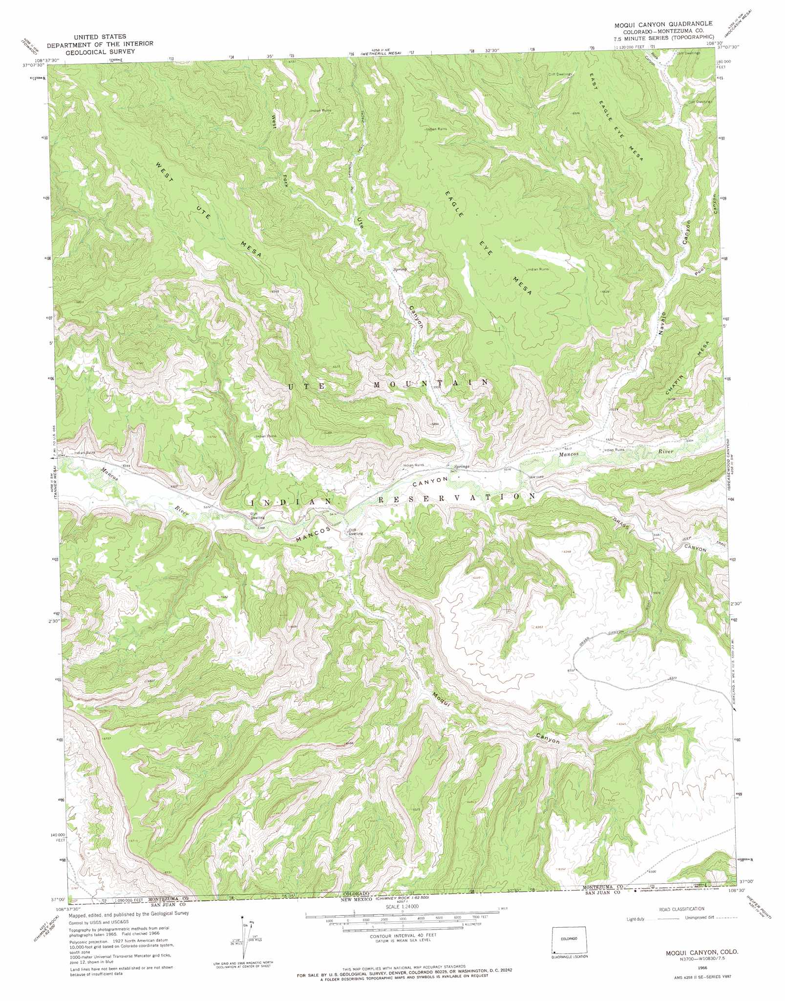
USGS Topo Quad 37108a5 - 1:24,000 scale
| Topo Map Name: | Moqui Canyon |
| USGS Topo Quad ID: | 37108a5 |
| Print Size: | ca. 21 1/4" wide x 27" high |
| Southeast Coordinates: | 37° N latitude / 108.5° W longitude |
| Map Center Coordinates: | 37.0625° N latitude / 108.5625° W longitude |
| U.S. State: | CO |
| Filename: | o37108a5.jpg |
| Download Map JPG Image: | Moqui Canyon topo map 1:24,000 scale |
| Map Type: | Topographic |
| Topo Series: | 7.5´ |
| Map Scale: | 1:24,000 |
| Source of Map Images: | United States Geological Survey (USGS) |
| Alternate Map Versions: |
Moqui Canyon CO 1966, updated 1969 Download PDF Buy paper map Moqui Canyon CO 2010 Download PDF Buy paper map Moqui Canyon CO 2013 Download PDF Buy paper map Moqui Canyon CO 2016 Download PDF Buy paper map |
1:24,000 Topo Quads surrounding Moqui Canyon
Battle Rock |
Mud Creek |
Cortez |
Point Lookout |
Mancos |
Mariano Wash East |
Towaoc |
Wetherill Mesa |
Moccasin Mesa |
Trail Canyon |
Sentinel Peak Se |
Tanner Mesa |
Moqui Canyon |
Greasewood Canyon |
Red Horse Gulch |
Canal Creek |
Skinney Rock |
Palmer Mesa |
Heifer Point |
Purgatory Canyon |
Rattlesnake |
Shiprock |
Chimney Rock |
Waterflow |
Youngs Lake |
> Back to 37108a1 at 1:100,000 scale
> Back to 37108a1 at 1:250,000 scale
> Back to U.S. Topo Maps home
Moqui Canyon topo map: Gazetteer
Moqui Canyon: Mines
Shiprock Group Mine elevation 1847m 6059′Moqui Canyon: Valleys
Grass Canyon elevation 1671m 5482′Navajo Canyon elevation 1688m 5538′
Pool Canyon elevation 1747m 5731′
Rock Canyon elevation 1772m 5813′
Ute Canyon elevation 1670m 5479′
West Fork Ute Canyon elevation 1729m 5672′
Moqui Canyon digital topo map on disk
Buy this Moqui Canyon topo map showing relief, roads, GPS coordinates and other geographical features, as a high-resolution digital map file on DVD: