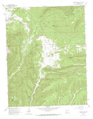
Thompson Park Topo Map Colorado
To zoom in, hover over the map of Thompson Park
USGS Topo Quad 37108c2 - 1:24,000 scale
| Topo Map Name: | Thompson Park |
| USGS Topo Quad ID: | 37108c2 |
| Print Size: | ca. 21 1/4" wide x 27" high |
| Southeast Coordinates: | 37.25° N latitude / 108.125° W longitude |
| Map Center Coordinates: | 37.3125° N latitude / 108.1875° W longitude |
| U.S. State: | CO |
| Filename: | o37108c2.jpg |
| Download Map JPG Image: | Thompson Park topo map 1:24,000 scale |
| Map Type: | Topographic |
| Topo Series: | 7.5´ |
| Map Scale: | 1:24,000 |
| Source of Map Images: | United States Geological Survey (USGS) |
| Alternate Map Versions: |
Thompson Park CO 1963, updated 1965 Download PDF Buy paper map Thompson Park CO 1963, updated 1965 Download PDF Buy paper map Thompson Park CO 1963, updated 1972 Download PDF Buy paper map Thompson Park CO 2011 Download PDF Buy paper map Thompson Park CO 2013 Download PDF Buy paper map Thompson Park CO 2016 Download PDF Buy paper map |
| FStopo: | US Forest Service topo Thompson Park is available: Download FStopo PDF Download FStopo TIF |
1:24,000 Topo Quads surrounding Thompson Park
> Back to 37108a1 at 1:100,000 scale
> Back to 37108a1 at 1:250,000 scale
> Back to U.S. Topo Maps home
Thompson Park topo map: Gazetteer
Thompson Park: Airports
Madden Peak Heliport elevation 2829m 9281′Thompson Park: Basins
Twin Canyon Basin elevation 2865m 9399′Thompson Park: Flats
Thompson Park elevation 2267m 7437′Thompson Park: Mines
Charlene Mine elevation 2998m 9835′E A K Mine elevation 2542m 8339′
Havert Mine elevation 2342m 7683′
Little Jim Mine elevation 2542m 8339′
Mancos Hill Mine elevation 2570m 8431′
Red Arrow Mine elevation 2529m 8297′
Southern Cross Mine elevation 2542m 8339′
Valley View Mine elevation 2542m 8339′
West Mancos River Placers elevation 2346m 7696′
Willden Mine elevation 2385m 7824′
Wood Mine elevation 2601m 8533′
Thompson Park: Pillars
Maggie Rock elevation 2631m 8631′Thompson Park: Reservoirs
Cottonwood Reservoir elevation 2555m 8382′Sponsel Reservoir elevation 2546m 8353′
Thompson Park: Springs
Caviness Spring elevation 3017m 9898′Valley View Spring elevation 2956m 9698′
Thompson Park: Streams
Cottonwood Creek elevation 2241m 7352′Middle Mancos River elevation 2274m 7460′
Starvation Creek elevation 2310m 7578′
Thompson Park: Summits
Caviness Mountain elevation 3128m 10262′Menefee Mountain elevation 2688m 8818′
Menefee Peak elevation 2688m 8818′
Thompson Park: Valleys
Cottonwood Canyon elevation 2381m 7811′Deadman Gulch elevation 2207m 7240′
Devils Canyon elevation 2205m 7234′
Spring Gulch elevation 2241m 7352′
Thompson Park digital topo map on disk
Buy this Thompson Park topo map showing relief, roads, GPS coordinates and other geographical features, as a high-resolution digital map file on DVD:


