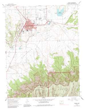
Cortez Topo Map Colorado
To zoom in, hover over the map of Cortez
USGS Topo Quad 37108c5 - 1:24,000 scale
| Topo Map Name: | Cortez |
| USGS Topo Quad ID: | 37108c5 |
| Print Size: | ca. 21 1/4" wide x 27" high |
| Southeast Coordinates: | 37.25° N latitude / 108.5° W longitude |
| Map Center Coordinates: | 37.3125° N latitude / 108.5625° W longitude |
| U.S. State: | CO |
| Filename: | o37108c5.jpg |
| Download Map JPG Image: | Cortez topo map 1:24,000 scale |
| Map Type: | Topographic |
| Topo Series: | 7.5´ |
| Map Scale: | 1:24,000 |
| Source of Map Images: | United States Geological Survey (USGS) |
| Alternate Map Versions: |
Cortez CO 1965, updated 1967 Download PDF Buy paper map Cortez CO 1965, updated 1967 Download PDF Buy paper map Cortez CO 1965, updated 1984 Download PDF Buy paper map Cortez CO 2010 Download PDF Buy paper map Cortez CO 2013 Download PDF Buy paper map Cortez CO 2016 Download PDF Buy paper map |
1:24,000 Topo Quads surrounding Cortez
> Back to 37108a1 at 1:100,000 scale
> Back to 37108a1 at 1:250,000 scale
> Back to U.S. Topo Maps home
Cortez topo map: Gazetteer
Cortez: Airports
County Airport elevation 1801m 5908′Cortez: Areas
Montezuma Valley elevation 1861m 6105′Cortez: Canals
Highline Ditch elevation 1897m 6223′Rocky Ford Ditch elevation 1852m 6076′
Cortez: Cliffs
Krueger Point elevation 2522m 8274′North Rim elevation 2518m 8261′
Cortez: Dams
Denny Lake Dam elevation 1864m 6115′Robert Leighton Dam elevation 1873m 6145′
Totten Dam elevation 1873m 6145′
Cortez: Falls
McElmo Falls elevation 1794m 5885′Cortez: Mines
Cortez Mine elevation 1878m 6161′Mitchell Springs Mine elevation 1840m 6036′
Montezuma Mine elevation 1902m 6240′
Mowry Mine elevation 1843m 6046′
Todd Mine elevation 2282m 7486′
Wilson Mines elevation 1899m 6230′
Cortez: Parks
Centennial Park elevation 1881m 6171′Cortez City Park elevation 1883m 6177′
Denny Lake Park elevation 1868m 6128′
Denny Park elevation 1874m 6148′
Mesa Park and Environmental Lab elevation 1870m 6135′
Montezuma Park elevation 1892m 6207′
Cortez: Populated Places
Cortez elevation 1887m 6190′Cortez: Reservoirs
Denny Lake elevation 1864m 6115′Robert Leighton Reservoir elevation 1873m 6145′
Totten Lake elevation 1873m 6145′
Cortez: Ridges
Long Spur elevation 2379m 7805′Cortez: Summits
Long Mesa elevation 2480m 8136′Long Mesa elevation 2479m 8133′
Cortez: Trails
Upper Navajo Canyon Trail elevation 2313m 7588′Cortez: Valleys
Crow Canyon elevation 1783m 5849′Hartman Draw elevation 1800m 5905′
Cortez digital topo map on disk
Buy this Cortez topo map showing relief, roads, GPS coordinates and other geographical features, as a high-resolution digital map file on DVD:


