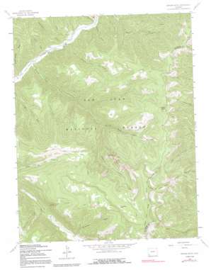
Orphan Butte Topo Map Colorado
To zoom in, hover over the map of Orphan Butte
USGS Topo Quad 37108e1 - 1:24,000 scale
| Topo Map Name: | Orphan Butte |
| USGS Topo Quad ID: | 37108e1 |
| Print Size: | ca. 21 1/4" wide x 27" high |
| Southeast Coordinates: | 37.5° N latitude / 108° W longitude |
| Map Center Coordinates: | 37.5625° N latitude / 108.0625° W longitude |
| U.S. State: | CO |
| Filename: | o37108e1.jpg |
| Download Map JPG Image: | Orphan Butte topo map 1:24,000 scale |
| Map Type: | Topographic |
| Topo Series: | 7.5´ |
| Map Scale: | 1:24,000 |
| Source of Map Images: | United States Geological Survey (USGS) |
| Alternate Map Versions: |
Orphan Butte CO 1963, updated 1965 Download PDF Buy paper map Orphan Butte CO 1963, updated 1965 Download PDF Buy paper map Orphan Butte CO 1963, updated 1970 Download PDF Buy paper map Orphan Butte CO 1963, updated 1970 Download PDF Buy paper map Orphan Butte CO 1963, updated 1991 Download PDF Buy paper map Orphan Butte CO 1963, updated 1991 Download PDF Buy paper map Orphan Butte CO 2011 Download PDF Buy paper map Orphan Butte CO 2013 Download PDF Buy paper map Orphan Butte CO 2016 Download PDF Buy paper map |
| FStopo: | US Forest Service topo Orphan Butte is available: Download FStopo PDF Download FStopo TIF |
1:24,000 Topo Quads surrounding Orphan Butte
> Back to 37108e1 at 1:100,000 scale
> Back to 37108a1 at 1:250,000 scale
> Back to U.S. Topo Maps home
Orphan Butte topo map: Gazetteer
Orphan Butte: Basins
Bear Creek Basin elevation 3143m 10311′Orphan Butte: Cliffs
Cape of Good Hope elevation 3513m 11525′Devil Point elevation 3180m 10433′
Orphan Butte: Flats
Echo Park elevation 3135m 10285′Orphan Butte: Reservoirs
Grindstone Lake elevation 3413m 11197′Last Chance Reservoir elevation 2888m 9475′
Park Reservoir elevation 2935m 9629′
Point Reservoir elevation 2941m 9648′
Ridgetop Reservoir elevation 3071m 10075′
Orphan Butte: Streams
Grindstone Creek elevation 2793m 9163′Polly Creek elevation 2739m 8986′
Roaring Forks Creek elevation 2492m 8175′
Tenderfoot Creek elevation 2507m 8225′
Wildcat Creek elevation 2543m 8343′
Orphan Butte: Summits
Orphan Butte elevation 3395m 11138′Orphan Butte: Trails
Bear Creek Trail elevation 2667m 8750′Gold Run Trail elevation 3134m 10282′
Rough Canyon Trail elevation 2874m 9429′
Ryman Trail elevation 2845m 9333′
Schoolhouse Trail elevation 2800m 9186′
Orphan Butte: Valleys
East Canyon elevation 2655m 8710′Estes Draw elevation 2531m 8303′
Pasture Gulch elevation 2516m 8254′
Rough Canyon elevation 2740m 8989′
School House Draw elevation 2476m 8123′
Silver Draw elevation 2509m 8231′
Waechter Gulch elevation 2542m 8339′
Orphan Butte digital topo map on disk
Buy this Orphan Butte topo map showing relief, roads, GPS coordinates and other geographical features, as a high-resolution digital map file on DVD:


