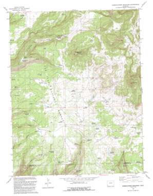
Narraguinnep Mountain Topo Map Colorado
To zoom in, hover over the map of Narraguinnep Mountain
USGS Topo Quad 37108f5 - 1:24,000 scale
| Topo Map Name: | Narraguinnep Mountain |
| USGS Topo Quad ID: | 37108f5 |
| Print Size: | ca. 21 1/4" wide x 27" high |
| Southeast Coordinates: | 37.625° N latitude / 108.5° W longitude |
| Map Center Coordinates: | 37.6875° N latitude / 108.5625° W longitude |
| U.S. State: | CO |
| Filename: | o37108f5.jpg |
| Download Map JPG Image: | Narraguinnep Mountain topo map 1:24,000 scale |
| Map Type: | Topographic |
| Topo Series: | 7.5´ |
| Map Scale: | 1:24,000 |
| Source of Map Images: | United States Geological Survey (USGS) |
| Alternate Map Versions: |
Narraguinnep Mountain CO 1965, updated 1968 Download PDF Buy paper map Narraguinnep Mountain CO 1965, updated 1968 Download PDF Buy paper map Narraguinnep Mountain CO 1965, updated 1980 Download PDF Buy paper map Narraguinnep Mountain CO 1965, updated 1983 Download PDF Buy paper map Narraguinnep Mountain CO 1993, updated 1993 Download PDF Buy paper map Narraguinnep Mountain CO 2011 Download PDF Buy paper map Narraguinnep Mountain CO 2013 Download PDF Buy paper map Narraguinnep Mountain CO 2016 Download PDF Buy paper map |
| FStopo: | US Forest Service topo Narraguinnep Mountain is available: Download FStopo PDF Download FStopo TIF |
1:24,000 Topo Quads surrounding Narraguinnep Mountain
> Back to 37108e1 at 1:100,000 scale
> Back to 37108a1 at 1:250,000 scale
> Back to U.S. Topo Maps home
Narraguinnep Mountain topo map: Gazetteer
Narraguinnep Mountain: Flats
Long Park elevation 2536m 8320′Narraguinnep Mountain: Lakes
Little Dry Lake elevation 2498m 8195′Long Park Lake elevation 2542m 8339′
Narraguinnep Mountain: Reservoirs
Aaron Reservoir elevation 2519m 8264′Abbot Reservoir elevation 2486m 8156′
Barney Reservoir elevation 2433m 7982′
Brumley Reservoir elevation 2537m 8323′
Buster Reservoir elevation 2536m 8320′
Cabin Reservoir elevation 2528m 8293′
Calf Reservoir elevation 2382m 7814′
Coal Spring Reservoir elevation 2453m 8047′
Cow Camp Reservoir elevation 2422m 7946′
Crooked Reservoir elevation 2465m 8087′
Darnell Reservoir elevation 2440m 8005′
Drake Reservoir elevation 2432m 7979′
Drale Reservoir elevation 2432m 7979′
Dry Canyon Reservoir elevation 2427m 7962′
Dry Canyon Spring Reservoir elevation 2382m 7814′
Dry Lake Reservoir elevation 2515m 8251′
Ferris Reservoir elevation 2503m 8211′
Hinchman Reservoir elevation 2467m 8093′
Holly Reservoir elevation 2489m 8166′
Horsetooth Reservoir elevation 2468m 8097′
Hosea Reservoir elevation 2512m 8241′
Knolls Reservoir elevation 2482m 8143′
Koppenhafer Reservoir elevation 2479m 8133′
Lone Pine Reservoir elevation 2542m 8339′
Long Park Reservoir elevation 2535m 8316′
Narraguinnep Reservoir elevation 2344m 7690′
Near Draw Reservoir elevation 2543m 8343′
Nielson Reservoir elevation 2494m 8182′
Oak Draw Reservoir elevation 2555m 8382′
Perkins Reservoir elevation 2685m 8809′
Red Lake elevation 2469m 8100′
Road Spring Reservoir elevation 2557m 8389′
Robert Reservoir elevation 2506m 8221′
Rock Bottom Reservoir elevation 2453m 8047′
Roy Reservoir elevation 2490m 8169′
Salter Bench Reservoir elevation 2395m 7857′
Salter Canyon Reservoir elevation 2462m 8077′
Salter Reservoir elevation 2514m 8248′
Summers Reservoir elevation 2470m 8103′
Tozer Number One Reservoir elevation 2497m 8192′
Turner Reservoir elevation 2501m 8205′
Twin Spring Reservoir elevation 2507m 8225′
Upper Willow Reservoir elevation 2494m 8182′
Violet Reservoir elevation 2495m 8185′
Young Reservoir elevation 2489m 8166′
Narraguinnep Mountain: Springs
Dry Canyon Spring elevation 2339m 7673′Indian Spring elevation 2347m 7700′
Narraguinnep Spring elevation 2447m 8028′
Trimble Spring elevation 2415m 7923′
Narraguinnep Mountain: Summits
Elston Mountain elevation 2782m 9127′Narraguinnep Mountain elevation 2753m 9032′
Narraguinnep Mountain digital topo map on disk
Buy this Narraguinnep Mountain topo map showing relief, roads, GPS coordinates and other geographical features, as a high-resolution digital map file on DVD:


