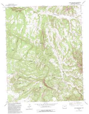
Glade Mountain Topo Map Colorado
To zoom in, hover over the map of Glade Mountain
USGS Topo Quad 37108g5 - 1:24,000 scale
| Topo Map Name: | Glade Mountain |
| USGS Topo Quad ID: | 37108g5 |
| Print Size: | ca. 21 1/4" wide x 27" high |
| Southeast Coordinates: | 37.75° N latitude / 108.5° W longitude |
| Map Center Coordinates: | 37.8125° N latitude / 108.5625° W longitude |
| U.S. State: | CO |
| Filename: | o37108g5.jpg |
| Download Map JPG Image: | Glade Mountain topo map 1:24,000 scale |
| Map Type: | Topographic |
| Topo Series: | 7.5´ |
| Map Scale: | 1:24,000 |
| Source of Map Images: | United States Geological Survey (USGS) |
| Alternate Map Versions: |
Glade Mountain CO 1964, updated 1968 Download PDF Buy paper map Glade Mountain CO 1964, updated 1968 Download PDF Buy paper map Glade Mountain CO 1964, updated 1978 Download PDF Buy paper map Glade Mountain CO 1964, updated 1990 Download PDF Buy paper map Glade Mountain CO 1993, updated 1993 Download PDF Buy paper map Glade Mountain CO 1993, updated 1993 Download PDF Buy paper map Glade Mountain CO 2011 Download PDF Buy paper map Glade Mountain CO 2013 Download PDF Buy paper map Glade Mountain CO 2016 Download PDF Buy paper map |
| FStopo: | US Forest Service topo Glade Mountain is available: Download FStopo PDF Download FStopo TIF |
1:24,000 Topo Quads surrounding Glade Mountain
> Back to 37108e1 at 1:100,000 scale
> Back to 37108a1 at 1:250,000 scale
> Back to U.S. Topo Maps home
Glade Mountain topo map: Gazetteer
Glade Mountain: Mines
Broken Thumb Mine elevation 2763m 9064′Glade Mountain: Reservoirs
Beef Trail Reservoir elevation 2519m 8264′Bradfield Reservoir elevation 2670m 8759′
Cat Reservoir elevation 2071m 6794′
Diana Reservoir elevation 2650m 8694′
Disappointment Number Five Reservoir elevation 2283m 7490′
Disappointment Number Four Reservoir elevation 2317m 7601′
Disappointment Number Nine Reservoir elevation 2135m 7004′
Disappointment Number Seven Reservoir elevation 2499m 8198′
Disappointment Number Six Reservoir elevation 2444m 8018′
Disappointment Number Three Reservoir elevation 2455m 8054′
Disappointment Reservoir Number 1 elevation 2160m 7086′
Disappointment Reservoir Number 2 elevation 2375m 7791′
Don Smith Reservoir elevation 2547m 8356′
Flat Reservoir elevation 2540m 8333′
Forks Reservoir elevation 2567m 8421′
Horse Reservoir elevation 2250m 7381′
Manaugh Spring Reservoir elevation 2630m 8628′
McKinney Draw Reservoir elevation 2507m 8225′
McKinney Reservoir elevation 2340m 7677′
Near Draw Number Five Reservoir elevation 2673m 8769′
Near Draw Number Four Reservoir elevation 2658m 8720′
Near Draw Number Six Reservoir elevation 2738m 8982′
Near Draw Number Three Reservoir elevation 2656m 8713′
Near Draw Number Two Reservoir elevation 2605m 8546′
Palmer Reservoir elevation 2564m 8412′
Royce Reservoir elevation 2162m 7093′
Ryman Number Four Reservoir elevation 2125m 6971′
Ryman Number Three Reservoir elevation 2219m 7280′
Ryman Number Two Reservoir elevation 2392m 7847′
Snag Reservoir elevation 2461m 8074′
Willow Reservoir elevation 2562m 8405′
Glade Mountain: Ridges
The Hogback elevation 2250m 7381′Glade Mountain: Springs
Bradfield Spring elevation 2685m 8809′Far Draw Spring elevation 2597m 8520′
Glade Mountain Spring elevation 2651m 8697′
Manaugh Spring elevation 2619m 8592′
Glade Mountain: Streams
Hunt Creek elevation 2049m 6722′Pine Creek elevation 2074m 6804′
Rabbit Creek elevation 1938m 6358′
Ryman Creek elevation 2007m 6584′
Glade Mountain: Summits
Glade Mountain elevation 2794m 9166′Thomas Mountain elevation 2552m 8372′
Glade Mountain: Valleys
Cash Gulch elevation 2212m 7257′McKinney Draw elevation 1984m 6509′
Salt Arroyo elevation 2085m 6840′
Willow Draw elevation 2107m 6912′
Glade Mountain digital topo map on disk
Buy this Glade Mountain topo map showing relief, roads, GPS coordinates and other geographical features, as a high-resolution digital map file on DVD:


