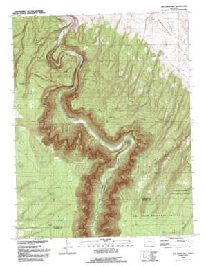
Joe Davis Hill Topo Map Colorado
To zoom in, hover over the map of Joe Davis Hill
USGS Topo Quad 37108h7 - 1:24,000 scale
| Topo Map Name: | Joe Davis Hill |
| USGS Topo Quad ID: | 37108h7 |
| Print Size: | ca. 21 1/4" wide x 27" high |
| Southeast Coordinates: | 37.875° N latitude / 108.75° W longitude |
| Map Center Coordinates: | 37.9375° N latitude / 108.8125° W longitude |
| U.S. State: | CO |
| Filename: | o37108h7.jpg |
| Download Map JPG Image: | Joe Davis Hill topo map 1:24,000 scale |
| Map Type: | Topographic |
| Topo Series: | 7.5´ |
| Map Scale: | 1:24,000 |
| Source of Map Images: | United States Geological Survey (USGS) |
| Alternate Map Versions: |
Joe Davis Hill CO 1949, updated 1957 Download PDF Buy paper map Joe Davis Hill CO 1949, updated 1957 Download PDF Buy paper map Joe Davis Hill CO 1949, updated 1974 Download PDF Buy paper map Joe Davis Hill CO 1949, updated 1974 Download PDF Buy paper map Joe Davis Hill CO 1949, updated 1978 Download PDF Buy paper map Joe Davis Hill CO 1950 Download PDF Buy paper map Joe Davis Hill CO 1950 Download PDF Buy paper map Joe Davis Hill CO 1993, updated 1993 Download PDF Buy paper map Joe Davis Hill CO 2011 Download PDF Buy paper map Joe Davis Hill CO 2013 Download PDF Buy paper map Joe Davis Hill CO 2016 Download PDF Buy paper map |
| FStopo: | US Forest Service topo Joe Davis Hill is available: Download FStopo PDF Download FStopo TIF |
1:24,000 Topo Quads surrounding Joe Davis Hill
> Back to 37108e1 at 1:100,000 scale
> Back to 37108a1 at 1:250,000 scale
> Back to U.S. Topo Maps home
Joe Davis Hill topo map: Gazetteer
Joe Davis Hill: Airports
Egnar Heliport elevation 2369m 7772′Joe Davis Hill: Mines
Betty Ruth Mine elevation 2280m 7480′Buckhorn Mine elevation 1949m 6394′
Clear View Claims elevation 2127m 6978′
Curtis Mine elevation 2232m 7322′
Dan Mine elevation 2218m 7276′
Depression Mine elevation 2258m 7408′
Dolores River Mine elevation 2231m 7319′
Fox Mine elevation 2080m 6824′
France Mine elevation 2144m 7034′
Full Moon Group Mine elevation 1711m 5613′
Full Moon Mine elevation 1696m 5564′
Horseshoe One through Seven Mines elevation 2049m 6722′
Joe Davis Hill Mine elevation 2061m 6761′
Little Max Mine elevation 2247m 7372′
Little Roy Mine elevation 2232m 7322′
Mardi Mine elevation 2260m 7414′
Marne Mine elevation 2247m 7372′
Mucho Grande Mine elevation 2085m 6840′
Muleshoe Six Mine elevation 1788m 5866′
Mystery Mine elevation 2044m 6706′
Norma Jean Mine elevation 2179m 7148′
Norma Jean Number 2 Mine elevation 2205m 7234′
Owensby Mine elevation 1924m 6312′
Parrot Group Mine elevation 2055m 6742′
Parrot Mine elevation 1871m 6138′
Philura Group Mine elevation 1871m 6138′
Powder Drift Mine elevation 1871m 6138′
Red Rock Four and Five Mines elevation 2167m 7109′
Red Rock Mine elevation 1871m 6138′
Red Top Mine elevation 2014m 6607′
Rim Mine elevation 2146m 7040′
Roy Lee Mine elevation 1744m 5721′
S.B. Group Mine elevation 2354m 7723′
Sara M. Mine elevation 2099m 6886′
Sarah Ellen Mine elevation 1996m 6548′
Space Ship Number One Mine elevation 2150m 7053′
Spud Patch Mine elevation 2222m 7290′
Suncup Mine elevation 2053m 6735′
Suncup Two Mine elevation 2016m 6614′
Uncle Sam Mine elevation 2020m 6627′
Uncle Sammy Mine elevation 2021m 6630′
Wally Mine elevation 1821m 5974′
Joe Davis Hill: Reservoirs
Bell Canyon Reservoir elevation 2400m 7874′DR Reservoir elevation 2506m 8221′
Little Pony Reservoir elevation 2481m 8139′
North Reservoir elevation 2471m 8106′
Park Reservoir elevation 2473m 8113′
Pole Canyon Reservoir elevation 2447m 8028′
Pony Reservoir elevation 2491m 8172′
Rogers-Dalton Reservoir elevation 2435m 7988′
Sand Rock Reservoir elevation 2410m 7906′
Wayne Rogers Reservoir Number One elevation 2465m 8087′
Wayne Rogers Reservoir Number Two elevation 2410m 7906′
Wilson Reservoir elevation 2395m 7857′
Joe Davis Hill: Springs
Piney Spring elevation 2372m 7782′Quakie Spring elevation 2432m 7979′
Sawmill Spring elevation 2432m 7979′
Joe Davis Hill: Streams
South Branch Chico Creek elevation 2300m 7545′Joe Davis Hill: Summits
Joe Davis Hill elevation 2248m 7375′Joe Davis Hill: Valleys
Bell Canyon elevation 1744m 5721′Dolores Canyon elevation 1715m 5626′
Joe Davis Hill digital topo map on disk
Buy this Joe Davis Hill topo map showing relief, roads, GPS coordinates and other geographical features, as a high-resolution digital map file on DVD:


