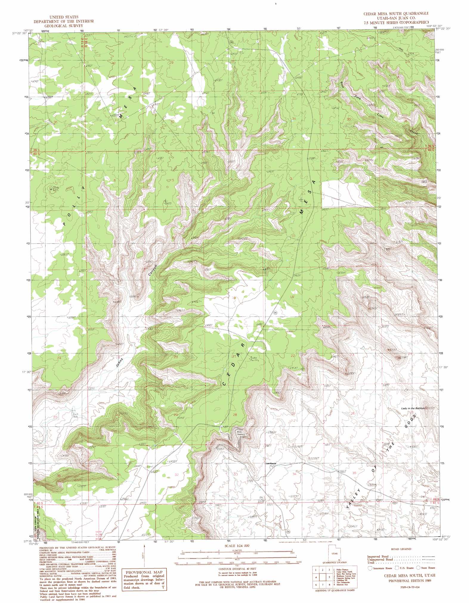
Cedar Mesa South Topo Map Utah
To zoom in, hover over the map of Cedar Mesa South
USGS Topo Quad 37109c8 - 1:24,000 scale
| Topo Map Name: | Cedar Mesa South |
| USGS Topo Quad ID: | 37109c8 |
| Print Size: | ca. 21 1/4" wide x 27" high |
| Southeast Coordinates: | 37.25° N latitude / 109.875° W longitude |
| Map Center Coordinates: | 37.3125° N latitude / 109.9375° W longitude |
| U.S. State: | UT |
| Filename: | o37109c8.jpg |
| Download Map JPG Image: | Cedar Mesa South topo map 1:24,000 scale |
| Map Type: | Topographic |
| Topo Series: | 7.5´ |
| Map Scale: | 1:24,000 |
| Source of Map Images: | United States Geological Survey (USGS) |
| Alternate Map Versions: |
Cedar Mesa South UT 1989, updated 1989 Download PDF Buy paper map Cedar Mesa South UT 1989, updated 1995 Download PDF Buy paper map Cedar Mesa South UT 1996, updated 2002 Download PDF Buy paper map Cedar Mesa South UT 2010 Download PDF Buy paper map Cedar Mesa South UT 2014 Download PDF Buy paper map |
1:24,000 Topo Quads surrounding Cedar Mesa South
Fry Spring |
Moss Back Butte |
Kane Gulch |
South Long Point |
Hotel Rock |
Red House Spring |
Pollys Pasture |
Cedar Mesa North |
Snow Flat Spring Cave |
Bluff Nw |
Slickhorn Canyon West |
Slickhorn Canyon East |
Cedar Mesa South |
Cigarette Spring Cave |
Bluff Sw |
Goulding Nw |
Goulding Ne |
The Goosenecks |
Mexican Hat |
San Juan Hill |
Goulding |
Monument Pass |
Mexican Hat Sw |
Mexican Hat Se |
Moses Rock |
> Back to 37109a1 at 1:100,000 scale
> Back to 37108a1 at 1:250,000 scale
> Back to U.S. Topo Maps home
Cedar Mesa South topo map: Gazetteer
Cedar Mesa South: Pillars
Lady in the Bathtub elevation 1580m 5183′Cedar Mesa South: Slopes
Moki Dugway elevation 1844m 6049′Cedar Mesa South digital topo map on disk
Buy this Cedar Mesa South topo map showing relief, roads, GPS coordinates and other geographical features, as a high-resolution digital map file on DVD: