No-Mans Island Topo Map Utah
To zoom in, hover over the map of No-Mans Island
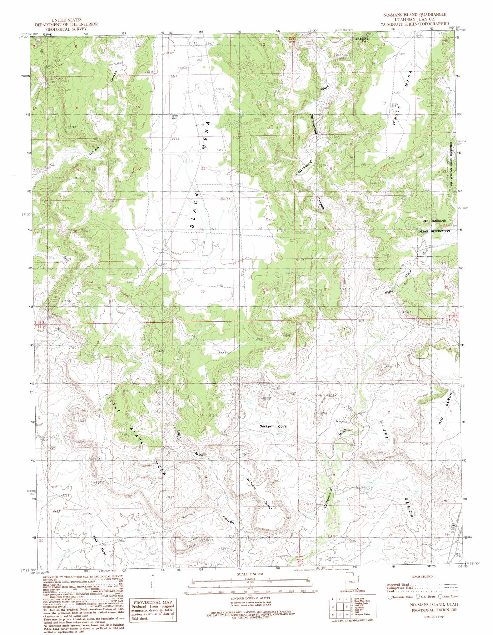
USGS Topo Quad 37109d5 - 1:24,000 scale
| Topo Map Name: | No-Mans Island |
| USGS Topo Quad ID: | 37109d5 |
| Print Size: | ca. 21 1/4" wide x 27" high |
| Southeast Coordinates: | 37.375° N latitude / 109.5° W longitude |
| Map Center Coordinates: | 37.4375° N latitude / 109.5625° W longitude |
| U.S. State: | UT |
| Filename: | o37109d5.jpg |
| Download Map JPG Image: | No-Mans Island topo map 1:24,000 scale |
| Map Type: | Topographic |
| Topo Series: | 7.5´ |
| Map Scale: | 1:24,000 |
| Source of Map Images: | United States Geological Survey (USGS) |
| Alternate Map Versions: |
No-mans Island UT 1989, updated 1989 Download PDF Buy paper map No-Mans Island UT 2010 Download PDF Buy paper map No-Mans Island UT 2014 Download PDF Buy paper map |
1:24,000 Topo Quads surrounding No-Mans Island
Kigalia Point |
Cream Pots |
Mancos Jim Butte |
Blanding North |
Devil Mesa |
South Long Point |
Hotel Rock |
Black Mesa Butte |
Blanding South |
Bradford Canyon |
Snow Flat Spring Cave |
Bluff Nw |
No-Mans Island |
Big Bench |
Mccracken Spring |
Cigarette Spring Cave |
Bluff Sw |
Bluff |
Recapture Pocket |
Montezuma Creek |
Mexican Hat |
San Juan Hill |
White Rock Point |
Hogan Mesa |
White Mesa Village |
> Back to 37109a1 at 1:100,000 scale
> Back to 37108a1 at 1:250,000 scale
> Back to U.S. Topo Maps home
No-Mans Island topo map: Gazetteer
No-Mans Island: Cliffs
Ruin Spring Point elevation 1657m 5436′No-Mans Island: Summits
Black Mesa elevation 1699m 5574′Little Black Mesa elevation 1676m 5498′
No-Mans Island elevation 1523m 4996′
No-Mans Island: Valleys
Decker Cove elevation 1422m 4665′Right Hand Fork Cottonwood Wash elevation 1408m 4619′
No-Mans Island: Wells
Jones Well elevation 1690m 5544′No-Mans Island digital topo map on disk
Buy this No-Mans Island topo map showing relief, roads, GPS coordinates and other geographical features, as a high-resolution digital map file on DVD: