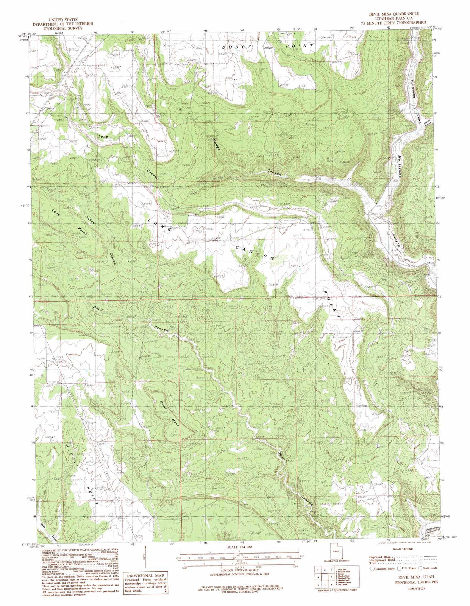
Devil Mesa Topo Map Utah
To zoom in, hover over the map of Devil Mesa
USGS Topo Quad 37109f3 - 1:24,000 scale
| Topo Map Name: | Devil Mesa |
| USGS Topo Quad ID: | 37109f3 |
| Print Size: | ca. 21 1/4" wide x 27" high |
| Southeast Coordinates: | 37.625° N latitude / 109.25° W longitude |
| Map Center Coordinates: | 37.6875° N latitude / 109.3125° W longitude |
| U.S. State: | UT |
| Filename: | o37109f3.jpg |
| Download Map JPG Image: | Devil Mesa topo map 1:24,000 scale |
| Map Type: | Topographic |
| Topo Series: | 7.5´ |
| Map Scale: | 1:24,000 |
| Source of Map Images: | United States Geological Survey (USGS) |
| Alternate Map Versions: |
Verdure 3 NE UT 1955, updated 1955 Download PDF Buy paper map Devil Mesa UT 1985, updated 1985 Download PDF Buy paper map Devil Mesa UT 2010 Download PDF Buy paper map Devil Mesa UT 2014 Download PDF Buy paper map |
1:24,000 Topo Quads surrounding Devil Mesa
Shay Mountain |
Monticello Lake |
Monticello North |
Eastland Nw |
Piute Point |
Mount Linnaeus |
Abajo Peak |
Monticello South |
Eastland |
Northdale |
Mancos Jim Butte |
Blanding North |
Devil Mesa |
Horsehead Point |
Burnt Cabin Creek |
Black Mesa Butte |
Blanding South |
Bradford Canyon |
Bug Canyon |
Papoose Canyon |
No-Mans Island |
Big Bench |
Mccracken Spring |
Hatch Trading Post |
Ruin Point |
> Back to 37109e1 at 1:100,000 scale
> Back to 37108a1 at 1:250,000 scale
> Back to U.S. Topo Maps home
Devil Mesa topo map: Gazetteer
Devil Mesa: Capes
Long Canyon Point elevation 2031m 6663′Devil Mesa: Ridges
Long Point elevation 2059m 6755′Devil Mesa: Summits
Devil Mesa elevation 1916m 6286′Devil Mesa: Valleys
Dodge Canyon elevation 1661m 5449′Indian Canyon elevation 1808m 5931′
Long Canyon elevation 1756m 5761′
Pearson Canyon elevation 1671m 5482′
Devil Mesa digital topo map on disk
Buy this Devil Mesa topo map showing relief, roads, GPS coordinates and other geographical features, as a high-resolution digital map file on DVD: