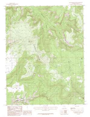
Woodenshoe Buttes Topo Map Utah
To zoom in, hover over the map of Woodenshoe Buttes
USGS Topo Quad 37109f8 - 1:24,000 scale
| Topo Map Name: | Woodenshoe Buttes |
| USGS Topo Quad ID: | 37109f8 |
| Print Size: | ca. 21 1/4" wide x 27" high |
| Southeast Coordinates: | 37.625° N latitude / 109.875° W longitude |
| Map Center Coordinates: | 37.6875° N latitude / 109.9375° W longitude |
| U.S. State: | UT |
| Filename: | o37109f8.jpg |
| Download Map JPG Image: | Woodenshoe Buttes topo map 1:24,000 scale |
| Map Type: | Topographic |
| Topo Series: | 7.5´ |
| Map Scale: | 1:24,000 |
| Source of Map Images: | United States Geological Survey (USGS) |
| Alternate Map Versions: |
Elk Ridge 3 NW UT 1954 Download PDF Buy paper map Woodenshoe Buttes UT 1985, updated 1985 Download PDF Buy paper map Woodenshoe Buttes UT 2001, updated 2004 Download PDF Buy paper map Woodenshoe Buttes UT 2011 Download PDF Buy paper map Woodenshoe Buttes UT 2014 Download PDF Buy paper map |
| FStopo: | US Forest Service topo Woodenshoe Buttes is available: Download FStopo PDF Download FStopo TIF |
1:24,000 Topo Quads surrounding Woodenshoe Buttes
> Back to 37109e1 at 1:100,000 scale
> Back to 37108a1 at 1:250,000 scale
> Back to U.S. Topo Maps home
Woodenshoe Buttes topo map: Gazetteer
Woodenshoe Buttes: Areas
The Hideout elevation 2441m 8008′Woodenshoe Buttes: Flats
Lower Lost Parks elevation 2052m 6732′Upper Lost Parks elevation 2433m 7982′
Woodenshoe Buttes: Mines
Cys Monument Mine elevation 2628m 8622′Woodenshoe Buttes: Springs
Twin Springs elevation 2646m 8681′Woodenshoe Buttes: Summits
The Heel elevation 2711m 8894′The Toe elevation 2705m 8874′
Woodenshoe Buttes elevation 2655m 8710′
Woodenshoe Buttes: Valleys
Burch Canyon elevation 1844m 6049′Cherry Canyon elevation 2085m 6840′
Woodenshoe Buttes digital topo map on disk
Buy this Woodenshoe Buttes topo map showing relief, roads, GPS coordinates and other geographical features, as a high-resolution digital map file on DVD:


