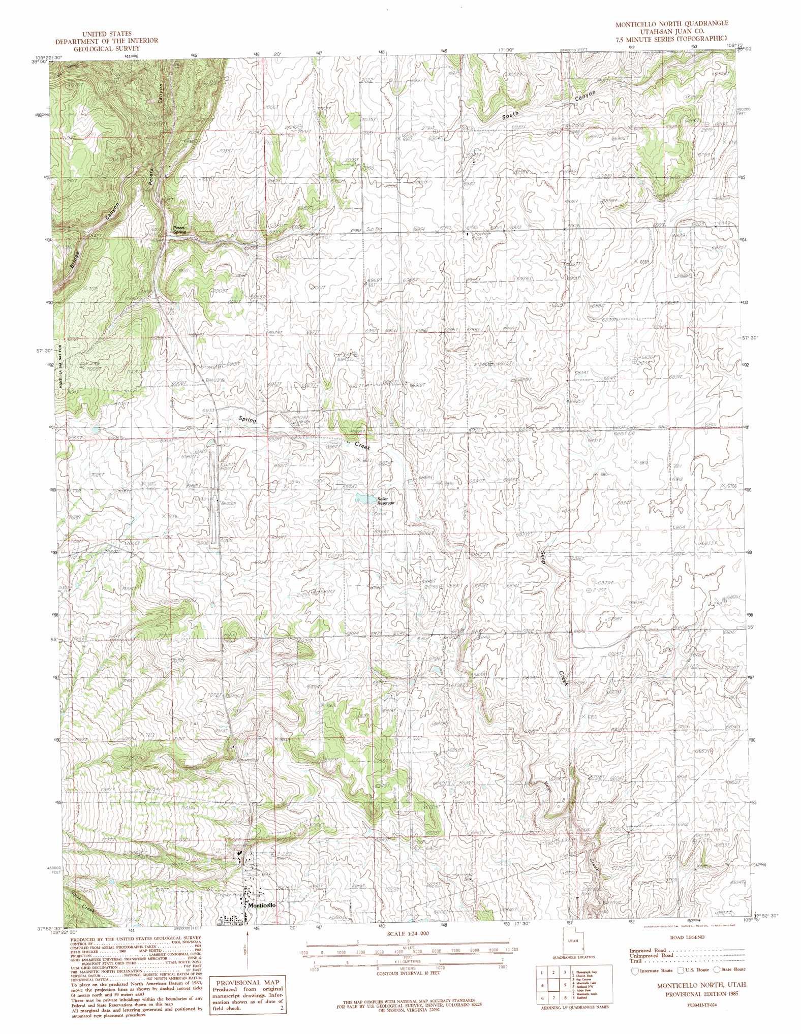
Monticello North Topo Map Utah
To zoom in, hover over the map of Monticello North
USGS Topo Quad 37109h3 - 1:24,000 scale
| Topo Map Name: | Monticello North |
| USGS Topo Quad ID: | 37109h3 |
| Print Size: | ca. 21 1/4" wide x 27" high |
| Southeast Coordinates: | 37.875° N latitude / 109.25° W longitude |
| Map Center Coordinates: | 37.9375° N latitude / 109.3125° W longitude |
| U.S. State: | UT |
| Filename: | o37109h3.jpg |
| Download Map JPG Image: | Monticello North topo map 1:24,000 scale |
| Map Type: | Topographic |
| Topo Series: | 7.5´ |
| Map Scale: | 1:24,000 |
| Source of Map Images: | United States Geological Survey (USGS) |
| Alternate Map Versions: |
Verdure 2 NE UT 1958, updated 1958 Download PDF Buy paper map Monticello North UT 1985, updated 1985 Download PDF Buy paper map Monticello North UT 2001, updated 2004 Download PDF Buy paper map Monticello North UT 2011 Download PDF Buy paper map Monticello North UT 2014 Download PDF Buy paper map |
| FStopo: | US Forest Service topo Monticello North is available: Download FStopo PDF Download FStopo TIF |
1:24,000 Topo Quads surrounding Monticello North
Harts Point North |
Hatch Rock |
Sandstone Draw |
Lisbon Valley |
Lisbon Gap |
Harts Point South |
Photograph Gap |
Church Rock |
Sop Canyon |
Summit Point |
Shay Mountain |
Monticello Lake |
Monticello North |
Eastland Nw |
Piute Point |
Mount Linnaeus |
Abajo Peak |
Monticello South |
Eastland |
Northdale |
Mancos Jim Butte |
Blanding North |
Devil Mesa |
Horsehead Point |
Burnt Cabin Creek |
> Back to 37109e1 at 1:100,000 scale
> Back to 37108a1 at 1:250,000 scale
> Back to U.S. Topo Maps home
Monticello North topo map: Gazetteer
Monticello North: Airports
San Juan County Airport elevation 2129m 6984′Monticello North: Dams
Keller Dam elevation 2094m 6870′Monticello North: Parks
Mountain View Trailer Park elevation 2152m 7060′Monticello North: Populated Places
Rowleys Trailer Park elevation 2153m 7063′Monticello North: Reservoirs
Keller Reservoir elevation 2094m 6870′Monticello North: Springs
Peters Spring elevation 2087m 6847′Monticello North: Streams
Bankhead Creek elevation 2208m 7244′Seep Creek elevation 2053m 6735′
Spring Creek elevation 2074m 6804′
Monticello North digital topo map on disk
Buy this Monticello North topo map showing relief, roads, GPS coordinates and other geographical features, as a high-resolution digital map file on DVD: