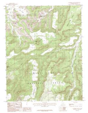
Cathedral Butte Topo Map Utah
To zoom in, hover over the map of Cathedral Butte
USGS Topo Quad 37109h6 - 1:24,000 scale
| Topo Map Name: | Cathedral Butte |
| USGS Topo Quad ID: | 37109h6 |
| Print Size: | ca. 21 1/4" wide x 27" high |
| Southeast Coordinates: | 37.875° N latitude / 109.625° W longitude |
| Map Center Coordinates: | 37.9375° N latitude / 109.6875° W longitude |
| U.S. State: | UT |
| Filename: | o37109h6.jpg |
| Download Map JPG Image: | Cathedral Butte topo map 1:24,000 scale |
| Map Type: | Topographic |
| Topo Series: | 7.5´ |
| Map Scale: | 1:24,000 |
| Source of Map Images: | United States Geological Survey (USGS) |
| Alternate Map Versions: |
Elk Ridge 1 NW UT 1954 Download PDF Buy paper map Cathedral Butte UT 1985, updated 1985 Download PDF Buy paper map Cathedral Butte UT 1985, updated 1985 Download PDF Buy paper map Cathedral Butte UT 2001, updated 2004 Download PDF Buy paper map Cathedral Butte UT 2011 Download PDF Buy paper map Cathedral Butte UT 2014 Download PDF Buy paper map |
| FStopo: | US Forest Service topo Cathedral Butte is available: Download FStopo PDF Download FStopo TIF |
1:24,000 Topo Quads surrounding Cathedral Butte
> Back to 37109e1 at 1:100,000 scale
> Back to 37108a1 at 1:250,000 scale
> Back to U.S. Topo Maps home
Cathedral Butte topo map: Gazetteer
Cathedral Butte: Arches
Cleft Arch elevation 1913m 6276′Natural Bridge elevation 2002m 6568′
Wedding Ring Arch elevation 1990m 6528′
Cathedral Butte: Basins
Big Pocket elevation 1803m 5915′Cathedral Butte: Capes
Cathedral Point elevation 2166m 7106′Mormon Pasture Point elevation 2125m 6971′
Cathedral Butte: Cliffs
Lavender Point elevation 1698m 5570′Cathedral Butte: Mines
Betty Mine elevation 2278m 7473′Cathedral Butte: Streams
East Fork Salt Creek elevation 1818m 5964′Hop Creek elevation 1873m 6145′
Vega Creek elevation 1970m 6463′
Cathedral Butte: Summits
Boundary Butte elevation 2497m 8192′Bridger Jack Mesa elevation 2225m 7299′
Cathedral Butte elevation 2400m 7874′
Salt Creek Mesa elevation 2202m 7224′
Seven Sisters Buttes elevation 2569m 8428′
Cathedral Butte: Valleys
Davis Canyon elevation 1926m 6318′Reservoir Canyon elevation 1975m 6479′
Stevens Canyon elevation 1818m 5964′
Cathedral Butte digital topo map on disk
Buy this Cathedral Butte topo map showing relief, roads, GPS coordinates and other geographical features, as a high-resolution digital map file on DVD:


