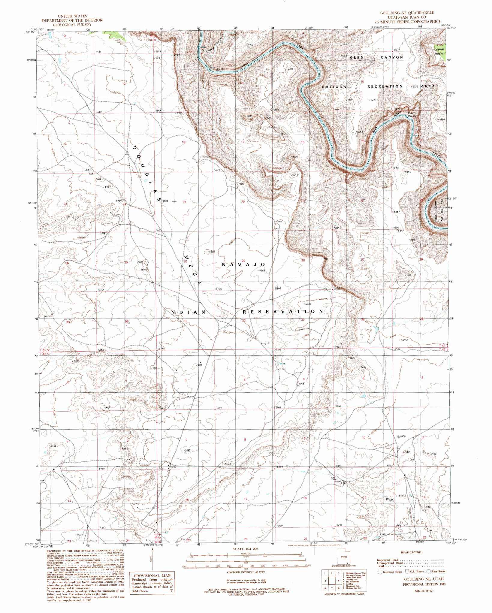
Goulding Ne Topo Map Utah
To zoom in, hover over the map of Goulding Ne
USGS Topo Quad 37110b1 - 1:24,000 scale
| Topo Map Name: | Goulding Ne |
| USGS Topo Quad ID: | 37110b1 |
| Print Size: | ca. 21 1/4" wide x 27" high |
| Southeast Coordinates: | 37.125° N latitude / 110° W longitude |
| Map Center Coordinates: | 37.1875° N latitude / 110.0625° W longitude |
| U.S. State: | UT |
| Filename: | o37110b1.jpg |
| Download Map JPG Image: | Goulding Ne topo map 1:24,000 scale |
| Map Type: | Topographic |
| Topo Series: | 7.5´ |
| Map Scale: | 1:24,000 |
| Source of Map Images: | United States Geological Survey (USGS) |
| Alternate Map Versions: |
Goulding NE UT 1989, updated 1989 Download PDF Buy paper map Goulding NE UT 2011 Download PDF Buy paper map Goulding NE UT 2014 Download PDF Buy paper map |
1:24,000 Topo Quads surrounding Goulding Ne
Clay Hills |
Red House Spring |
Pollys Pasture |
Cedar Mesa North |
Snow Flat Spring Cave |
Whirlwind Draw |
Slickhorn Canyon West |
Slickhorn Canyon East |
Cedar Mesa South |
Cigarette Spring Cave |
Oljeto Ne |
Goulding Nw |
Goulding Ne |
The Goosenecks |
Mexican Hat |
Oljeto |
Goulding |
Monument Pass |
Mexican Hat Sw |
Mexican Hat Se |
Boot Mesa |
Mystery Valley |
Mitten Buttes |
Rooster Rock |
Garnet Ridge |
> Back to 37110a1 at 1:100,000 scale
> Back to 37110a1 at 1:250,000 scale
> Back to U.S. Topo Maps home
Goulding Ne topo map: Gazetteer
Goulding Ne: Rapids
Ross Rapids elevation 1183m 3881′Goulding Ne: Summits
Douglas Mesa elevation 1688m 5538′Goulding Ne: Valleys
Johns Canyon elevation 1250m 4101′Goulding Ne digital topo map on disk
Buy this Goulding Ne topo map showing relief, roads, GPS coordinates and other geographical features, as a high-resolution digital map file on DVD: